Navigation altitude obtaining method combining relative altitude and absolute altitude

A technology of relative altitude and absolute altitude, which is applied in the direction of altitude or depth control, and can solve problems such as navigation altitude value jump, different altitude values, and unmanned aerial vehicle altitude drop rapidly

Active Publication Date: 2014-09-17
BEIHANG UNIV
View PDF6 Cites 40 Cited by
  • Summary
  • Abstract
  • Description
  • Claims
  • Application Information

AI Technical Summary

Problems solved by technology

Otherwise, the physical form of the navigation altitude will be unclear, and the flight control system will make mistakes when using the navigation altitude, causing flight accidents
For example, the desired flight altitude in the flight control system is in the form of relative altitude, and the current value is 100m. If the navigation altitude is in the form of absolute altitude, and the current value is 500m, then the flight control system will make an error that the current flight altitude is much higher than the expected flight altitude. Judgment, so that the altitude of the unmanned aerial vehicle drops rapidly. If the altitude of the ground is greater than 100m at this time, a crash accident will occur
[0008] The third is that there is a problem of altitude jump when the navigation altitude is switched between relative altitude and absolute altitude. Different altimeters have different measurement accuracy and measurement range. Therefore, even if the relative altitude and absolute altitude are converted into the same physical form when used as navigation altitude , but the height values ​​provided by the two are still different
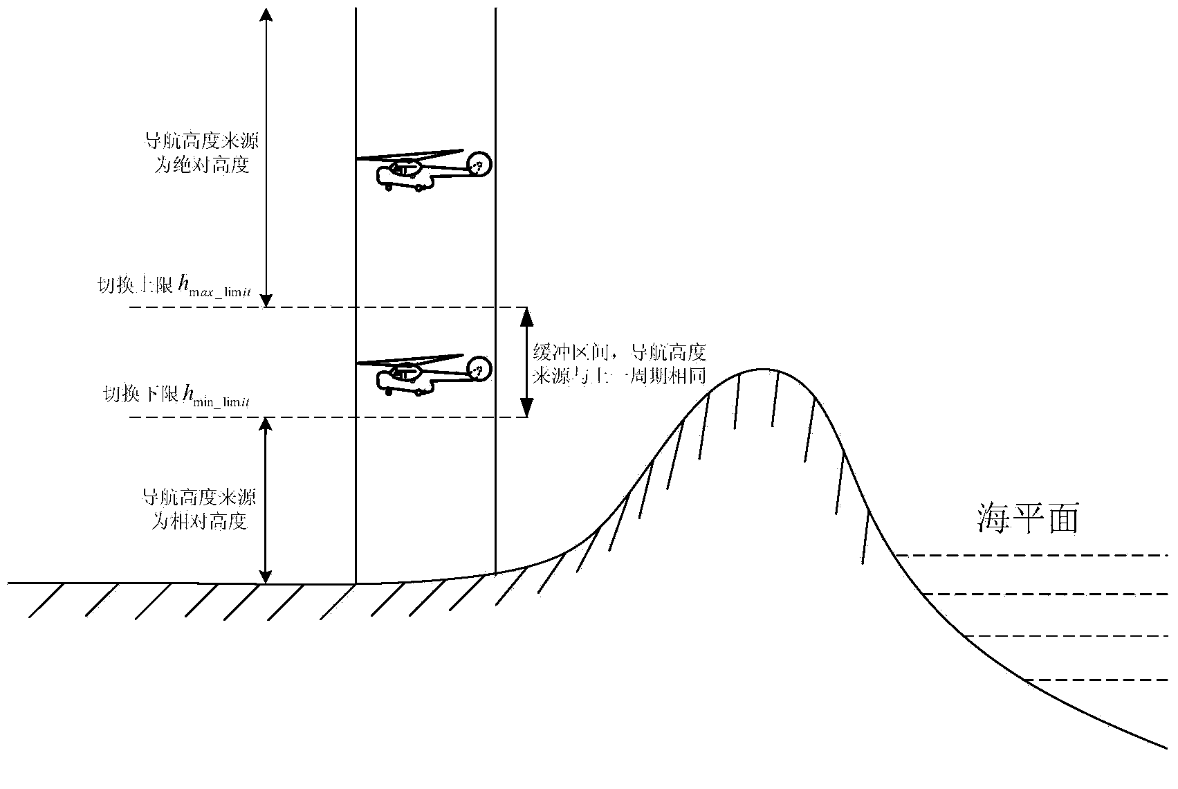
If the navigation altitude derived from the relative altitude and the navigation altitude derived from the absolute altitude are directly switched, it will cause a jump in the navigation altitude value, which will cause a jump in the control quantity output by the flight control system, causing the flight altitude and flight attitude of the aircraft to change. Large changes, and even cause flight accidents

Method used


Image

  • Navigation altitude obtaining method combining relative altitude and absolute altitude
  • Navigation altitude obtaining method combining relative altitude and absolute altitude
  • Navigation altitude obtaining method combining relative altitude and absolute altitude

Examples


Embodiment Construction

[0093] The present invention is described in further detail now in conjunction with accompanying drawing. These drawings are all simplified schematic diagrams, and only illustrate the design concept of the present invention in a schematic manner.

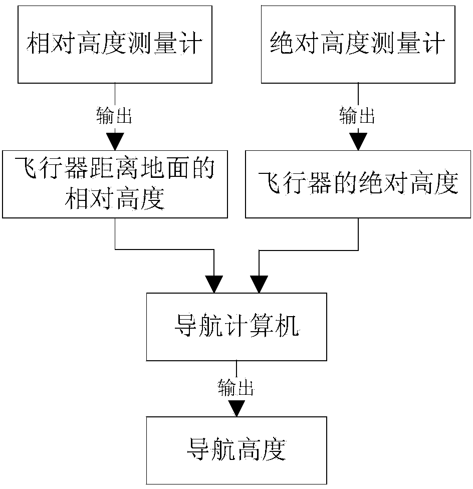
[0094] Such as figure 1 As shown, a method of fusing relative altitude and absolute altitude to obtain navigation altitude requires the following equipment conditions: relative altitude gauge, absolute altitude gauge and navigation computer;

[0095] Among them, the relative altimeter can be ultrasonic altimeter, laser altimeter, radio altimeter and other sensors that can measure relative altitude, and the absolute altimeter can be GPS (Global Positioning System) positioning system, barometric altimeter, etc. Any sensor that measures absolute altitude;

[0096] Among them, the relative height data h of the aircraft from the ground is obtained from the relative altimeter relat , obtain the absolute height data h of the aircraft fr...


PUM


Abstract

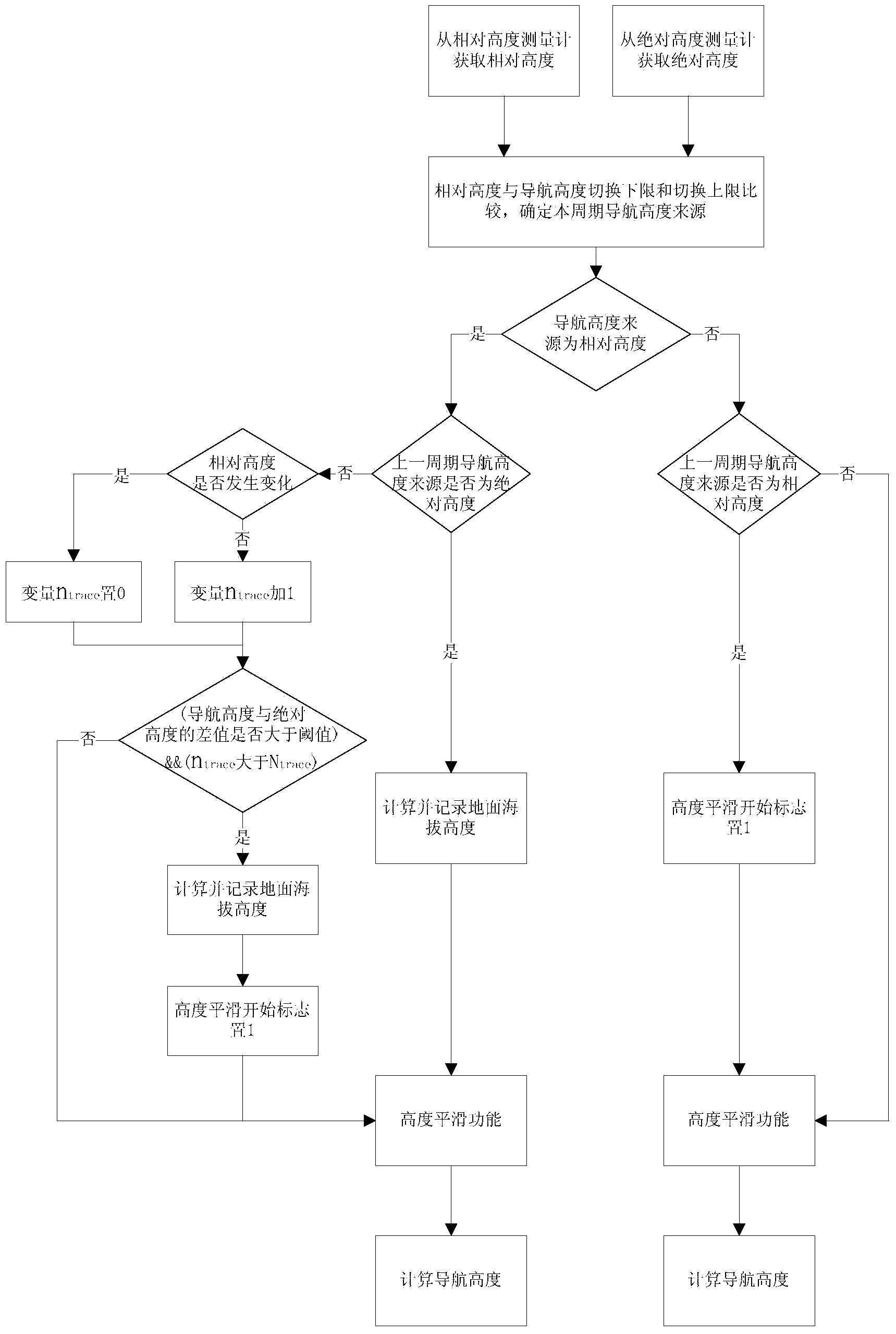
A navigation altitude obtaining method combining relative altitude and absolute altitude comprises the five steps of obtaining the relative altitude hrelat of an aircraft from the ground with a relative altitude measurement meter, obtaining the absolute altitude habs of the aircraft with an absolute altitude measurement meter, determining the navigation altitude source according to the relative altitude hrelat, calculating the navigation altitude hNavi by means of the absolute altitude habs if it is determined that the navigation altitude source is the absolute altitude habs in the third step, and calculating the navigation altitude hNavi by means of the relative altitude hrelat and the ground altitude hground and calculating and recording the difference value hoffset between the navigation altitude hNavi and the absolute altitude habs if it is determined that the navigation altitude source is the relative altitude hrelat in the third step. According to the navigation altitude obtaining method combining relative altitude and absolute altitude, the reliability and accuracy of the navigation altitude are improved; when the aircraft flies near the ground, the aircraft flies along with the ascending terrain, the aircraft can exit from the current state and return to an expected altitude when the aircraft flies along with the descending terrain, and then flight safety is guaranteed.

Description

technical field [0001] The present invention relates to a method for obtaining navigation altitude by fusing relative altitude and absolute altitude. Aircraft navigation control technology field. Background technique [0002] The method for obtaining the flying height of the unmanned aerial vehicle includes using an absolute altimeter to obtain an absolute height, and using a relative altimeter to obtain a relative height. Absolute altimeters include GPS (Global Positioning System) positioning system, barometric altimeter and other instruments; relative altimeters include ultrasonic altimeters, laser altimeters, radio altimeters and other instruments. [0003] The absolute altimeter has a large measurement range and can be used within the entire ceiling of the aircraft. However, when it is close to the ground, it is easily affected by factors such as surrounding buildings, trees, and weather changes, which will reduce the measurement accuracy or even fail. Therefore, using...

Claims


Application Information

Patent Timeline
Patent Type & Authority Applications(China)
IPC IPC(8): G05D1/04
Inventor 蒙志君陈旭智林子豪周尧明
Owner BEIHANG UNIV
Why Eureka
Try Eureka