

Map data downloading method and navigation device
A technology of map data and navigation equipment, applied in navigation, surveying and mapping, navigation, measuring devices, etc., can solve problems such as lack of map data, untimely update of local data, and deviation between paths and actual conditions, etc., to achieve convenient use and shorten download time , the effect of reducing the cost of use
- Summary
- Abstract
- Description
- Claims
- Application Information
AI Technical Summary
Problems solved by technology
Method used
Image

Examples
Embodiment 1
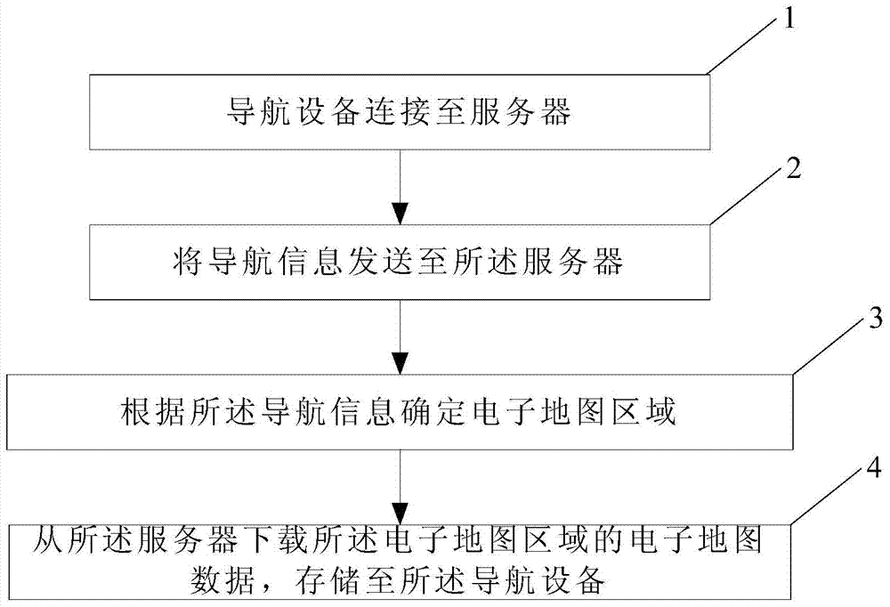
[0058] This embodiment provides a method for downloading map data, the process can refer to image 3 , including the following steps:
[0059] 301. The navigation device is connected to the server;
[0060] Connection methods can be: GPRS, WCDMA, TD-SCDMA, CDMA2000, wifi network, etc. The server is the server of the online map service provider.
[0061] 302. The navigation device determines the location information of the current location, and sends the location information to the server;
[0062] Specifically, the location information for determining the current location is determined by GPS, Beidou, gyroscope or base station.
[0063] 303. The server determines an electronic map area according to the location information of the current location; the electronic map area is an area within a preset range around the current location. The area within the preset range around the current location is a circular area with the current location point as the center and a preset radius...
Embodiment 2
[0070] This embodiment provides a method for downloading map data, the process can refer to Figure 4 , including the following steps:
[0071] 401. The navigation device is connected to the server;
[0072] Connection methods can be: GPRS, WCDMA, TD-SCDMA, CDMA2000, wifi network, etc. The server is the server of the online map service provider.
[0073] 402. The navigation device determines the destination according to the user's operation instruction, and sends the destination location information to the server; the destination can be obtained by user input;
[0074] 403. The server determines an electronic map area according to the destination location information; the electronic map area is an area within a preset range around the destination. The area within the preset range around the destination is a circular area whose center is the destination and whose radius is a preset value. The preset range is preset by the server, or preset by the navigation device and sent ...
Embodiment 3
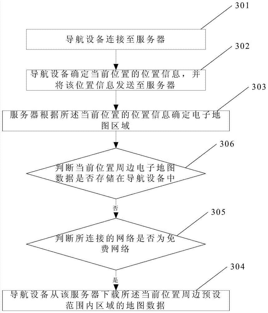
[0081] This embodiment provides a method for downloading map data, the process can refer to Figure 5 , including the following steps:
[0082] 501. The navigation device is connected to the server;
[0083] Connection methods can be: GPRS, WCDMA, TD-SCDMA, CDMA2000, wifi network, etc. The server is the server of the online map service provider.
[0084] 502. The navigation device determines the specified range area according to the user operation, and sends the specified range area to the server; the specified range area is an electronic map area arbitrarily defined by the user, which may be an electronic map area defined around the current location ;
[0085] 503. The server determines an electronic map area according to the specified area; the electronic map area is the specified area;
[0086] 504. The navigation device downloads the electronic map data of the specified area from the server.
[0087] Preferably, before 504, further include: 505, judge whether the conn...
PUM
 Abstract
Description
Claims
Application Information