
Three-dimensional civil defense geographic information service system

A geographic information service and air defense technology, which is applied in data processing applications, electrical digital data processing, special data processing applications, etc. Ensure safety and optimize the effect of upgrades

Inactive Publication Date: 2014-12-24
NANTONG BEICHENG SCI & TECH ENTREPRENEURIAL MANAGEMENT +1
View PDF4 Cites 9 Cited by
  • Summary
  • Abstract
  • Description
  • Claims
  • Application Information

AI Technical Summary

Problems solved by technology

The traditional civil air defense command system does not have the visualization function, and cannot obtain effective information in real time and accurately, and make command decisions

Method used


Image

  • Three-dimensional civil defense geographic information service system

Examples


Embodiment Construction

[0015] The present invention will be described in detail below in conjunction with the accompanying drawings and specific embodiments.

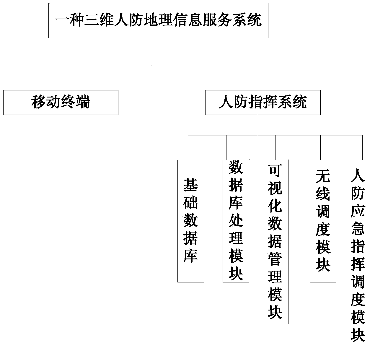
[0016] Such as figure 1 As shown, a three-dimensional civil air defense geographic information service system includes a mobile terminal and a civil air defense command system; the mobile terminal is used to collect data and transmits to the civil air defense command system, which includes a GPS module and is wirelessly connected to the civil air defense system; The civil air defense command system includes a basic database, a database processing module, a visual data management module, a wireless dispatch module and a civil air defense emergency command and dispatch module; the basic database includes basic spatial layer data and civil air defense business layer data; the database processing The module is used to store, add, modify and delete the data in the database; the visualized data management module is used to display the command post ...


PUM


Abstract

The invention discloses a three-dimensional civil defense geographic information service system. The three-dimensional civil defense geographic information service system comprises a mobile terminal and a civil defense commanding system. The mobile terminal is used for collecting data and transmitting the data to the civil defense commanding system. The civil defense commanding system comprises a basic database, a database processing module, a visual data management module, a wireless dispatching module and a civil defense emergency commanding and dispatching module. The basic database comprises fundamental space layer data and civil defense service layer data. The database processing module is used for storing, increasing, modifying and deleting the data in the database. The visual data management module is used for displaying a structure in an underground space of a command post in the system through a three-dimensional model. The wireless dispatching module supports basic cluster services such as single calling, group calling, broadcast calling and emergency calling. The civil defense emergency commanding and dispatching module comprises an emergency event analysis module, an emergency plan modeling module and an emergency plan automatic monitoring and early warning module.

Description

technical field [0001] The invention relates to civil air defense management technology, in particular to a three-dimensional civil air defense geographic information service system. Background technique [0002] With the continuous improvement of people's living standards, more and more fields have gradually realized digitalization with the progress and development of computer technology and digital transmission technology. The informatization and digitalization process of civil air defense projects are also constantly improving and developing rapidly under the great development of the national economy and urbanization. [0003] As we all know, the responsibility of the civil air defense department is to command air raids in wartime and disaster prevention and relief in peacetime. Modern warfare has greatly shortened the command cycle of urban air defense, and the capabilities of analysis, insight, judgment, and decision-making will directly affect the outcome of the war. ...

Claims


Application Information

Patent Timeline
Patent Type & Authority Applications(China)
IPC IPC(8): G06Q10/06G06Q50/26G06F17/30
Inventor 戴亮
Owner NANTONG BEICHENG SCI & TECH ENTREPRENEURIAL MANAGEMENT
Learn More