Paddy field and dry land distinguishing method based on oriented objects and medium-resolution-ration remote sensing image

An object-oriented, remote sensing image technology, applied in image analysis, image enhancement, image data processing, etc., can solve the problem of inaccurate extraction of paddy field and dry land spatial information, and achieve the effect of clear geographic meaning and high precision

Inactive Publication Date: 2015-01-07
NORTHEAST INST OF GEOGRAPHY & AGRIECOLOGY C A S
View PDF2 Cites 15 Cited by
  • Summary
  • Abstract
  • Description
  • Claims
  • Application Information

AI Technical Summary

Problems solved by technology

[0005] The present invention aims to solve the technical problem that the current remote sensing classification method cannot accurately extract the spatial information of paddy fields and dry lands by only using spectral information, and provides a method for distinguishing paddy fields and dry lands based on object-oriented and medium-resolution remote sensing images

Method used


Image

  • Paddy field and dry land distinguishing method based on oriented objects and medium-resolution-ration remote sensing image
  • Paddy field and dry land distinguishing method based on oriented objects and medium-resolution-ration remote sensing image

Examples


specific Embodiment approach 1

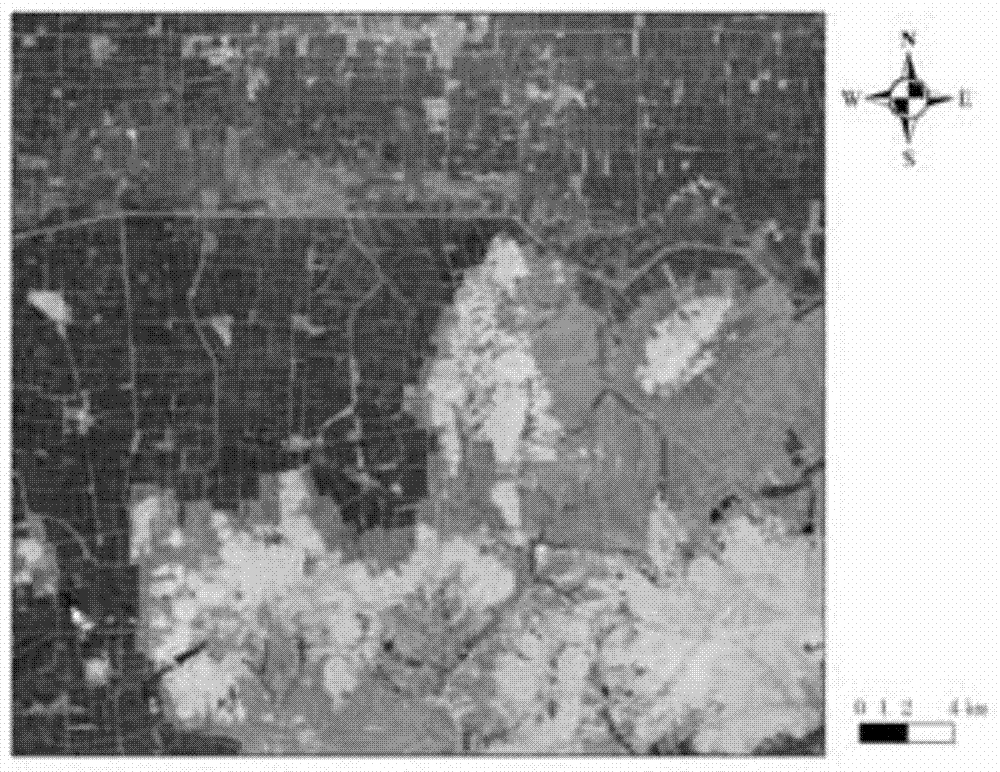
[0023] Specific implementation mode one: the method for distinguishing paddy fields and dry areas based on object-oriented and medium-resolution remote sensing images in this embodiment is carried out according to the following steps:

[0024] Step 1: Perform orthorectification and geometric fine correction on Landsat-8 OLI data;

[0025] Step 2: Carry out multi-layer and multi-scale segmentation on the Landsat-8 OLI image to obtain a series of segmentation units. Each segmentation unit is composed of spatially adjacent pixels with a homogeneity of more than 80%. Each segmentation unit as an object;

[0026] Step 3: Extract the spectral features, texture features, shape features and structural features of each object obtained in step 2, and use the hue features derived from the HIS transformation to calculate the arithmetic features of the object;

[0027] Step 4: Using the spectral features, texture features, shape features, and structural features obtained in Step 3, determ...

specific Embodiment approach 2

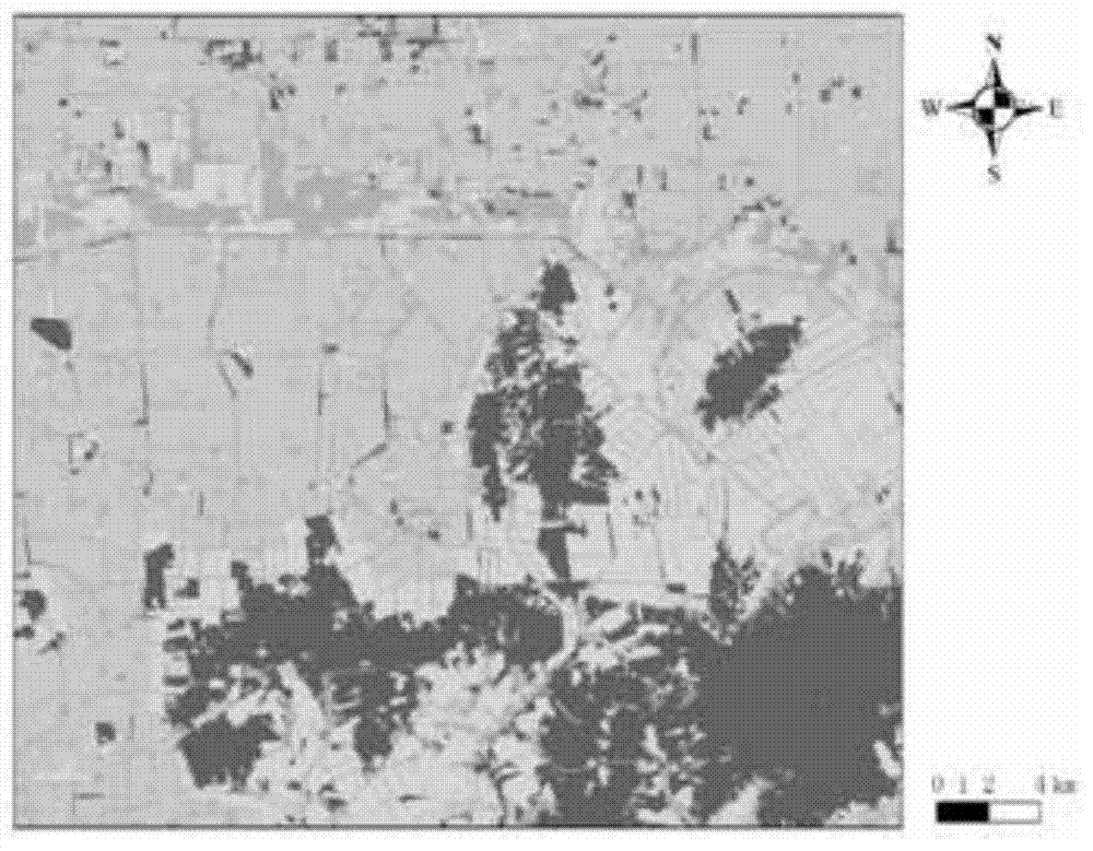
[0032] Embodiment 2: The difference between this embodiment and Embodiment 1 is that in step 4, objects whose arithmetic characteristics obtained in step 3 are less than or equal to 0.37 are removed to obtain cultivated land objects. Others are the same as in the first embodiment.

specific Embodiment approach 3

[0033] Embodiment 3: This embodiment differs from Embodiment 1 or Embodiment 2 in that in step 5, objects whose arithmetic characteristics are less than or equal to 0.89 are extracted to obtain paddy field objects. Others are the same as those in the first or second embodiment.


PUM


Abstract

The invention provides a paddy field and dry land distinguishing method based on oriented objects and a medium-resolution-ration remote sensing image, and relates to the paddy field and dry land distinguishing method. The method solves the technical problem that currently, due to the fact that according to a remote sensing classification method, only spectrum information is utilized, and paddy field and dry land spatial information can not be accurately extracted. The method includes the steps of firstly, conducting ortho-rectification and geometric fine correction on data; secondly, conducting multi-layer and multi-resolution segmentation on an OLI image of the Landsat-8; thirdly, calculating the arithmetic characteristics of the objects; fourthly, removing the forest land objects; extracting the paddy field objects; sixthly, extracting the dry land objects; seventhly, exporting the paddy field objects and the dry land objects, and generating cultivated land vectors; eighthly, manufacturing a cultivated land thematic map in the ArcGIS software. The difficulty that the distinguishing omission phenomenon and the false distinguishing phenomenon are serious when paddy fields and dry lands are extracted is overcome; meanwhile, the problem that the pepper salt phenomenon exists in the paddy field and dry land spatial information obtained through classification is solved, and no clear geography significance problem exists. The invention belongs to the field of the paddy field and dry land distinguishing of remote sensing images.

Description

technical field [0001] The invention relates to a method for distinguishing paddy fields and dry areas. Background technique [0002] Agriculture is a country's basic industry. According to the law of regional differentiation of agriculture, it is the basic principles and laws of agricultural production to develop agriculture according to local conditions, make rational use of agricultural resources, and give full play to regional advantages. In terms of agricultural production, the country's macro-control plays an important role, and the country's macro-control needs to accurately grasp the distribution information of cultivated land. Remote sensing images provide a data basis for the acquisition of cultivated land distribution information, but the key to serving the country's macro-control is to accurately use remote sensing data to extract paddy and dry land information. [0003] The object-oriented remote sensing image interpretation method is compared with the traditio...

Claims


Application Information

Patent Timeline
IPC IPC(8): G06K9/62G06T7/00
CPCG06T7/12G06T2207/30188G06T2207/20112G06T2207/10032G06V10/56
Inventor 满卫东王宗明贾明明刘明月路春燕毛德华
Owner NORTHEAST INST OF GEOGRAPHY & AGRIECOLOGY C A S
Why Eureka
Try Eureka