

Image display method and system based on streetscape attribute information
A technology of graphic display and attribute information, applied in geographic information database, image analysis, image data processing and other directions, can solve the problem of difficult to carry out search and spatial positioning based on street view content, to increase the amount of information and expressiveness, improve navigation ability, the effect of increasing effective information
- Summary
- Abstract
- Description
- Claims
- Application Information
AI Technical Summary
Problems solved by technology
Method used
Image

Examples
Embodiment Construction
[0027] In order to make the object, technical solution and advantages of the present invention clearer, the present invention will be further described in detail below in conjunction with the accompanying drawings and embodiments. It should be understood that the specific embodiments described here are only used to explain the present invention, not to limit the present invention.
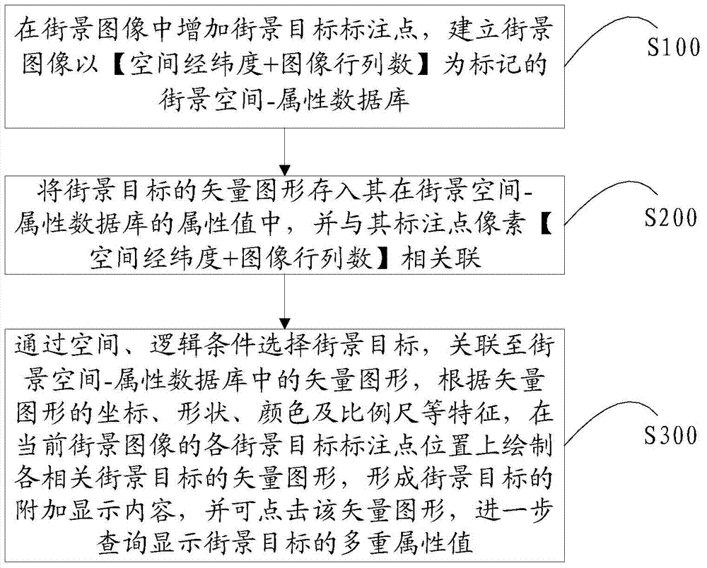
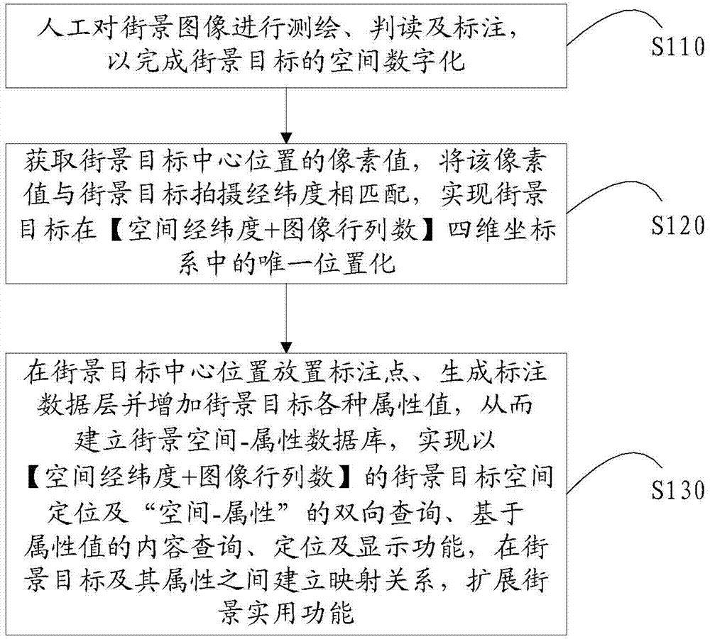
[0028] see figure 1 , is a flowchart of a graphic display method based on street view attribute information according to an embodiment of the present invention. The graphic display method based on street view attribute information in the embodiment of the present invention comprises the following steps:
[0029] Step 100: adding street view target marking points in the street view image, and establishing a street view space-attribute database marked with [spatial latitude and longitude + number of image rows and columns] in the street view image;
[0030] In step 100, the street view target inclu...
PUM
 Abstract
Description
Claims
Application Information