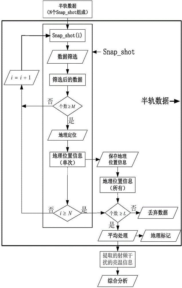
Radio frequency interference detection method based on satellite passive microwave remote sensing data
A passive microwave remote sensing and radio frequency interference technology, which is applied in the field of microwave remote sensing, can solve the problems of poor positioning accuracy, inability to locate, and malfunction of the navigation system
- Summary
- Abstract
- Description
- Claims
- Application Information
AI Technical Summary
Problems solved by technology
Method used
Image
Examples
Embodiment 1
[0040] Example 1: Radio frequency interference of SMOS satellite data in China
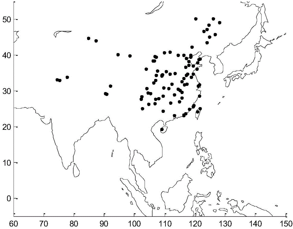
[0041] In this embodiment, using the radio frequency interference detection method proposed above, by processing the L1-c level data provided by the SMOS satellite on August 18, 2013-August 20, 2013, obtained: the L-band radio frequency interference in China location distribution, such as figure 2 shown; the geographical coordinates of radio frequency interference in China are given in Table 1. exist figure 2 In , the black dots indicate the location of the RF interference and its source.
[0042] Table 1 Geographic coordinates of radio frequency interference in China
[0043] RFI source name
RFI source name
Beijing
116.3340.00
Xi'an, Shaanxi
108.9634.26
Tianjin
117.1539.15
Shaanxi Baoji
107.2734.39
Shanghai
121.5631.83
Hanzhong City, Shaanxi
106.9633.01
Guangzhou, Guangd...
PUM
 Abstract
Description
Claims
Application Information
 - R&D
- Intellectual Property
- Life Sciences
- Materials
- Tech Scout
- Unparalleled Data Quality
- Higher Quality Content
- 60% Fewer Hallucinations
Browse by: Latest US Patents, China's latest patents, Technical Efficacy Thesaurus, Application Domain, Technology Topic, Popular Technical Reports.
© 2025 PatSnap. All rights reserved.Legal|Privacy policy|Modern Slavery Act Transparency Statement|Sitemap|About US| Contact US: help@patsnap.com


