Automatic generating method for three-dimensional virtual city
A three-dimensional virtual and automatic generation technology, applied in the field of virtual cities, can solve the problem that the land use model cannot fully and accurately reflect the distribution of roads and buildings in the city
- Summary
- Abstract
- Description
- Claims
- Application Information
AI Technical Summary
Problems solved by technology
Method used
Image
Examples
Embodiment 1
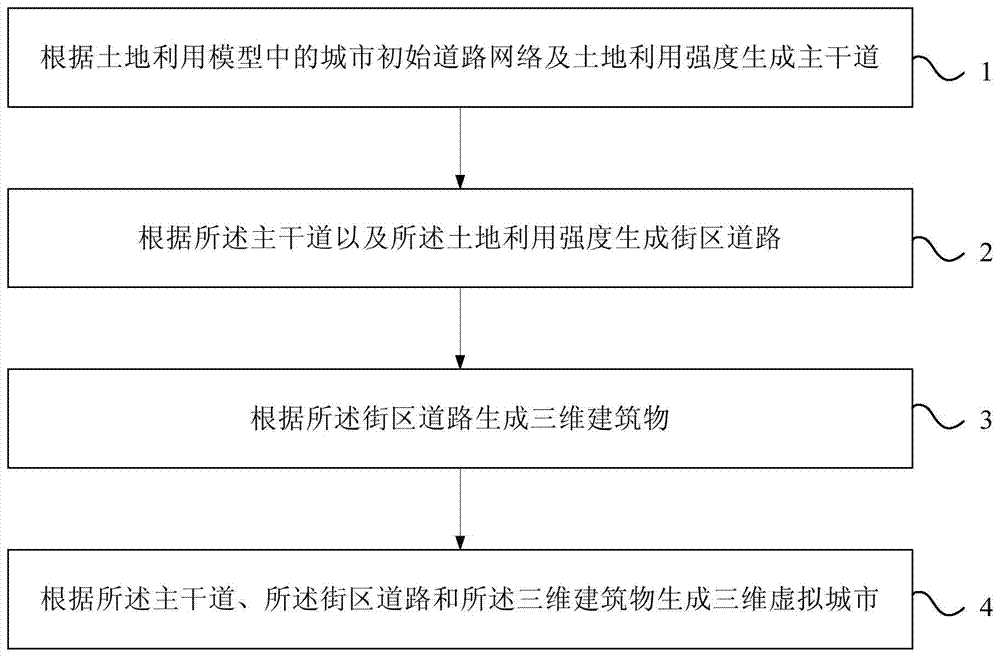
[0018] figure 1 It is a flow chart of the method for automatically generating a 3D virtual city provided by Embodiment 1 of the present invention. Such as figure 1 As shown, the automatic generation method of the three-dimensional virtual city in this embodiment may include:
[0019] Step 1. Generate arterial roads according to the initial urban road network and land use intensity in the land use model.
[0020] Specifically, when the planner needs to simulate a brand new city, the initial urban road network can be empty, that is, multiple main roads are generated directly according to the land use intensity; when the planner needs to simulate urban expansion on the basis of the existing urban area , the initial road network of the city can include the main roads of the existing urban areas, and on the basis of the initial road network formed by the main roads of the existing urban areas, new main roads are generated according to the intensity of land use.
[0021] Urban ro...
Embodiment 2
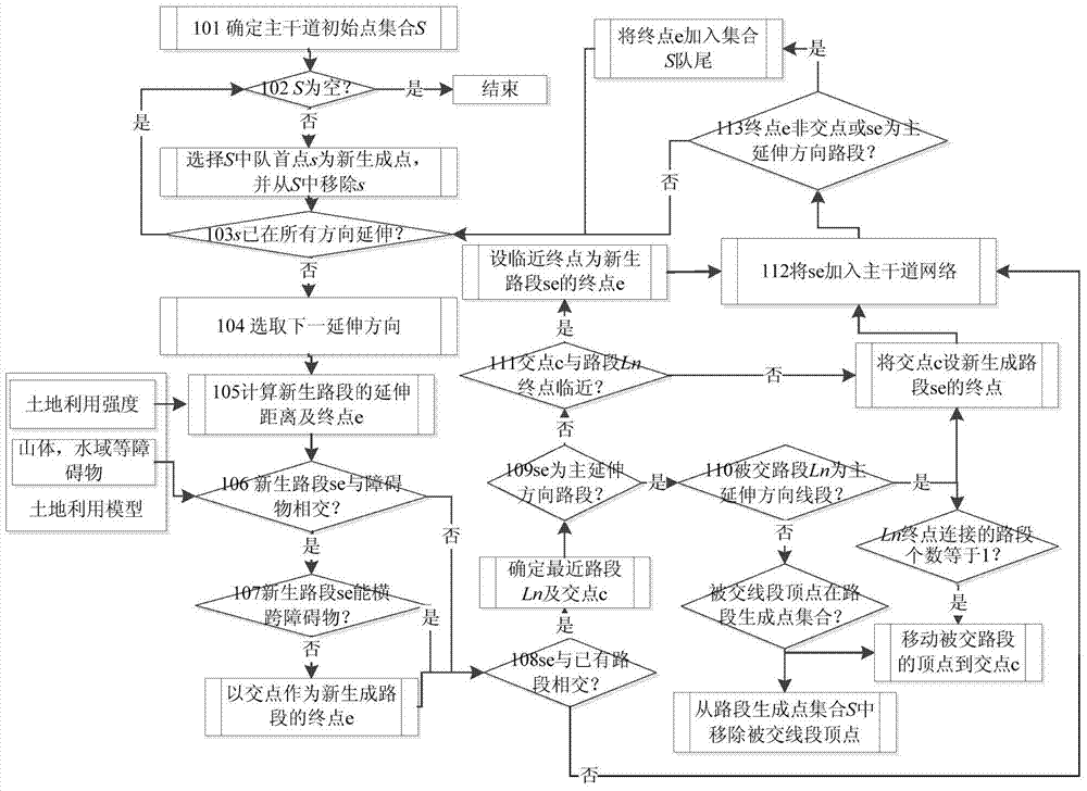
[0032] figure 2 It is a flow chart of generating arterial roads in the method for automatically generating a 3D virtual city provided in Embodiment 2 of the present invention. This embodiment is based on the method for automatically generating a three-dimensional virtual city provided in the first embodiment, and provides a specific implementation of step 1. In this embodiment, main roads are generated according to the initial urban road network and land use intensity in the land use model, which may specifically include:
[0033] Determine the initial point of the main road for extending the main road according to the initial road network of the city, form a set of initial points of the main road, determine the extension direction for each initial point of the main road, and the extension direction includes a main extension direction and at least one secondary The direction of extension, and perform the following steps in turn for each initial point of the main road in the ...
Embodiment 3
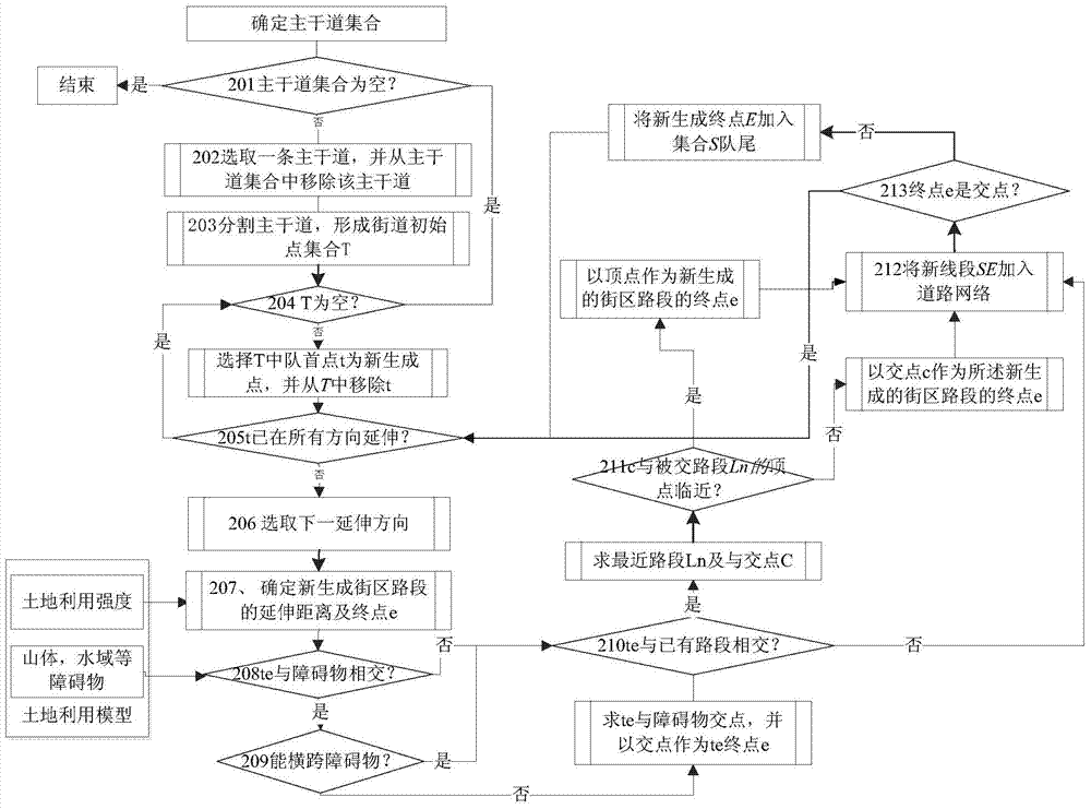
[0082] image 3 It is a flow chart of generating block roads in the method for automatically generating a 3D virtual city provided by Embodiment 3 of the present invention. This embodiment is based on the method for automatically generating a three-dimensional virtual city provided in the first embodiment, and provides a specific implementation of step 2. In this embodiment, generating block roads according to the main road and the land use intensity may specifically include:
[0083] Determine the initial street point for extending the block road according to the main road, form a street initial point set, determine the extension direction for each street initial point, and execute the following steps in sequence for each street initial point in the street initial point set The above steps:
[0084] A new block section is generated in each extension direction of the initial point of the street, and the land use intensity covered by the newly generated block section satisfie...
PUM
 Abstract
Description
Claims
Application Information
 - R&D
- Intellectual Property
- Life Sciences
- Materials
- Tech Scout
- Unparalleled Data Quality
- Higher Quality Content
- 60% Fewer Hallucinations
Browse by: Latest US Patents, China's latest patents, Technical Efficacy Thesaurus, Application Domain, Technology Topic, Popular Technical Reports.
© 2025 PatSnap. All rights reserved.Legal|Privacy policy|Modern Slavery Act Transparency Statement|Sitemap|About US| Contact US: help@patsnap.com


