Method for carrying out on-site supplementary survey of indoor map by smartphone

A smart phone and indoor map technology, applied in the field of map surveying and mapping, can solve the problems of inconsistency between the map and the scene, high cost, etc.

Active Publication Date: 2015-10-14
李巍岳 +1
View PDF6 Cites 4 Cited by
  • Summary
  • Abstract
  • Description
  • Claims
  • Application Information

AI Technical Summary

Problems solved by technology

[0005] After the vector map is generated, there is often a problem: that is, the map is inconsistent with the scene
This drawing method has high precision, but the cost is high, and it is suitable for use in some specific occasions

Method used


Image

  • Method for carrying out on-site supplementary survey of indoor map by smartphone
  • Method for carrying out on-site supplementary survey of indoor map by smartphone
  • Method for carrying out on-site supplementary survey of indoor map by smartphone

Examples


Embodiment Construction

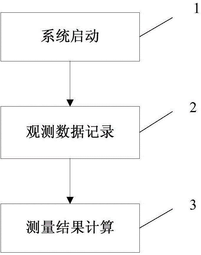
[0072] The present invention will be described in detail below in conjunction with the accompanying drawings and specific embodiments. This embodiment is carried out on the premise of the technical solution of the present invention, and detailed implementation and specific operation process are given, but the protection scope of the present invention is not limited to the following embodiments.

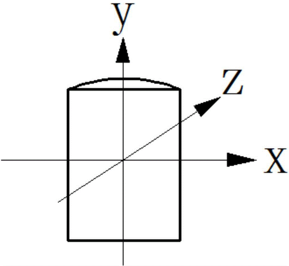
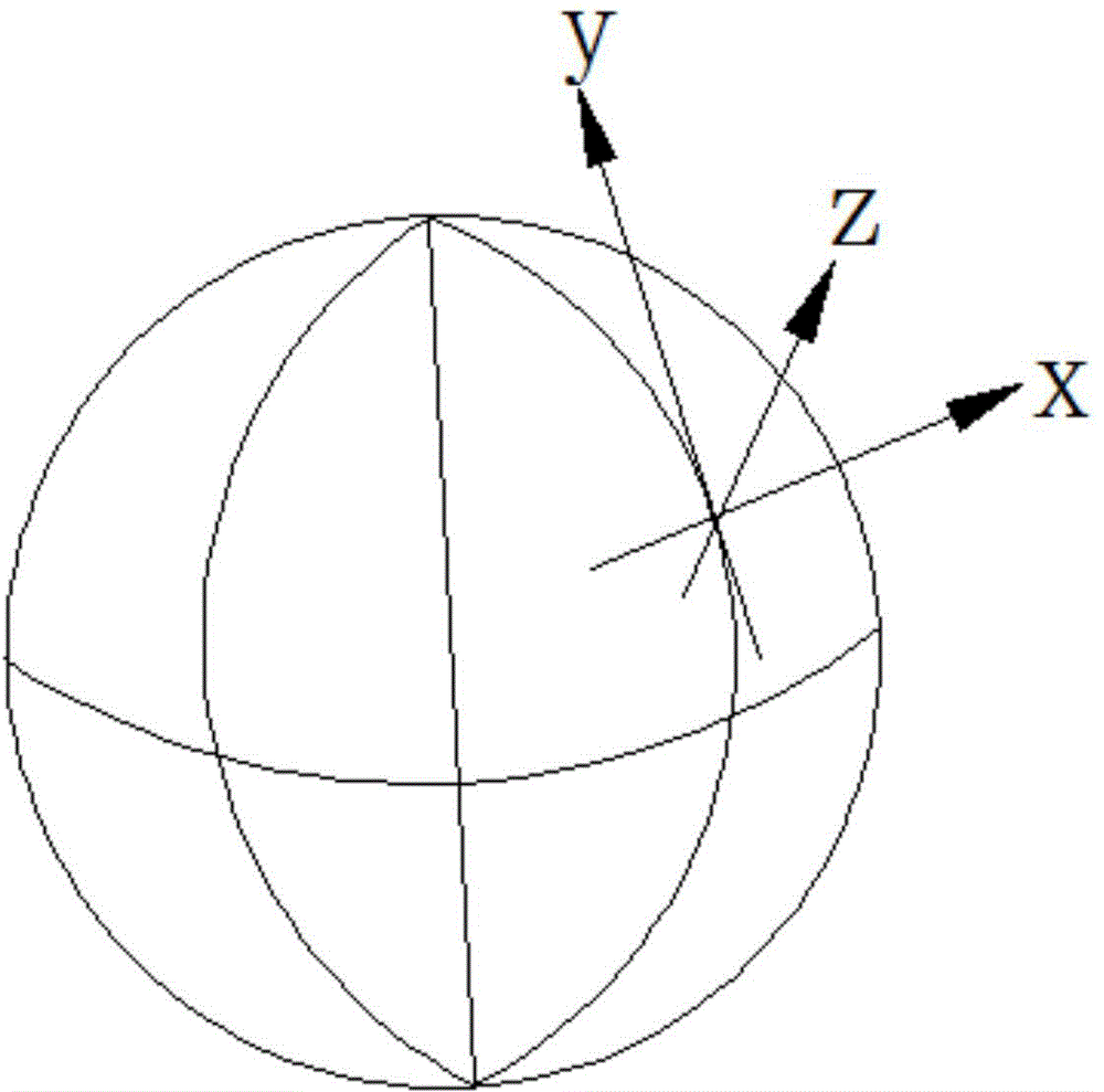
[0073] The invention discloses a method for on-site supplementary measurement of an indoor map by using a smart phone. During use, the user stands on the ground inside the house, uses the camera to point at the corners of the house, and takes a picture of each corner, and the system will record the moment when the camera is taken. In this process, the accelerometer, gyroscope, magnetometer and other sensors built into the smartphone are used to obtain observation data, and then corresponding calculations and data fusion are performed to calculate the length, corner and area of ​​each ...


PUM


Abstract

The invention relates to a method for carrying out the on-site supplementary survey of an indoor map by a smartphone. The method comprises the following steps: 1) sensor checking: the smartphone is put on a horizontal table top in a way that the screen of the smartphone faces downwards, the observation data of an accelerometer and a gyroscope is recorded after setting time stops, and a corresponding zero offset is calculated; 2) system initialization: when a user takes a picture by aiming at a first intersection point of a house, the system carries out initialization, and the initial attitude of the smartphone is calculated by the observation data of the accelerometer and a magnetometer; 3) observation data recording: the observation data of all sensors (including the accelerometer, the gyroscope and the magnetometer) is recorded, and a moment when each corner point is photographed is also recorded; and 4) measurement result calculation: fusion is carried out by all pieces of sensor data recorded in the previous step, and each side length, the corner and the area of the house to be detected are calculated. Compared with the prior art, the method has the advantages of being convenient, quick, precise, low in cost and the like.

Description

technical field [0001] The invention relates to a map surveying and mapping method, in particular to a method for on-site supplementary surveying of an indoor map by using a smart phone. Background technique [0002] People spend more than 80% of their time indoors. Therefore, applications around indoor maps and navigation are a market with huge demand and development potential. As the carrier of information, the indoor map not only graphically presents our environment to us intuitively, but also can search for points of interest, route guidance, and assist mobile phone sensor positioning based on the map. It can be seen that indoor maps play a vital role. [0003] indoors Figure 1 There are generally two categories; scalar format maps and vector format maps. The scalar map refers to the floor plan of the building in image format, such as PDF, JPG, PNG and other formats. Usually we see some schematic diagrams in the building, such as the evacuation route map posted on th...

Claims


Application Information

Patent Timeline
IPC IPC(8): G06F19/00G06F17/30G01C21/32G09B29/00
Inventor 李巍岳周发根
Owner 李巍岳
Why Eureka
Try Eureka