Operation land parcel automatic identification and area statistics method based on spatial mesh division

An automatic identification and spatial grid technology, applied in the field of satellite positioning and identification, achieves the effects of fast speed, overcoming positioning data drift, and high degree of automation

Active Publication Date: 2015-10-21
江苏北斗卫星应用产业研究院有限公司 +1
View PDF2 Cites 40 Cited by
  • Summary
  • Abstract
  • Description
  • Claims
  • Application Information

AI Technical Summary

Benefits of technology

This patented method helps identify and eliminate any potential parked spots that may affect an entire plant's performance or even cause damage during harvesting activities. By analyzing these areas over time, we aim to reduce the computational load needed while ensuring efficient use of space within the facility. Additionally, this approach allows us to create maps showing how crops grow on different types of equipment without being affected by their location. Overall, our inventors provide advanced methods for managing and optimizing crop growth environments through precise tracking of machine locations throughout its working range.

Problems solved by technology

This patented technical problem addressed by this patents relates to improving precise farming techniques that involve measuring soil properties during plant growth stages or harvest times on fields where crops may move around without being affected negatively affect their quality and yield potential. Current methods require significant effort from humans while still lacking accuracy and consistency across different terrains. There needs improvement over existing methods to address these issues effectively.

Method used


Image

  • Operation land parcel automatic identification and area statistics method based on spatial mesh division
  • Operation land parcel automatic identification and area statistics method based on spatial mesh division
  • Operation land parcel automatic identification and area statistics method based on spatial mesh division

Examples


Embodiment Construction

[0043] In order to deepen the understanding of the present invention, the present invention will be further described below in conjunction with the embodiments and accompanying drawings. The embodiments are only used to explain the present invention and do not constitute a limitation to the protection scope of the present invention.

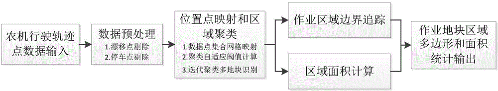
[0044] see figure 1 As shown, the main algorithm steps involved in the automatic identification and statistical method of working plots through the positioning track points of agricultural machinery vehicles are as follows

[0045] A) data preprocessing;

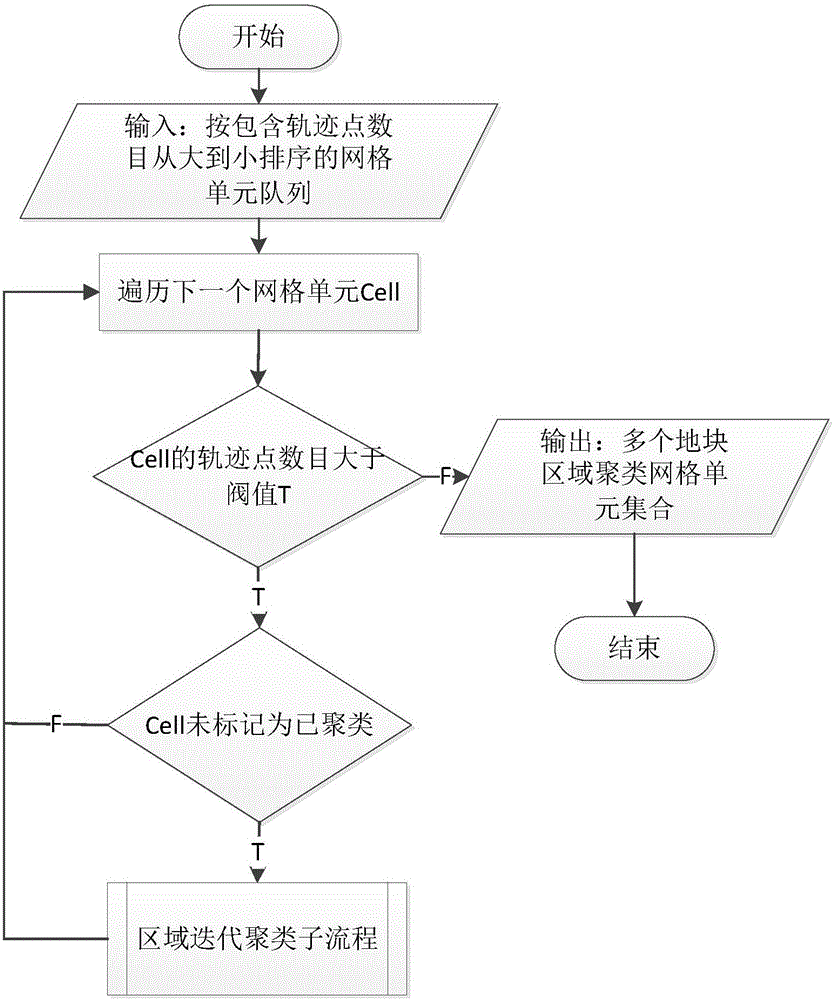
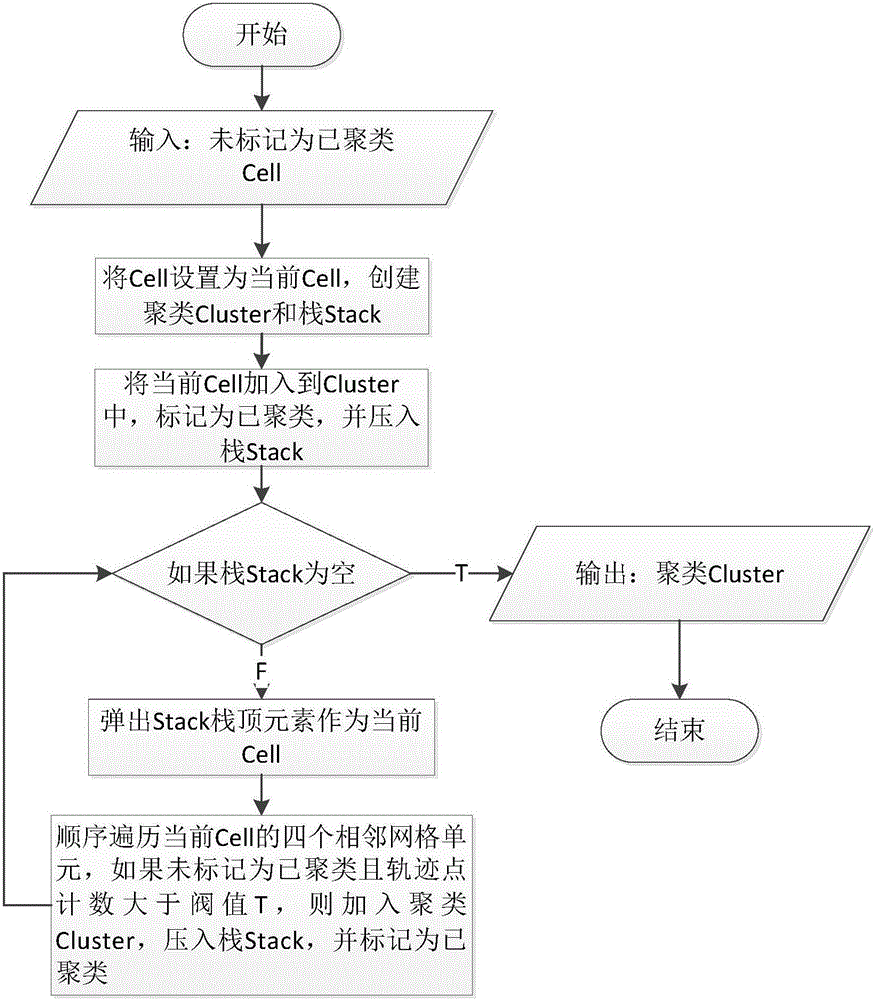
[0046] B) location point mapping and area clustering;

[0047]C) Operation area boundary tracking;

[0048] D) Area area calculation.

[0049] In the step A), the data preprocessing mainly completes:

[0050] (1) Elimination of positioning drift points. The data reporting interval of the positioning terminal is t seconds, and the maximum driving speed of the agricultural machinery is V m...


PUM


Abstract

The present invention discloses an operation land parcel automatic identification and area statistics method based on spatial mesh division, wherein a satellite is used to position a track point of operation driving of an agricultural vehicle. The method mainly comprises the following steps: A) data pre-processing; B) position point mapping and region clustering; C) operation region border tracing; and D) region area calculating. The method has the following technical advantages that: 1. an algorithm processing process requires no human intervention, has a high degree of automation and can be executed as a task background regularly triggered by a real application system, thereby greatly improving the efficiency of monitoring and managing the operation and production of the agricultural vehicle; 2. the calculation is stable and reliable, and by means of pre-processing and self-adaptive threshold mechanisms and the like, data drifting, a positioning error and the intervention of a non-operation positioning point can be effectively overcome; and 3. the method has a good adaptability for real agricultural vehicle operation regions in different shapes and a boundary polygon of a non-convex operation region can be generated, and the method is accurate in area calculation, high in algorithm execution efficiency and high in speed.

Description


Claims


Application Information

Patent Timeline
Owner 江苏北斗卫星应用产业研究院有限公司
Why Eureka
Try Eureka