Method for modeling terrain property of Wargame map by grid matrix
A grid and matrix technology, applied in the field of using grid matrix to establish terrain attributes of wargame maps, can solve problems such as increased complexity and reduced algorithm efficiency, and achieve the effect of reducing complexity, balancing computational efficiency, and improving efficiency
- Summary
- Abstract
- Description
- Claims
- Application Information
AI Technical Summary
Problems solved by technology
Method used
Image
Examples
Embodiment Construction
[0040] The present invention will be described in detail below in conjunction with the accompanying drawings and specific embodiments.
[0041] The steps of modeling the terrain attributes of wargame maps are as follows:
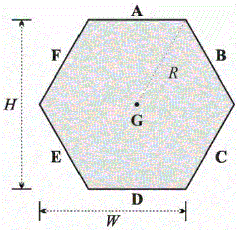
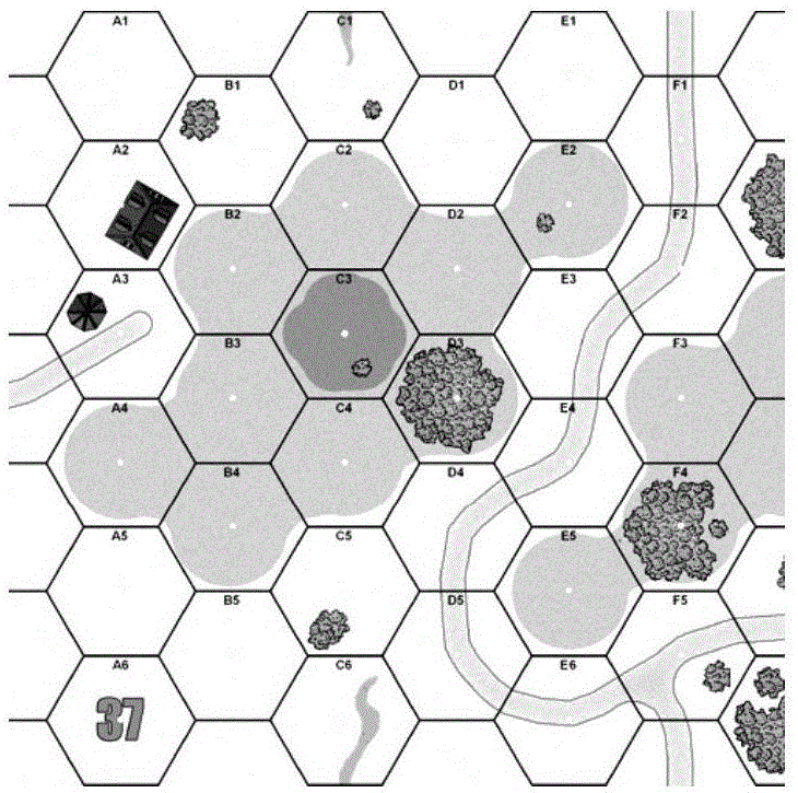
[0042] 1) The wargame map adopts a regular hexagonal grid, that is, a hexagonal grid;
[0043] 2) Determine the geographical environment elements involved in wargame map modeling;
[0044] 3) Calculate the capping area ratio of each geographical environment element to the hexagonal grid:
[0045] a. Set the size r of the grid matrix, determine the circumscribed rectangle surrounding the area where each geographical environment element is located, rasterize the circumscribed rectangle to form the initial grid matrix, and identify all the grid points of the initial grid matrix as 0;
[0046] b. Determine the situation that each geographical environment element covers the initial grid matrix, if the grid point covers the geographical environment element, the...
PUM
 Abstract
Description
Claims
Application Information
 - R&D
- Intellectual Property
- Life Sciences
- Materials
- Tech Scout
- Unparalleled Data Quality
- Higher Quality Content
- 60% Fewer Hallucinations
Browse by: Latest US Patents, China's latest patents, Technical Efficacy Thesaurus, Application Domain, Technology Topic, Popular Technical Reports.
© 2025 PatSnap. All rights reserved.Legal|Privacy policy|Modern Slavery Act Transparency Statement|Sitemap|About US| Contact US: help@patsnap.com


