Survey, search and rescue robot with functions of simultaneous localization and map building

A technology of map creation and robotics, applied in the field of robotics, can solve problems such as delayed rescue timing, complexity, and instability, and achieve the effect of reducing casualties and labor losses

Inactive Publication Date: 2016-01-06
BEIJING FORESTRY UNIVERSITY
View PDF7 Cites 23 Cited by
  • Summary
  • Abstract
  • Description
  • Claims
  • Application Information

AI Technical Summary

Problems solved by technology

After the disaster, the building structure collapsed on site, resulting in a narrow, complex and unstable environment and topographic structure. The current rescue method is external search and rescue, that is, using some living body sensing devices to detect whether there are people waiting to be rescued under the ruins. However, ordinary detection The

Method used


Image

  • Survey, search and rescue robot with functions of simultaneous localization and map building
  • Survey, search and rescue robot with functions of simultaneous localization and map building
  • Survey, search and rescue robot with functions of simultaneous localization and map building

Examples


Embodiment Construction

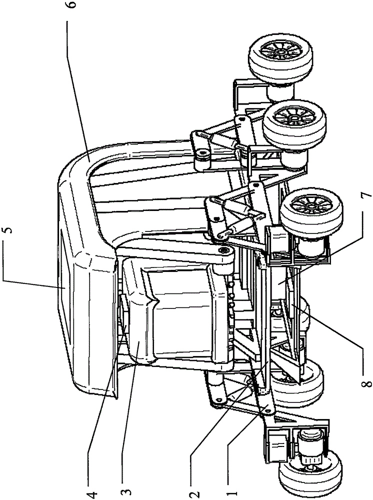
[0022] The real-time positioning and map creation survey search and rescue robot of the present invention, its preferred specific implementation is as follows Figure 1 to Figure 4 Shown:

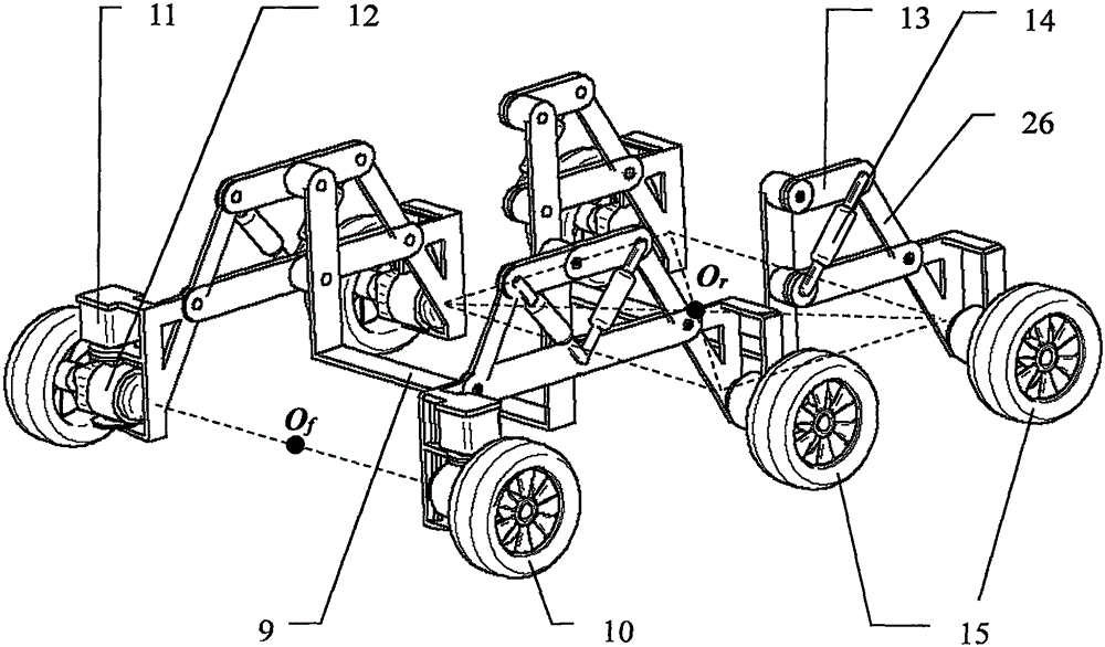
[0023] Such as figure 1 As shown, the real-time positioning and map creation survey search and rescue robot of the present invention includes an obstacle-crossing chassis 1 , a body platform 2 , a three-dimensional scanning module 3 , a main control unit 5 , a body shell 6 and a drive module 7 . Such as figure 1 with figure 2 As shown, the main mechanism and sensors are mounted on the main frame 9 of the obstacle-crossing chassis 1 , including a vehicle body platform 2 , a drive module 7 , a vehicle body inertial sensor 8 and a three-dimensional scanning module 3 . A three-dimensional scanning module 3 and a body shell 6 are installed on the body platform 2, and the body shell 6 is supported by a rigid support to prevent deformation or damage. Real-time positioning and map creation The...


PUM


Abstract

The invention discloses a survey, search and rescue robot with the functions of simultaneous localization and map building. The survey, search and rescue robot is applied to the field of map building of a tunnel, terrain exploration and the like after a disaster and comprises an obstacle crossing chassis, a vehicle body platform, a three-dimensional scanning module, a master control unit, a vehicle body shell and a driving module. A bionic suspension structure driven by six wheels is adopted for the obstacle crossing chassis, and a vehicle body has passive self-adaptability on different kinds of terrain. The three-dimensional scanning module comprises a three-dimensional scanning robot, a laser scanning radar, an infrared temperature sensor, a laser inertial sensor and a fixed support. The survey, search and rescue robot can explore the ambient environment autonomously in the marching process and establish a three-dimensional topographic map in real time, and meanwhile whether life bodies possibly exist or not is detected; the real-time three-dimensional topographic map and possible life body search and rescue positions can be fed back to operators; the operators are helped to fast and accurately know the site conditions so that the rescuing work can be carried out as soon as possible, and meanwhile unnecessary casualties and labor losses of exploration and search and rescue staff are reduced.

Description

technical field [0001] The present invention relates to a robot used for complex environment map creation, terrain survey, search and rescue in closed spaces, and in particular to a real-time detection of environment in unknown areas such as narrow caves and disaster areas under rough terrain conditions and the search and rescue of possible life forms. Locating and Mapping Create Survey Search and Rescue Robots. Background technique [0002] In recent years, disasters such as earthquakes, tsunamis, landslides, and nuclear power plant leaks have occurred one after another. After the disaster, the building structure collapsed on site, resulting in a narrow, complex and unstable environment and topographic structure. The current rescue method is external search and rescue, that is, using some living body sensing devices to detect whether there are people waiting to be rescued under the ruins. However, ordinary detection The device cannot directly understand the internal situat...

Claims


Application Information

Patent Timeline
IPC IPC(8): B62D61/10G01S17/89
Inventor 康峰高梦琪张志威张玲玲
Owner BEIJING FORESTRY UNIVERSITY
Why Eureka
Try Eureka