Portable multifunctional rock-soil body structure reconstruction auxiliary tool

An auxiliary tool and multi-functional technology, applied in the field of geological engineering survey and geology, it can solve the problems such as inability to use geological field survey to take photos of spatial orientation indicators, and achieve the effect of three-dimensional convenient resolution, precise pointing, and pointing balance

Inactive Publication Date: 2016-04-20
TONGJI UNIV
View PDF5 Cites 1 Cited by
  • Summary
  • Abstract
  • Description
  • Claims
  • Application Information

AI Technical Summary

Problems solved by technology

It can be seen that the device can better improve the efficiency and accuracy of geological survey work, but the device can also not be used for geological site survey photographs, video and 3D scanning space orientation indicators

Method used


Image

  • Portable multifunctional rock-soil body structure reconstruction auxiliary tool
  • Portable multifunctional rock-soil body structure reconstruction auxiliary tool
  • Portable multifunctional rock-soil body structure reconstruction auxiliary tool

Examples


Embodiment Construction

[0038] The present invention will be described in detail below in conjunction with the accompanying drawings and specific embodiments. This embodiment is carried out on the premise of the technical solution of the present invention, and detailed implementation and specific operation process are given, but the protection scope of the present invention is not limited to the following embodiments.

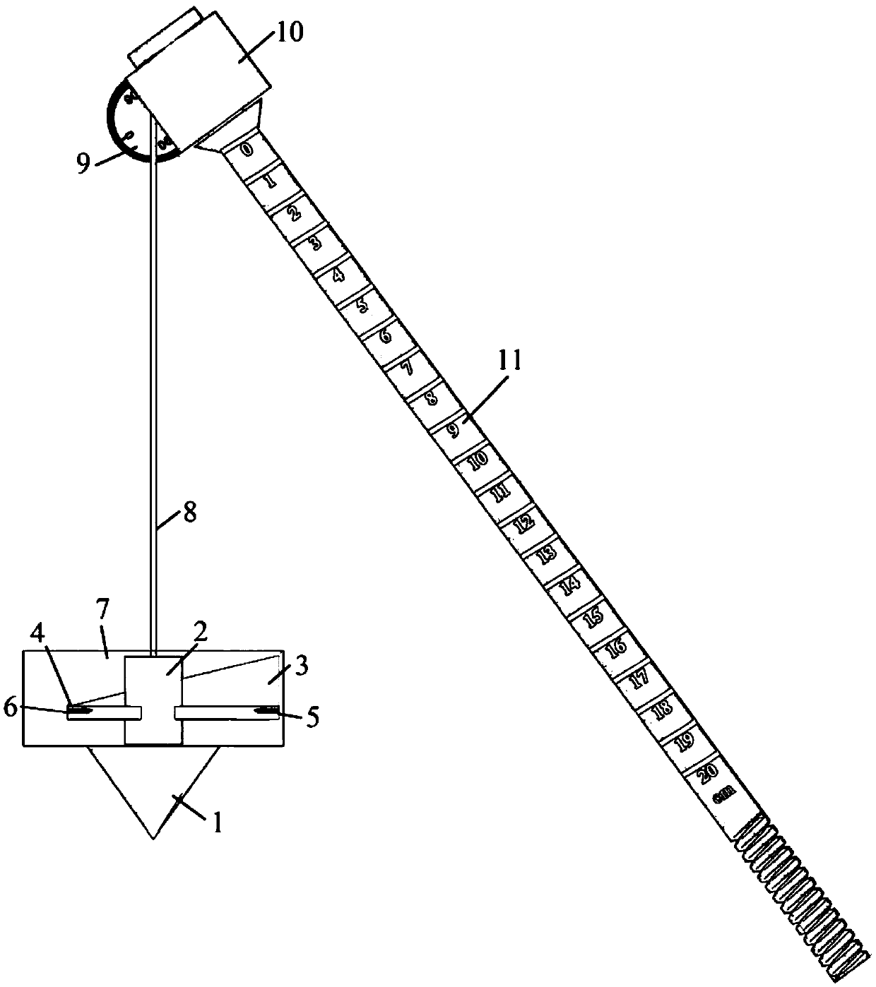
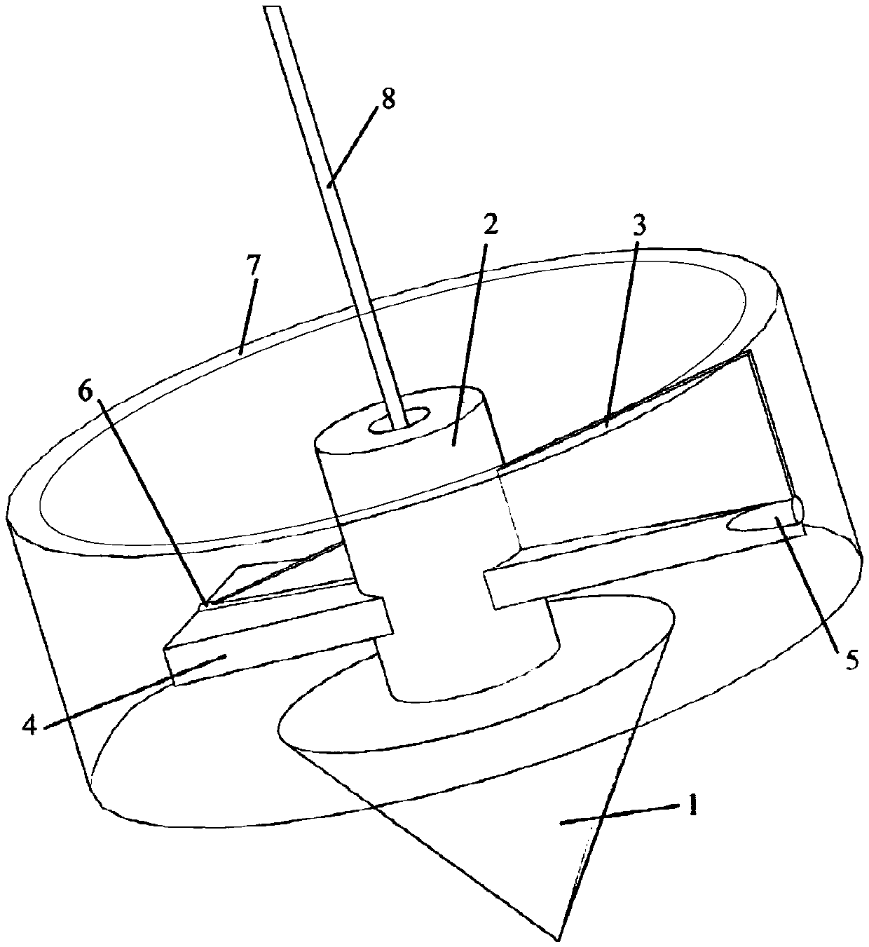
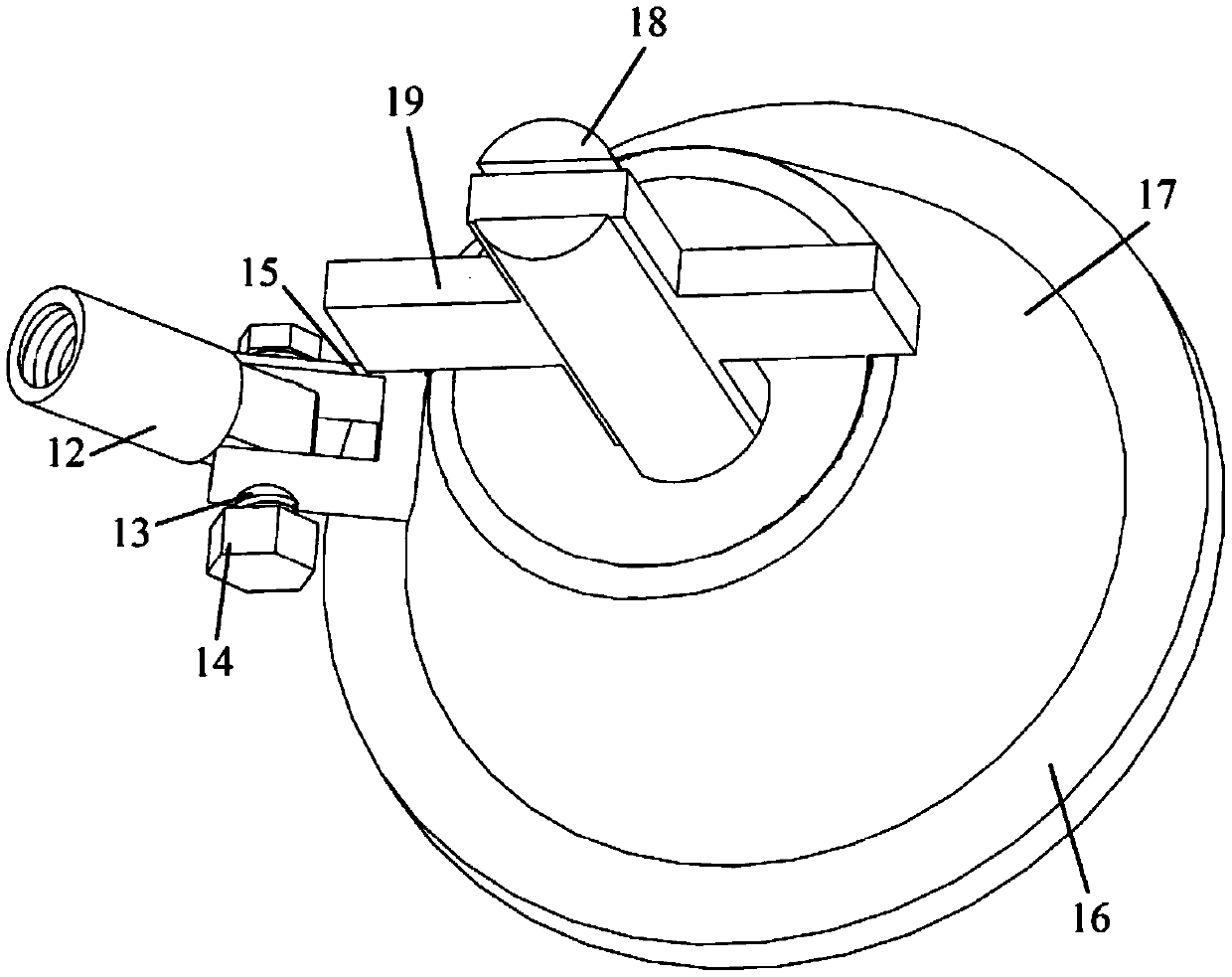
[0039] A portable multi-functional auxiliary tool for rock and soil structure reconstruction, which can be used as a sign of spatial orientation and actual size when taking pictures and 3D scanning of geological survey and engineering geological survey, and can also be used to measure the spatial inclination of rock and soil structural planes Measurement. The tool generally includes two parts, the measuring part and the base part, among which, such as figure 1 As shown, the measuring components mainly include a gravity cone 1, a pointing component, a sling 8, a measuring angle componen...


PUM


Abstract

The invention relates to a portable multifunctional rock-soil body structure reconstruction auxiliary tool which comprises a gravity cone, a direction pointing assembly, an angle measurement assembly, a suspension rod and a base, the gravity cone is connected with the angle measurement assembly through a suspension rope, the direction pointing assembly is arranged on the suspension rope in a sleeving mode, the angle measurement assembly is arranged at the top end of the suspension rod in a sleeving mode, and the bottom end of the suspension rod is connected with the base; in the measurement process, the base is fixed to the structural face of a geological body, and the position of the suspension rod is adjusted, so that the suspension rod is perpendicular to the structural face, after the whole tool is in the balanced state, the spatial true dip angle of the structural face is obtained through the angle between the suspension rope on the angle measurement assembly and the suspension rod, and spatial orientation direction pointing is conducted through the direction pointing assembly. Compared with the prior art, the tool has the advantages of being comprehensive in function, wide in applicability, convenient to operate in practice and the like.

Description

technical field [0001] The invention relates to the technical fields of geology and geological engineering survey, in particular to a portable multifunctional auxiliary tool for rock and soil structure reconstruction. Background technique [0002] During the on-site investigation of geological survey and engineering geological survey, in order to reconstruct the spatial form and structure of geological bodies, it is necessary to take a large number of photos and videos of geological phenomena with clear spatial orientation; with the development of 3D scanning and 3D printing technology, the geological body On-site 3D scanning has also been rapidly applied, and when performing numerical reconstruction on these scanning data, it is necessary to know the corresponding spatial orientation and actual size ratio; One of the basic needs of survey work. However, currently in the process of geological and engineering geological surveys, taking directional photos or videos needs to b...

Claims


Application Information

Patent Timeline
Patent Type & Authority Applications(China)
IPC IPC(8): G01C15/00
CPCG01C15/00
Inventor 王建秀吴林波刘笑天刘无忌宋东升
Owner TONGJI UNIV
Why Eureka
Try Eureka