Geographic information system
A geographic information system and planting area technology, applied in data processing applications, instruments, calculations, etc., can solve the problems of different crop growth conditions, low crop yield and quality, etc.
- Summary
- Abstract
- Description
- Claims
- Application Information
AI Technical Summary
Problems solved by technology
Method used
Image
Examples
Embodiment Construction
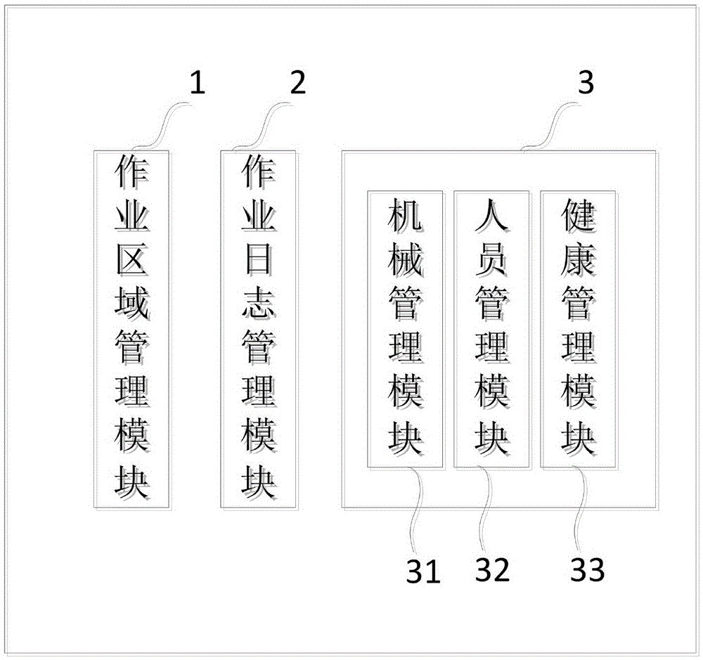
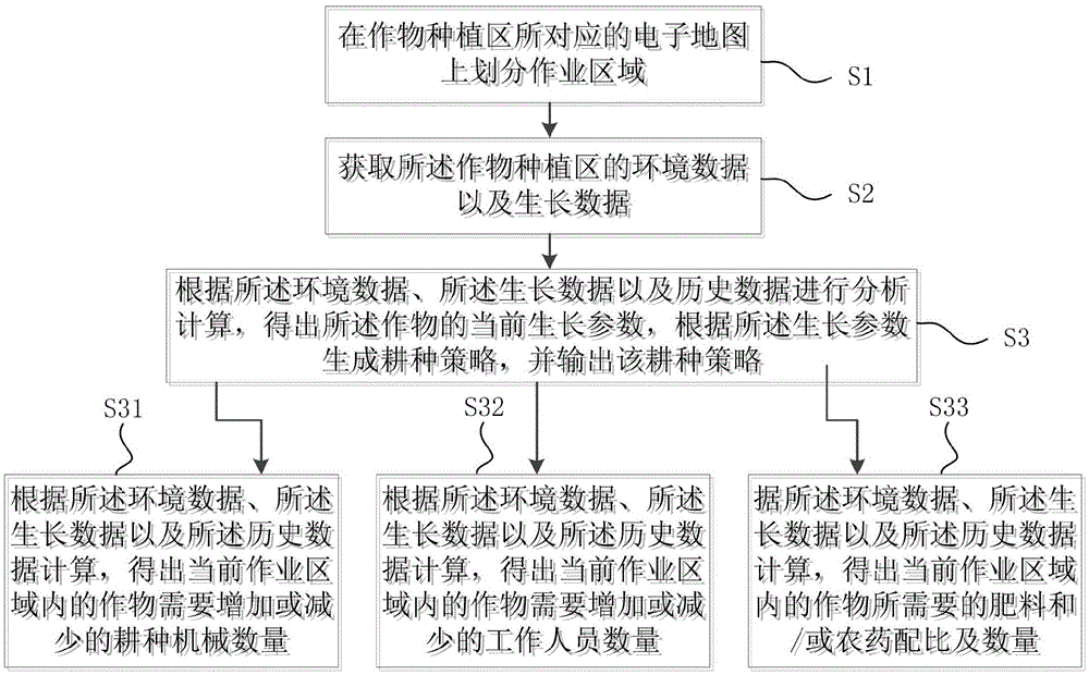
[0022] figure 1 It is a schematic diagram of a geographic information system according to an embodiment of the present invention. Please refer to figure 1 , in the present embodiment, the geographical information system includes an operation area management module 1, which is used to divide the operation area on the electronic map corresponding to the crop planting area; a job log management module 2, which is used to obtain environmental data and growth information of the crop planting area. data; and the operation module 3, which is used to receive the environmental data and growth data sent by the operation log management module 2, and analyze and calculate according to the environmental data, growth data and historical data stored in the geographical system to obtain the current growth parameters of the crops , generate a farming strategy according to the current growth parameters, and output the farming strategy.
[0023] Environmental data include air temperature, air ...
PUM
 Abstract
Description
Claims
Application Information
 - R&D
- Intellectual Property
- Life Sciences
- Materials
- Tech Scout
- Unparalleled Data Quality
- Higher Quality Content
- 60% Fewer Hallucinations
Browse by: Latest US Patents, China's latest patents, Technical Efficacy Thesaurus, Application Domain, Technology Topic, Popular Technical Reports.
© 2025 PatSnap. All rights reserved.Legal|Privacy policy|Modern Slavery Act Transparency Statement|Sitemap|About US| Contact US: help@patsnap.com


