

Three dimensional laser scanning-GPS-combined side slope monitoring method
A three-dimensional laser, combined technology, used in active optical measuring devices, measuring devices, measuring instruments, etc., can solve the problems of difficult to keep still, difficult to arrange fixed points, reduced monitoring accuracy, etc., to ensure measurement accuracy and improve intelligence. and predict the effect, the effect of improving personnel safety
- Summary
- Abstract
- Description
- Claims
- Application Information
AI Technical Summary
Problems solved by technology
Method used
Image

Examples
Embodiment Construction
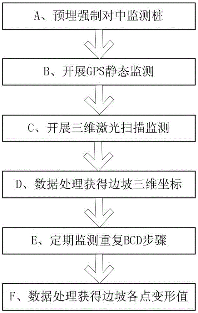
[0027] The present invention will be further described below in conjunction with accompanying drawing.
[0028] Such as Figure 1-5 As shown, a mine slope monitoring method combining three-dimensional laser scanning and GPS of the present invention is characterized in that: the three-dimensional laser scanner system is organically combined with the GPS monitoring and positioning system to accurately monitor slope geological hazards ,Specific steps are as follows:
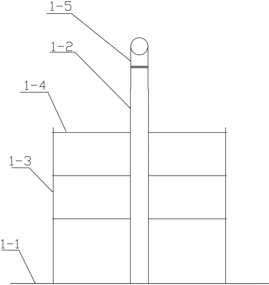
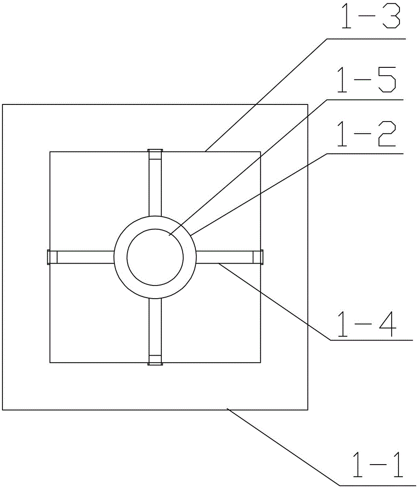
[0029] (1) First, install the monitoring pile I1 on the central axis of the slope to be monitored. The monitoring pile I1 includes a fixed base 1-1, and a centering hollow rod 1-2 set on the middle and upper part of the fixed base 1-1. On the support plate 1-3 around the fixed base, two support bolts 1-4 in the shape of a cross are welded at the upper, middle and lower positions of the centering hollow rod 1-2 respectively. Bolt holes are provided on the support plate 1-3, and the support plate 1-3 is fixedly conn...
PUM
 Abstract
Description
Claims
Application Information