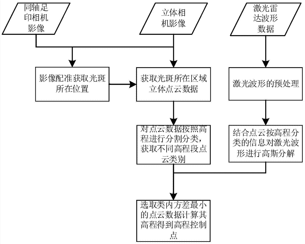
A method for generating elevation control points of laser altimeter combined with stereo image pairs
A laser altimeter, elevation control point technology, applied in height/level measurement, re-radiation of electromagnetic waves, measurement devices, etc., can solve problems such as large area, increased difficulty in waveform decomposition, and complex waveforms
- Summary
- Abstract
- Description
- Claims
- Application Information
AI Technical Summary
Problems solved by technology
Method used
Image
Examples
Embodiment Construction
[0038] The technical scheme provided by the invention adopts the following steps:
[0039] S1 Footprint Camera Geometric Correction: Calculate the geographical coordinates of each image point of the footprint camera according to the attitude of the satellite, the installation angle of the footprint camera system, the focal length of the footprint camera and the size of the CCD, and then calculate the geographic coordinates of each image point of the footprint camera according to the obtained Geographic coordinates of the image points are used to geometrically correct the footprint camera image and the image is resampled to the same resolution as the dual line scan image.
[0040] S2 Correction of dual-line array images: Stereo matching is performed on the dual-line array images to obtain the plane and elevation coordinates of each image point, and the dual-line array images are resampled into orthophoto images according to the coordinates of each image point. In order to speed...
PUM
 Abstract
Description
Claims
Application Information
 - R&D
- Intellectual Property
- Life Sciences
- Materials
- Tech Scout
- Unparalleled Data Quality
- Higher Quality Content
- 60% Fewer Hallucinations
Browse by: Latest US Patents, China's latest patents, Technical Efficacy Thesaurus, Application Domain, Technology Topic, Popular Technical Reports.
© 2025 PatSnap. All rights reserved.Legal|Privacy policy|Modern Slavery Act Transparency Statement|Sitemap|About US| Contact US: help@patsnap.com

