Enhanced digital vector map production method with road longitudinal gradient
A longitudinal gradient and vector map technology, applied in the field of geographic information systems, can solve the problems of heavy workload, insufficient precision, and lack of road longitudinal gradient information in digital map production
- Summary
- Abstract
- Description
- Claims
- Application Information
AI Technical Summary
Problems solved by technology
Method used
Image

Examples
Embodiment Construction
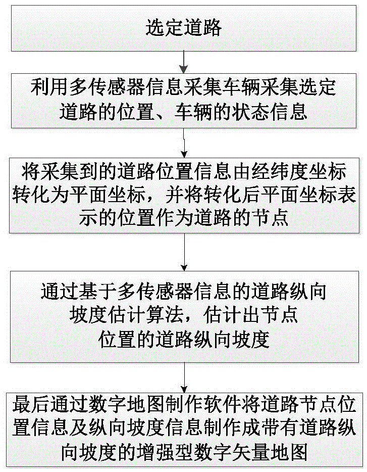
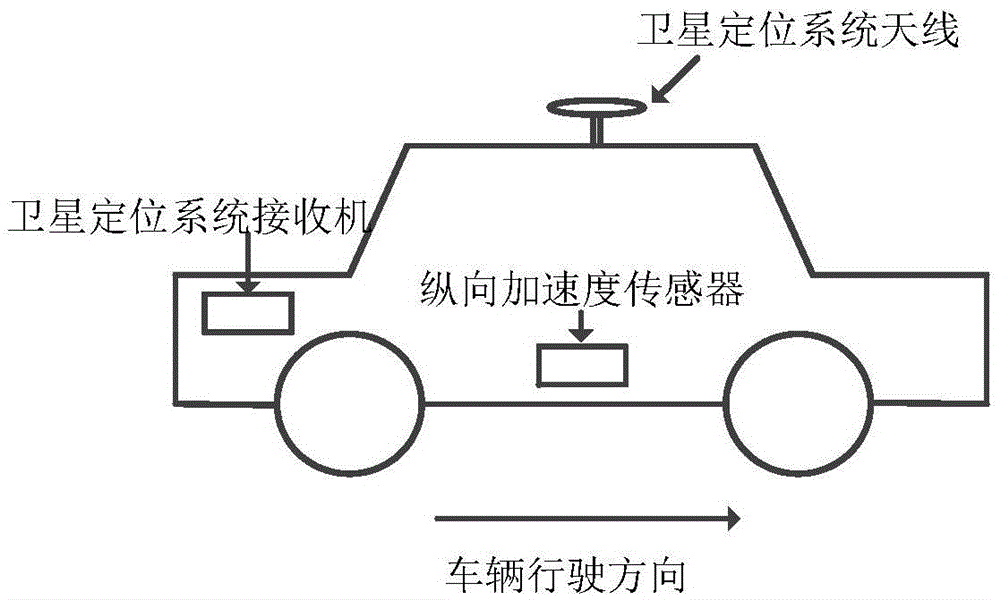
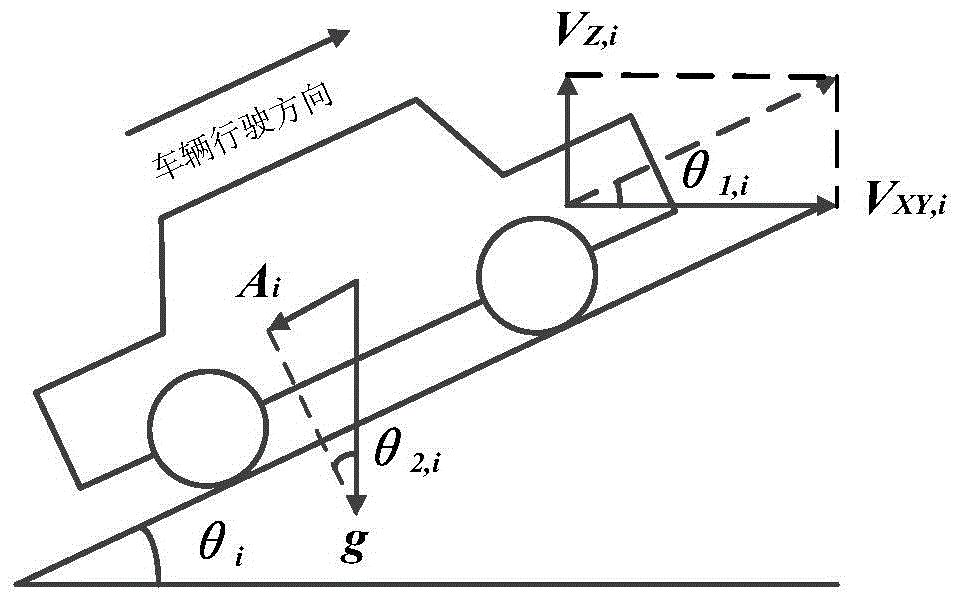
[0035] Digital map is to store urban geographic information in a certain format through digitization and present it in the form of a continuous map. It is essentially an urban geographic database. Digital maps can provide a wealth of location-based services, bringing great convenience to people's lives. However, the current digital maps have the following problems: the accuracy of digital maps is low, and it is impossible to further calculate information such as road slopes with high accuracy through existing information; map information is scarce, generally only contains location information, and some important information that people care about For example, information such as road heading, curvature, slope, and height of nearby floors are not included; digital maps are currently complicated to make and require high professionalism, requiring mastery of spatial transformation, geometric transformation algorithms, vector and raster data models, etc.; There are high requiremen...
PUM
 Abstract
Description
Claims
Application Information
 - R&D
- Intellectual Property
- Life Sciences
- Materials
- Tech Scout
- Unparalleled Data Quality
- Higher Quality Content
- 60% Fewer Hallucinations
Browse by: Latest US Patents, China's latest patents, Technical Efficacy Thesaurus, Application Domain, Technology Topic, Popular Technical Reports.
© 2025 PatSnap. All rights reserved.Legal|Privacy policy|Modern Slavery Act Transparency Statement|Sitemap|About US| Contact US: help@patsnap.com