

Network map pre-loading method based on spatial calculation domain similarity match
A similarity matching and spatial calculation technology, applied in the field of network geographic information system, can solve the problems of reducing the user experience of network map and low map display efficiency, and achieve the effect of improving display efficiency and enhancing user inspection
- Summary
- Abstract
- Description
- Claims
- Application Information
AI Technical Summary
Problems solved by technology
Method used
Image

Examples
Embodiment 1
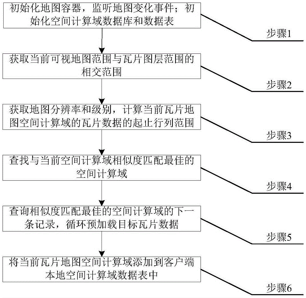
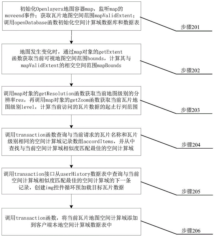
[0042] In order to illustrate the idea of the present invention more clearly, below in conjunction with appendix figure 2 , to further explain the tile map preloading method based on the similarity matching of the spatial computing domain. The Openlayers development library is used as the map display framework, and the local storage technology in HTML5 is used to realize the storage of the tile map spatial computing domain. A single tile The height and width of the slice are both 256 pixels, and the origin (ox, oy) of the map is the upper left corner. Specific steps are as follows:
[0043] Step 201: Initialize the OpenLayers map container object map, create a tile layer class object instance layer, set the tile layer name name, call the addLayer function of the map object to add the tile layer to the map container, and call map.events The .register function adds the event listener of the map change event moveend of the map container, and sets the callback function eventsC...
PUM
 Abstract
Description
Claims
Application Information