Method for judging irrigation need of farming soil by use of mobile phone APP (Application Program)
A mobile phone and land technology, which is applied in the application field of mobile APP, weather data collection and soil moisture collector data collection, which can solve problems such as waste of water resources.
- Summary
- Abstract
- Description
- Claims
- Application Information
AI Technical Summary
Problems solved by technology
Method used
Image

Examples
Embodiment Construction
[0019] The content of the present invention is described in more detail below:
[0020] A method for judging whether farming land needs to be irrigated using a mobile phone APP, comprising the following steps,
[0021] Step 1: Use java to collect real-time weather, and the collected weather is accurate to counties, cities, districts, towns, and villages.
[0022] Step 2: Through the remote sensing method: through the interpretation of low-altitude or satellite infrared remote sensing images, determine the soil moisture on the surface in a large range.
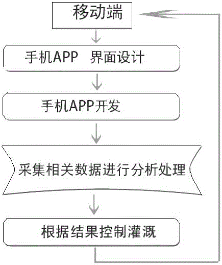
[0023] Step 3: Develop mobile APP, the main functions and steps are as follows
[0024] 1: UI designers design the APP interface
[0025] 2: The developer develops the app according to the function. The specific function has
[0026] (1): Local real-time weather display, weather summary (such as comprehensive weather in the past week, rainfall in a week, rainfall in a month, real-time temperature, etc.)
[0027] (2): Displa...
PUM
 Abstract
Description
Claims
Application Information