Two-dimensional code laser ranging vehicle positioning method and device thereof

A technology of laser ranging and positioning method, which is applied in the field of navigation and positioning of mobile vehicles, can solve the problems that the two-dimensional code identification block cannot provide positioning, is blocked, cannot be used, etc., and achieves high positioning accuracy, low cost and high precision. Effect

Inactive Publication Date: 2016-11-09
邓湘
View PDF0 Cites 29 Cited by
  • Summary
  • Abstract
  • Description
  • Claims
  • Application Information

AI Technical Summary

Problems solved by technology

This method can be used indoors in a small area, but if it is used outdoors, especially on roads where vehicles are often rolled over, the two-dimensional code identification block may soon become unusable due to wear, loss, and occlusion, and If the two-dimensional code identification block is covered by rain or snow in heavy rain or snow

Method used


Image

  • Two-dimensional code laser ranging vehicle positioning method and device thereof
  • Two-dimensional code laser ranging vehicle positioning method and device thereof

Examples


Embodiment Construction

[0044] The present invention will be further explained below in conjunction with the accompanying drawings, but the protection scope of the present invention is not limited to the scope expressed in the embodiments.

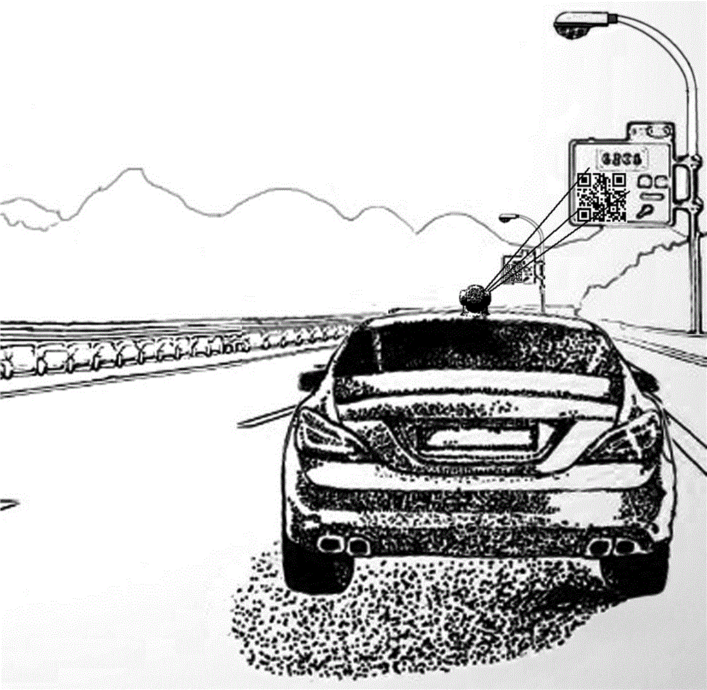
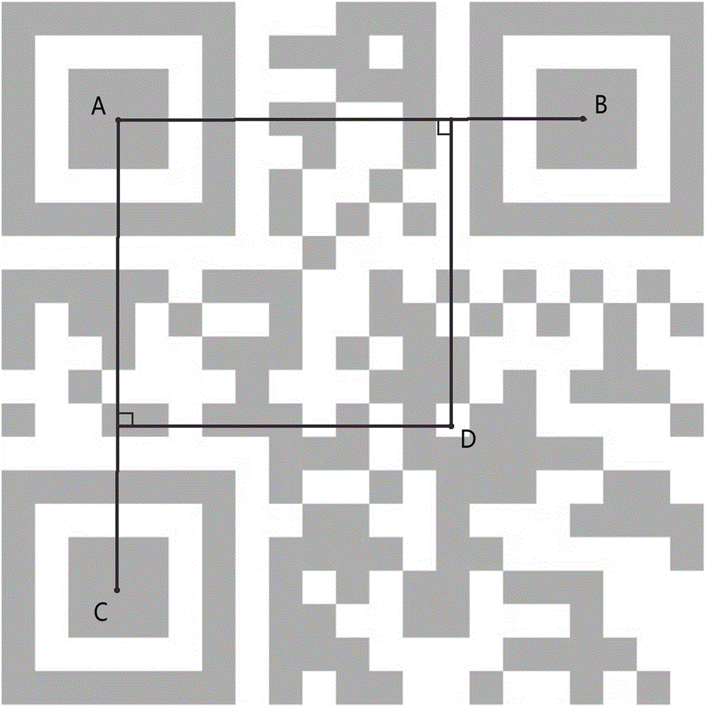
[0045] A two-dimensional code laser ranging vehicle positioning method and its equipment, including a two-dimensional code pattern on a flat reflective surface, a rotating adjustment base that can be installed on a vehicle, a laser distance measuring device, and a two-dimensional code scanning identification and positioning device , which is characterized as follows.

[0046] The two-dimensional code is mainly located on the flat reflective surface on the street light pole billboard, the flat reflective surface on the back of the road sign, the flat reflective surface on the intersection signal light pole, the flat reflective wall, etc. on the flat reflective surface that is easy to observe.

[0047] The laser ranging equipment should be composed of at least a mi...


PUM


Abstract

The invention relates to a method of acquiring information by scanning a two-dimensional code and locating a vehicle accurately by laser ranging, and a device thereof. The device comprises a two-dimensional pattern disposed on a flat light reflecting surface, a rotating adjusting base disposed on the vehicle, a laser ranging device, and a two-dimensional code scanning identifying positioning device. The method is characterized in that the two-dimensional code scanning identifying positioning device is used to identify and locate the two-dimensional codes disposed on the flat light reflecting surfaces, which are disposed on road sides, and are convenient for observation; the three laser emitters of the laser ranging device are used to emit laser beams to the surfaces of the two-dimensional codes sequentially, and the laser receiving device of the laser ranging device is used to measure distances between three laser impact points and the measurement reference points of the three laser emitters by combining with other devices; the laser beams are emitted by the laser emitters, and at the same time, the two-dimensional code scanning identifying positioning device is used to identify and locate the coordinates of the three laser impact points, and at last, the coordinates of the measurement reference points are calculated by adopting a method similar to GPS satellite positioning.

Description

technical field [0001] The invention relates to a navigation and positioning method for a moving vehicle, in particular to a method for scanning a two-dimensional code to acquire information and accurately locating the vehicle through laser ranging and its equipment. Background technique [0002] Most of the common car positioning technologies today are satellite navigation positioning. Although the cost of ordinary satellite navigation positioning is very low and only a small positioning chip is needed, the positioning accuracy is poor and the error is generally about 10 meters. In case of bad weather conditions or There are too many high-rise buildings around, and the occlusion error can be expanded to 30 meters. The use of pseudo-range differential positioning technology will improve the positioning accuracy to the level of lanes or even meters, but it is necessary to set up a positioning reference station at a certain distance beside the road, and to maintain wireless co...

Claims


Application Information

Patent Timeline
IPC IPC(8): G01S17/02G01S19/45G01C21/16
CPCG01C21/165G01S17/86G01S19/45
Inventor 邓湘
Owner 邓湘
Why Eureka
Try Eureka