
Method and device for generating geographical fence

A geographical fence and equipment technology, applied in the network field, can solve the problems of high labor cost, small amount of fence, inaccurate cell boundaries, etc., and achieve the effect of improving coverage and reducing labor cost

Active Publication Date: 2016-11-23
ADVANCED NEW TECH CO LTD
View PDF9 Cites 14 Cited by
  • Summary
  • Abstract
  • Description
  • Claims
  • Application Information

AI Technical Summary

Problems solved by technology

However, the plane circle model has many shortcomings in actual situations: first, the center position of the fence and the size of the fence need to be measured manually, and the offline labor cost is high; second, limited by the high labor cost, the amount of fence that can be covered is very small ;Third, in reality, the fences are all irregular polygons, and it is inaccurate to use a circle to represent the boundary of the community

Method used


Image

  • Method and device for generating geographical fence
  • Method and device for generating geographical fence
  • Method and device for generating geographical fence

Examples


Embodiment Construction

[0054] The technical solutions in this application will be clearly and completely described below in conjunction with the drawings in this application. Apparently, the described embodiments are part of the embodiments of this application, not all of them. Based on the embodiments in this application, other embodiments obtained by those skilled in the art all belong to the protection scope of this application.

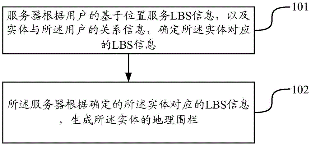
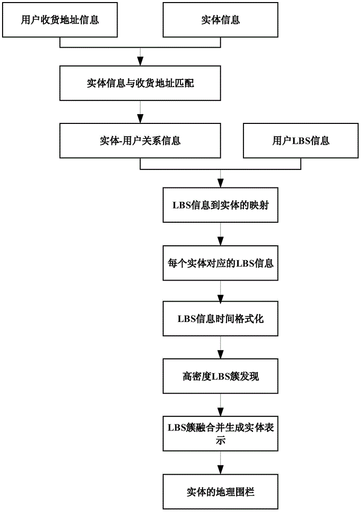
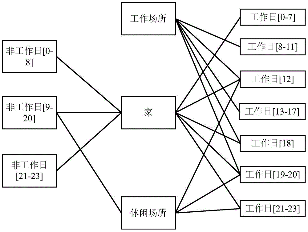
[0055] With the increasing application value of geofence technology, massive user addresses and LBS (Location Based Service, location-based service) information can be obtained, which makes the construction of geofences have a data foundation. In this application, a large number of user addresses and LBS information that can be obtained are used to automatically generate geo-fences, which can reduce labor costs, and the shape of the geo-fences is closer to the shape of the actual entity.

[0056] Such as figure 1 As shown, it is a method for generating a geofence in th...


PUM


Abstract

The application discloses a method and a device for generating a geographical fence. The method is characterized by comprising the steps as follows: a server determines location based service LBS information corresponding to an entity according to the LBS information of a user and the relation information between the entity and the user; and the server generates a geographical fence of the entity according to the determined LBS information corresponding to the entity. According to the application, the geographical fence of the entity is obtained according to the location information of the user and the relation between the user and the entity, so that the shape of the obtained geographical fence can be closer to the shape of the real entity, the coverage of the entity is increased, and the labor cost is reduced.

Description

technical field [0001] The present application relates to the field of network technologies, in particular to a method and device for generating a geographic fence. Background technique [0002] Geo-fence technology is a new application of location-based service (Location Based Service, LBS). It is a technology that uses a virtual fence to enclose a virtual geographic boundary. Group maps, regional information services and other systems provide geographic location service information for many information systems. [0003] In existing geo-fence generation techniques, a plane circle model is mainly used, that is, a plane circle is used to represent the fence, the center of the circle represents the center position of the fence, and the radius represents the size of the fence. However, the plane circle model has many shortcomings in actual situations: first, the center position of the fence and the size of the fence need to be measured manually, and the offline labor cost is h...

Claims


Application Information

Patent Timeline
IPC IPC(8): H04W4/02H04L29/08
Inventor 张辉
Owner ADVANCED NEW TECH CO LTD
Features
  • Generate Ideas
  • Intellectual Property
  • Life Sciences
  • Materials
  • Tech Scout
  • Unparalleled Data Quality
  • Higher Quality Content
  • 60% Fewer Hallucinations
Learn More