
A method and system for realizing industrial dynamic layer adaptive overlay slice map

A dynamic graph and self-adaptive technology, applied in geographic information databases, special data processing applications, structured data retrieval, etc., can solve problems such as scale display errors, easily lost scale levels, and incomplete display of layer data, so as to reduce rework efficiency, improve system reliability, and improve development efficiency

Active Publication Date: 2020-04-07
TAIHUA WISDOM IND GRP CO LTD
View PDF3 Cites 0 Cited by
  • Summary
  • Abstract
  • Description
  • Claims
  • Application Information

AI Technical Summary

Problems solved by technology

[0009] 1. The dynamic layer is superimposed with the tiled map service. The scale of the dynamic layer will be limited by the scale of the tiled map, so it is easy to lose the scale level, resulting in incomplete display of layer data
[0010] 2. Under screens with different resolutions, such as computers, tablets and mobile phones, the DPI is different, which will cause scale display errors, resulting in incomplete display of layer data

Method used


Image

  • A method and system for realizing industrial dynamic layer adaptive overlay slice map

Examples


Embodiment Construction

[0038] The present invention is described in detail below in conjunction with accompanying drawing:

[0039] The embodiment of the present invention in the geographical information system is the realization of the tool class method.

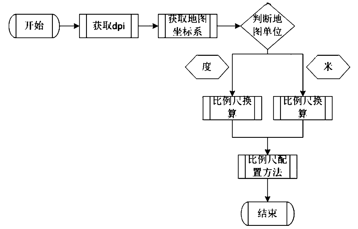
[0040] Because DPI has a conversion relationship with resolution and map scale. If the unit is meter, the conversion formula is resolution=scale*0.0254000508 / dpi. If the unit is degree, the conversion formula is resolution=scale*0.0254000508 / dpi / 111194.872221777. Different DPIs correspond to different map display scale levels, so the setting of the map scale must be dynamically set according to different DPIs to ensure that the map data does not generate bugs when displayed.

[0041] Such as figure 1As shown, first, through the program algorithm, use the program method provided by windowAPI (if it is a mobile terminal, use the method provided by the mobile terminal system API interface), obtain the dpi of the device (computer or mobile termina...


PUM


Abstract

The invention discloses a method and system for realizing self-adaptive stacking and sliced ​​maps of industrial dynamic layers, obtaining the dpi of equipment running in the system as an algorithm parameter; obtaining the coordinate system of the map; obtaining the basic unit of the map according to the coordinate system of the map, if If it is a projected coordinate system, the unit is meter; if it is a geographic coordinate system, the unit is degree; select the corresponding scale and resolution conversion formula according to the basic unit of the map, and calculate the resolution of the corresponding scale; calculate the resolution of each scale After coming out, reconfigure the scale structure of the map, and then load the overlay map. The present invention can be applied to all geographic information systems, avoiding the problem of map layer data not being displayed, reducing the rework rate, thereby improving development efficiency, improving system reliability, and avoiding some problems caused by incomplete display of map data. Serious bugs in some functional modules.

Description

technical field [0001] The invention relates to the field of map overlay technology, in particular to a method and system for realizing adaptive overlay of sliced ​​maps of industrial dynamic layers. Background technique [0002] A map is a graphic that expresses the spatial distribution, connection, and development and change status of various things on the earth by using cartographic language and integrated on a certain carrier according to certain mathematical rules. With the advancement of science and technology, the concept of maps is constantly evolving. For example, maps are regarded as "images and symbolic models reflecting natural and social phenomena", and maps are "carriers of spatial information" and "transmission channels of spatial information". Wait. [0003] The carrier of traditional maps is mostly paper. With the development of science and technology, various carriers such as electronic maps have appeared. The geographic information system is to store geo...

Claims


Application Information

Patent Timeline
Patent Type & Authority Patents(China)
IPC IPC(8): G06F16/29
CPCG06F16/29
Inventor 洛佳明张同义周永利马述杰刘治国赵恒胜庄同光高明乾王小鹏
Owner TAIHUA WISDOM IND GRP CO LTD
Learn More