Geological integrated identification method and device based on gravity-magnetic-electric-seismic three-dimensional joint inversion

A joint inversion and identification method technology, applied in the field of comprehensive geophysics of oil and gas exploration, can solve the problems of waste of manpower and material resources, consume a lot of manpower and material resources, etc., and achieve the effect of reducing workload, strong applicability, and good promotion and use value

Inactive Publication Date: 2017-02-22
CHINA PETROLEUM & CHEM CORP +1
View PDF6 Cites 8 Cited by
  • Summary
  • Abstract
  • Description
  • Claims
  • Application Information

AI Technical Summary

Problems solved by technology

[0003] In previous geological and geophysical interpretations, the stratigraphic information layers obtained from seismic interpretation or well logging were mapped to the inversion results, and the interpretation was performed on sections. Researchers can only obtain Qualitative geological and geophysical understanding, and this understanding is often closely related to the knowledge structure and background of the researchers themselves, so the results of this understanding are highly artificial and uncertain
In addition, if there are too many sections, it will take a lot of manpower and material resources, resulting in a waste of manpower and material resources

Method used


Image

  • Geological integrated identification method and device based on gravity-magnetic-electric-seismic three-dimensional joint inversion
  • Geological integrated identification method and device based on gravity-magnetic-electric-seismic three-dimensional joint inversion
  • Geological integrated identification method and device based on gravity-magnetic-electric-seismic three-dimensional joint inversion

Examples


Embodiment Construction

[0026] The specific embodiments of the present invention will be further described below in conjunction with the drawings.

[0027] The embodiment of the comprehensive geological identification method based on the three-dimensional joint inversion of gravity, magnetic, electric and seismic of the present invention

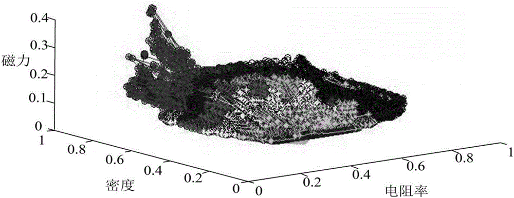
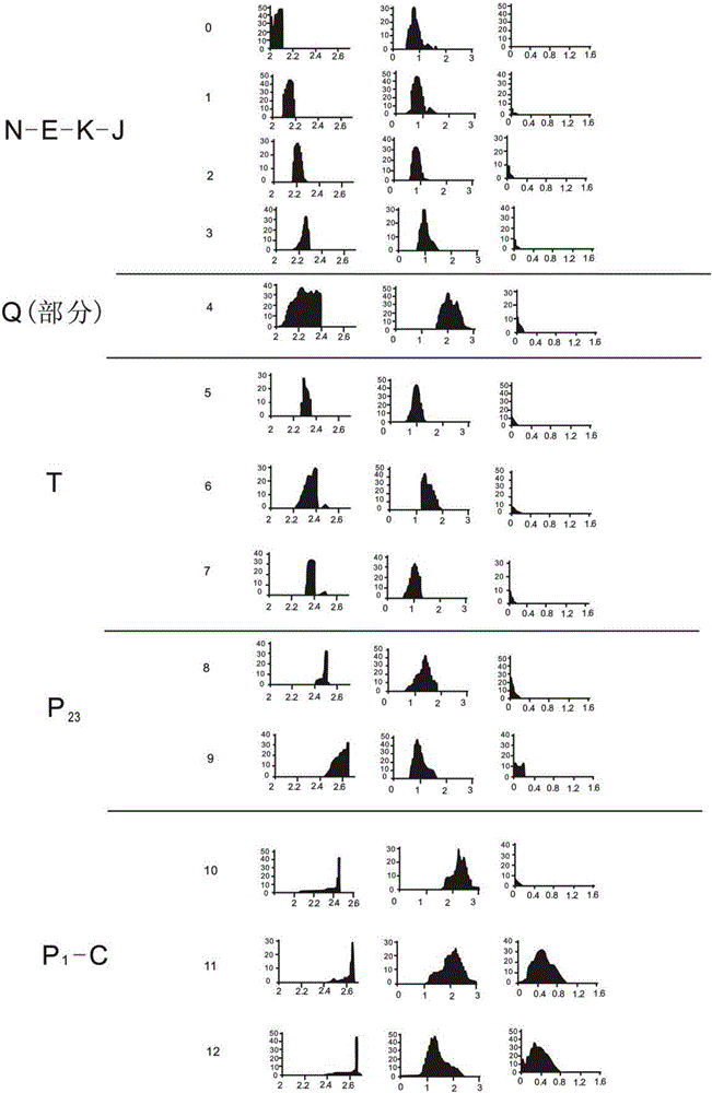
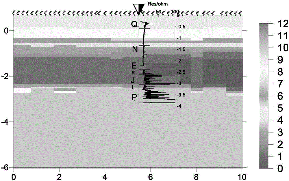
[0028] On the basis of 3D geophysical joint inversion, the present invention can quantitatively divide the characteristics of attributes by using fuzzy cluster analysis. Starting from the physical property distribution of the inversion results, the target strata we need are clearly divided, and compared with the known The prior information is in good agreement.

[0029] 1. Obtain the combined inversion results of gravity, magnetic and electric shocks and the physical property statistics of the study area.

[0030] Starting from the coupling mechanism of the gravity-magnetic-electric-seismic joint inversion model, the results of the gravity-magnetic-electric-seismic joint i...


PUM


Abstract

The present invention relates to a geological integrated identification method and device based on gravity-magnetic-electric-seismic three-dimensional joint inversion. The method comprises: obtaining a gravity-magnetic-electric-seismic joint inversion result and the physical property statistics of a research area; performing cluster analysis of the gravity-magnetic-electric-seismic joint inversion result, and obtaining the corresponding clustering result; and dividing the inhomogeneity in the clustering result into different stratums according to the physical property statistics of the research area, and performing clustering mean statistics to obtain the geological integrated interpretation result of the gravity-magnetic-electric-seismic joint inversion. Through the process mentioned above, the geological integrated identification method and device based on the gravity-magnetic-electric-seismic three-dimensional joint inversion overcome the influence of the human factors and obtain a reliable interpretation model through adoption of the limited geology and earthquake constraint conditions so as to realize the objective and integrated evaluation of the three-dimensional inversion result and especially have the high applicability for the complex geologic structure condition. Especially, in the condition of large interpretation workload, the geological integrated identification method based on the gravity-magnetic-electric-seismic three-dimensional joint inversion can greatly reduce the workload. The geological integrated identification method and device based on the gravity-magnetic-electric-seismic three-dimensional joint inversion is rapid, efficient and economic, and has wide market prospects and good popularization and usage values.

Description

Technical field [0001] The invention relates to a comprehensive geological identification method and device based on three-dimensional combined inversion of gravity, magnetic, and electric shock, and belongs to the technical field of comprehensive geophysics for oil and gas exploration. Background technique [0002] The combined inversion of gravity, magnetic, and seismic is based on physical properties and representative geological and geophysical models, using seismic and geological information constraints to give play to the advantages of 3D inversion and integrated geophysics in improving inversion accuracy and reducing ambiguity ; Introduce the synthesis and constraint conditions of multiple prior information in the joint inversion process, play the complementary role of integrated geophysics, improve the deep inversion ability, and reduce the ambiguity; promote the comprehensive evaluation of statistics and cluster analysis methods Research on quantitative methods for compr...

Claims


Application Information

Patent Timeline
Patent Type & Authority Applications(China)
IPC IPC(8): G01V11/00
CPCG01V11/007
Inventor 于明德曹建康刘司红王亮蒋永福董银磊林水清杜建波于鹏张新兵
Owner CHINA PETROLEUM & CHEM CORP
Why Eureka
Try Eureka