Spatial accessibility analysis method and device based on public facility differences

A technology of public facilities and analysis methods, applied in the direction of instruments, data processing applications, calculations, etc., can solve the problem of reducing the resolution and description ability of analysis results, unable to meet the classification guidance and planning of urban planning departments, and unable to distinguish between different functional classifications of public facilities. To achieve the effect of improving hierarchy and operability, and facilitating planning and construction

Inactive Publication Date: 2017-02-22
HENAN POLYTECHNIC UNIV
View PDF3 Cites 28 Cited by
  • Summary
  • Abstract
  • Description
  • Claims
  • Application Information

AI Technical Summary

Problems solved by technology

The spatial location, distribution, function, and service scope of public facilities affect the convenience and fairness of access to these public facilities by people in need. Therefore, precise calculations are required to fully and effectively meet the needs of public facilities when designing and evaluating the layout of public facilities. Use needs and improve the comprehensive utilization rate of public facilities. To solve this problem, it is usually analyzed by using the spatial accessibility value. When analyzing the spatial accessibility value, the current analysis is mainly by using the mobile search method. Yes, this analysis method can effectively meet the needs of actual work to a large extent, but at the same time there is a phenomenon that there is a large deviation between theoretical calculations and actual conditions, and it is concentrated in: Differentiate the functions of the facilities, and think that all public facilities are only different in the quantitative indicators of supply capacity, ignoring the differences in the functions of public facilities, and can...

Method used


Image

  • Spatial accessibility analysis method and device based on public facility differences
  • Spatial accessibility analysis method and device based on public facility differences
  • Spatial accessibility analysis method and device based on public facility differences

Examples


Embodiment Construction

[0039] In order to make the technical means, creative features, goals and effects achieved by the present invention easy to understand, the present invention will be further described below in conjunction with specific embodiments.

[0040] Taking the calculation of the accessibility of a park space in a certain community in a certain city as an example, the specific implementation method of the present invention is described in detail:

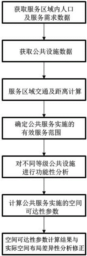
[0041] Such as figure 1 As shown in —10, a spatial accessibility analysis method based on the difference of public facilities includes the following steps:

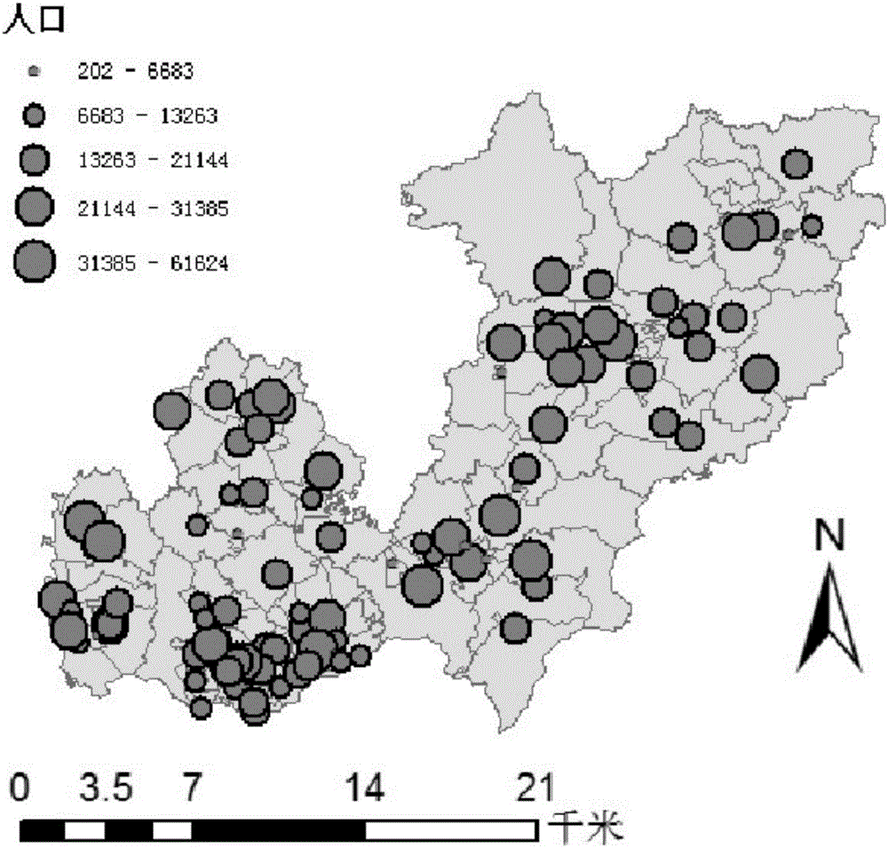
[0042] The first step is to obtain the population and service demand data in the service area, and use the relevant statistical department of the city government to collect information on the population, age ratio, education level and other information of the area to determine the public facilities services of the resident population in the service area Types and characteristics of dema...


PUM


Abstract

The invention discloses a spatial accessibility analysis method based on public facility differences. The method comprises the following seven steps of: 1) obtaining population and service requirement data in a service area; 2) obtaining public facility data; 3) carrying out traffic and distance calculation on the service area; 4) determining the effective service range of a public service facility; 5) carrying out functional analysis on different levels of public facilities; 6) calculating the spatial accessibility value of the public service facility; and 7) carrying out the difference analysis on a spatial accessibility result. A device used for the analysis method comprises an on-site data collection terminal and a remote data processing platform. By use of the method and the device, the hierarchy and the maneuverability of an analysis result are improved. Compared with the traditional method, the method more approaches to a realistic situation, is more favorable for a planning and construction department to evaluate the spatial configuration situation of the existing public facility, provides decision support for the layout regulation and planning of the public facility, and is convenient in carrying out classified guidance on the planning and the construction of the public facility.

Description

technical field [0001] The invention relates to a spatial accessibility analysis method and device based on the difference of public facilities, and belongs to the technical field of layout design and evaluation of public facilities. Background technique [0002] The rational allocation of public facilities space is an important embodiment of social equity. The spatial location, distribution, function, and service scope of public facilities affect the convenience and fairness of access to these public facilities by people in need. Therefore, precise calculations are required to fully and effectively meet the needs of public facilities when designing and evaluating the layout of public facilities. Use needs and improve the comprehensive utilization rate of public facilities. To solve this problem, it is usually analyzed by using the spatial accessibility value. When analyzing the spatial accessibility value, the current analysis is mainly by using the mobile search method. Y...

Claims


Application Information

Patent Timeline
IPC IPC(8): G06Q50/26
CPCG06Q50/26
Inventor 程钢杨杰卢小平朱腾逯静
Owner HENAN POLYTECHNIC UNIV
Why Eureka
Try Eureka