Autonomous navigation method for space multi-robots operating against targets in geostationary orbit

A technology of geostationary orbit and target operation, applied in the direction of integrated navigator, navigation calculation tool, etc., can solve the problem of low navigation accuracy

Active Publication Date: 2019-12-10
SOUTHEAST UNIV
View PDF5 Cites 0 Cited by
  • Summary
  • Abstract
  • Description
  • Claims
  • Application Information

AI Technical Summary

Problems solved by technology

[0005] Purpose of the invention: The present invention aims at the problem of low navigation accuracy due to insufficient observation information, and proposes a space multi-robot autonomous navigation method for geostationary orbit target operations, using a star sensor to autonomously and continuously observe the relative direction vector. Orbital service space multi-robots provide high-precision relative observation information

Method used


Image

  • Autonomous navigation method for space multi-robots operating against targets in geostationary orbit
  • Autonomous navigation method for space multi-robots operating against targets in geostationary orbit
  • Autonomous navigation method for space multi-robots operating against targets in geostationary orbit

Examples


Embodiment Construction

[0078] Embodiments of the present invention will be described in detail below in conjunction with the accompanying drawings;

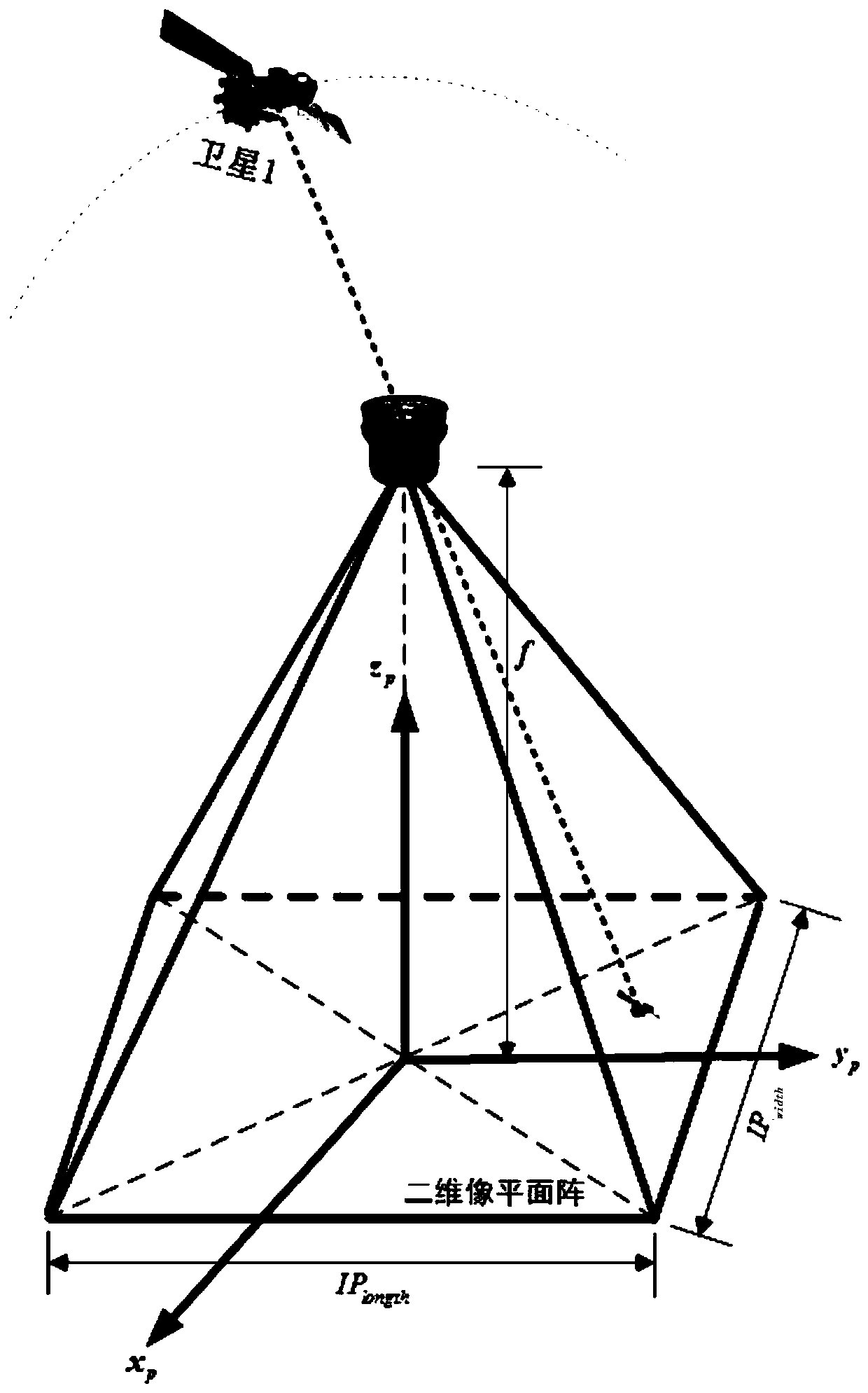
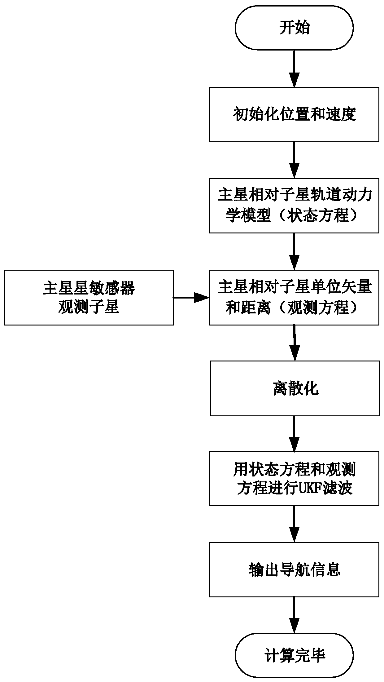
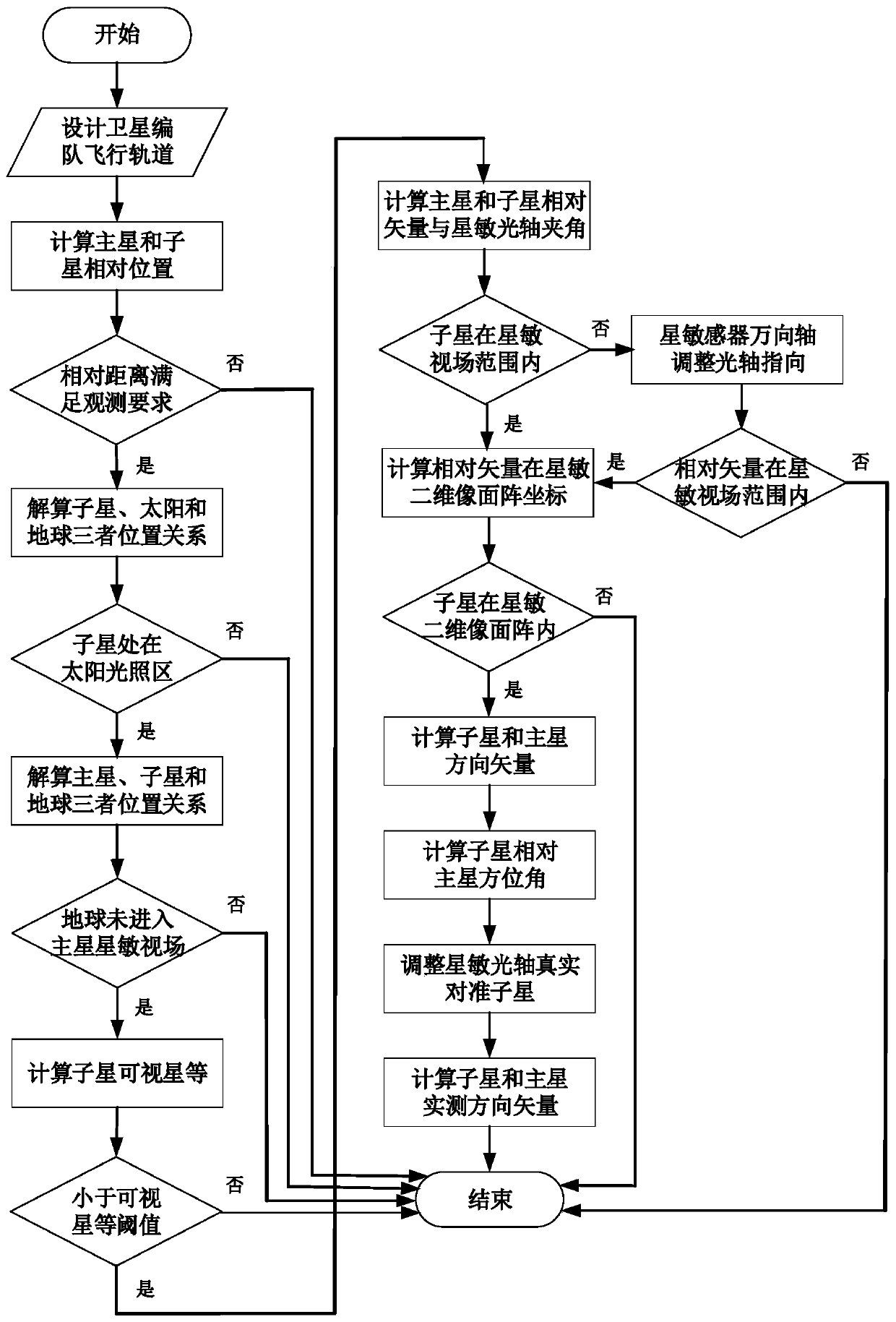
[0079] like figure 1 As shown, the present invention is a kind of space multi-robot relative observation method facing GEO satellite on-orbit service. In the stage of GEO satellite on-orbit service, space multi-robots (set as main star and sub-star) utilize star sensors to independently and continuously observe the relative direction The vector method is a space multi-robot relative observation method that is very suitable for on-orbit service. It includes the following steps:

[0080] (1) Design two space robots (set as main star and sub-star) formation flight configuration and orbital parameters (including orbital semi-major axis a, orbital eccentricity e, orbital inclination i, right ascension of ascending node Ω, argument of perigee ω, perigee time t p ), design the best installation orientation of the main star sensor to observe the sub-star; ...


PUM


Abstract

The invention discloses a space multi-robot autonomous navigation method for geostationary orbit target action. The method comprises the following steps: designing the formation flight configuration and the orbit parameters of two space robots (set as a primary star and a component star) by adopting a GEO target satellite as an on-orbit service target, and establishing an autonomous navigation system state model according to a relative orbit dynamic model of the satellite in an earth's core inertia coordinate system; providing theoretic illumination conditions and imaging conditions needed by observation of the component star by a primary star sensor; calculating the theoretic azimuth and the theoretic pitch angle of the component star to the primary star, adjusting the direction of a true star sensor optical axis to be consistent with a theoretic direction, truly observing the component star, and establishing an observation equation adopting relative unit direction vector and distance as observations; and establishing the relative position and speed of the primary star by using Unscented Kalman filtering. The method belongs to the technical field of space navigation, provides high-precision navigation information for GEO formation flight of the satellite, and provides references for design of an autonomous navigation system.

Description

technical field [0001] The invention belongs to the field of spacecraft on-orbit service space measurement, and in particular relates to an autonomous navigation method for space multi-robots operating on geostationary orbit targets. Background technique [0002] Geostationary orbit (Geostationary orbit, GEO) is a unique orbital resource for human beings. Satellites in this orbit (GEO satellites for short) cover a large area and are stationary relative to the ground. The military field is playing an increasingly important role. For some tasks, multiple satellites need to be networked to form a constellation, such as the US DSP (Defense Support Program) missile early warning satellite, which always maintains 5 (3 working, 2 spare) satellites in GEO orbit; The high-orbit segment of the Space-Based Infrared System (SBIRS) also includes 4 GEO satellites and 2 large elliptical orbit satellites. The Beidou system under construction is a global satellite navigation system indepen...

Claims


Application Information

Patent Timeline
Patent Type & Authority Patents(China)
IPC IPC(8): G01C21/24G01C21/20
CPCG01C21/20G01C21/24
Inventor 王鹏祝燕华
Owner SOUTHEAST UNIV
Why Eureka
Try Eureka