Verification and upgrading method and system for road information in electronic map

A road information and electronic map technology, applied in geographic information databases, maps/plans/charts, electronic digital data processing, etc., can solve problems such as risks and failure to ensure the accuracy of information collected in the field, and achieve verification of correctness, Solve collection and update problems and improve data quality

Active Publication Date: 2017-05-03
NAVINFO
View PDF6 Cites 24 Cited by
  • Summary
  • Abstract
  • Description
  • Claims
  • Application Information

AI Technical Summary

Problems solved by technology

However, this method cannot guarantee the correctness of information collected in the field for areas that have not been spot-checked, thus causing potential risks in the navigation and guidance process

Method used


Image

  • Verification and upgrading method and system for road information in electronic map
  • Verification and upgrading method and system for road information in electronic map
  • Verification and upgrading method and system for road information in electronic map

Examples


Embodiment Construction

[0041] The technical solutions in the embodiments of the present invention will be clearly and completely described below in conjunction with the accompanying drawings in the embodiments of the present invention. Obviously, the described embodiments are only a part of the embodiments of the present invention, rather than all the embodiments. Based on the embodiments of the present invention, all other embodiments obtained by those of ordinary skill in the art without creative work shall fall within the protection scope of the present invention.

[0042] It should be noted that the embodiments of the present invention and the features in the embodiments can be combined with each other if there is no conflict.

[0043] The embodiments of the present invention will be further described below in conjunction with the drawings:

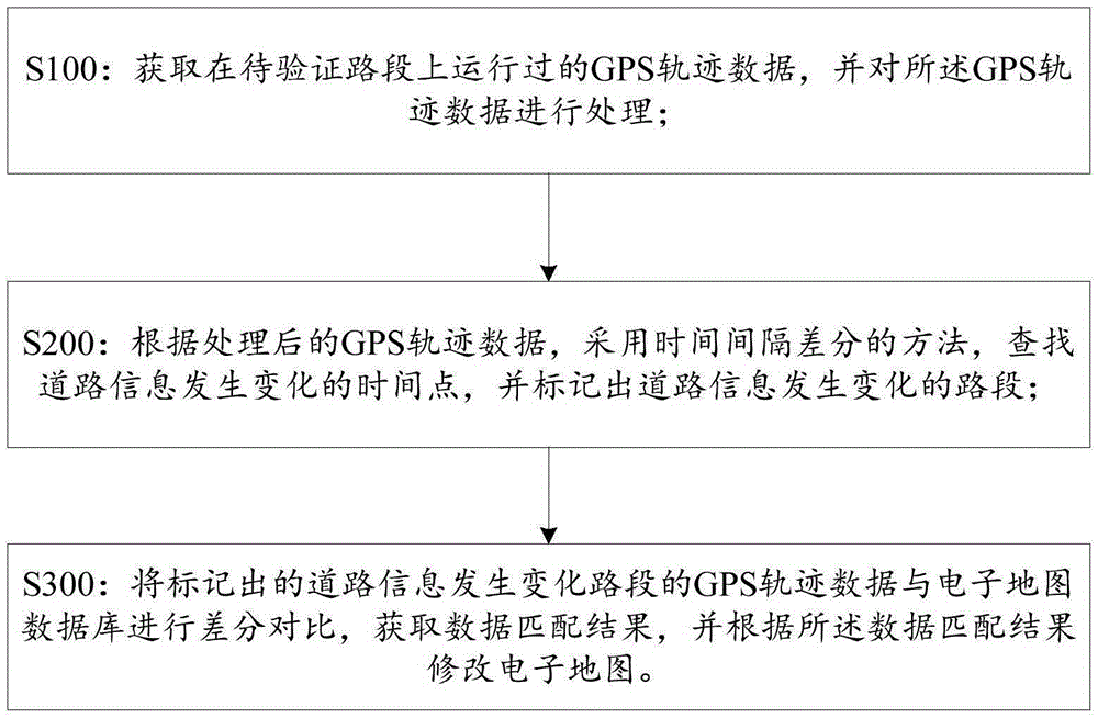
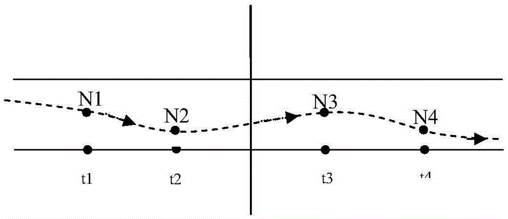
[0044] In view of the limitation and inconvenience of collecting road information in a specific time period in the prior art, the embodiment of the present invent...


PUM


Abstract

The invention discloses a verification and upgrading method and system for road information in an electronic map. The verification and upgrading method for the road information in the electronic map comprises the steps of acquiring global positioning system (GPS) trajectory data running on a road segment to be verified, processing the GPS trajectory data, and determining a road running direction corresponding to the GPS trajectory data; seeking a time point where road information changes and marking a road segment where the road information changes by employing a time interval differential method according to the processed GPS trajectory data; and performing differential comparison on the GPS trajectory data of the marked road segment where the road information changes and an electronic map database to acquire a data matching result, and modifying the electronic map according to the data matching result. Therefore, with the verification and upgrading method disclosed by the embodiment of the invention, the road driving direction can be rapidly acquired, the electronic map upgrading speed is increased, the data freshness is improved, and resources are saved.

Description

Technical field [0001] The invention relates to the field of map making, in particular to a method and system for verifying and updating road information in an electronic map. Background technique [0002] For some roads, in order to relieve the traffic pressure in a certain driving direction during the rush hour, the traffic rules of these roads can be adjusted, and some road traffic restrictions can be implemented, for example: set it in a certain time period and other time The normal driving directions are not consistent. [0003] At present, in the process of making electronic maps, the way of collecting road information for a specific time period is still to be collected by the field industry according to the collection plan. When verifying data operations, the following verification methods are usually used for the information collected on the field: [0004] Method 1: Default information collected in the field is correct. However, using this method of acquiescing that all t...

Claims


Application Information

Patent Timeline
Patent Type & Authority Applications(China)
IPC IPC(8): G06F17/30G09B29/00
CPCG09B29/006G06F16/29
Inventor 刘娜高扬周文华
Owner NAVINFO
Why Eureka
Try Eureka