

Ground precipitation station layout optimization method and device
A rain gauge station and ground technology, applied in the field of geographic information services in smart cities, can solve the problems of not considering the influence of satellite coverage on the layout of ground rain gauge stations, unable to meet the needs of coordinated observation of hydrological sensor networks and optimal allocation of resources, and achieve maximum The effect of space-time continuum coverage ability
- Summary
- Abstract
- Description
- Claims
- Application Information
AI Technical Summary
Problems solved by technology
Method used
Image

Examples
Embodiment 1
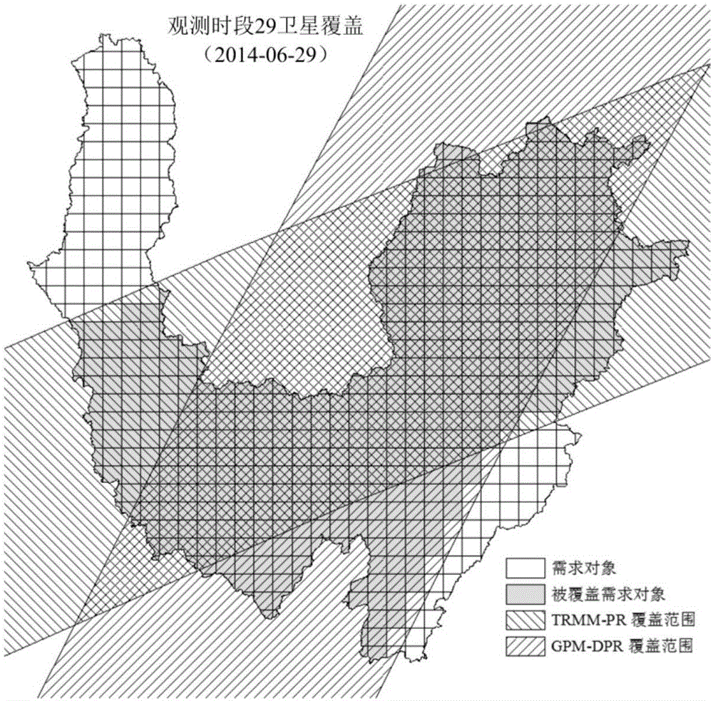
[0080] This embodiment uses the lower reaches of the Jinsha River as the research area to illustrate the technical solution. 38 rainfall stations established before 2009 are taken as existing stations, and the new satellite rain radar is taken into account on the ground coverage. The 31 ground rainfall stations were optimized and compared with the actual layout to verify the effectiveness of this method. The lower reaches of the Jinsha River is located in the upper reaches of the Yangtze River, with a basin area of 135473km 2 With abundant rainfall and frequent heavy rains in the rainy season, its rainfall monitoring is of great significance to hydrometeorology and flood forecasting in the middle and lower reaches of the Yangtze River. There are 69 rainfall stations in the lower reaches of the Jinsha River, of which 38 were established before 2009, and the other 31 were newly added in 2009. According to the results of the 2011 Yangtze River Basin Hydrological Station Network ...
Embodiment 2
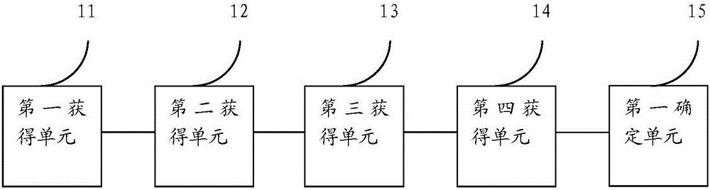
[0120] This embodiment provides an optimized layout device for ground rainfall stations, please refer to figure 2 , The device includes:
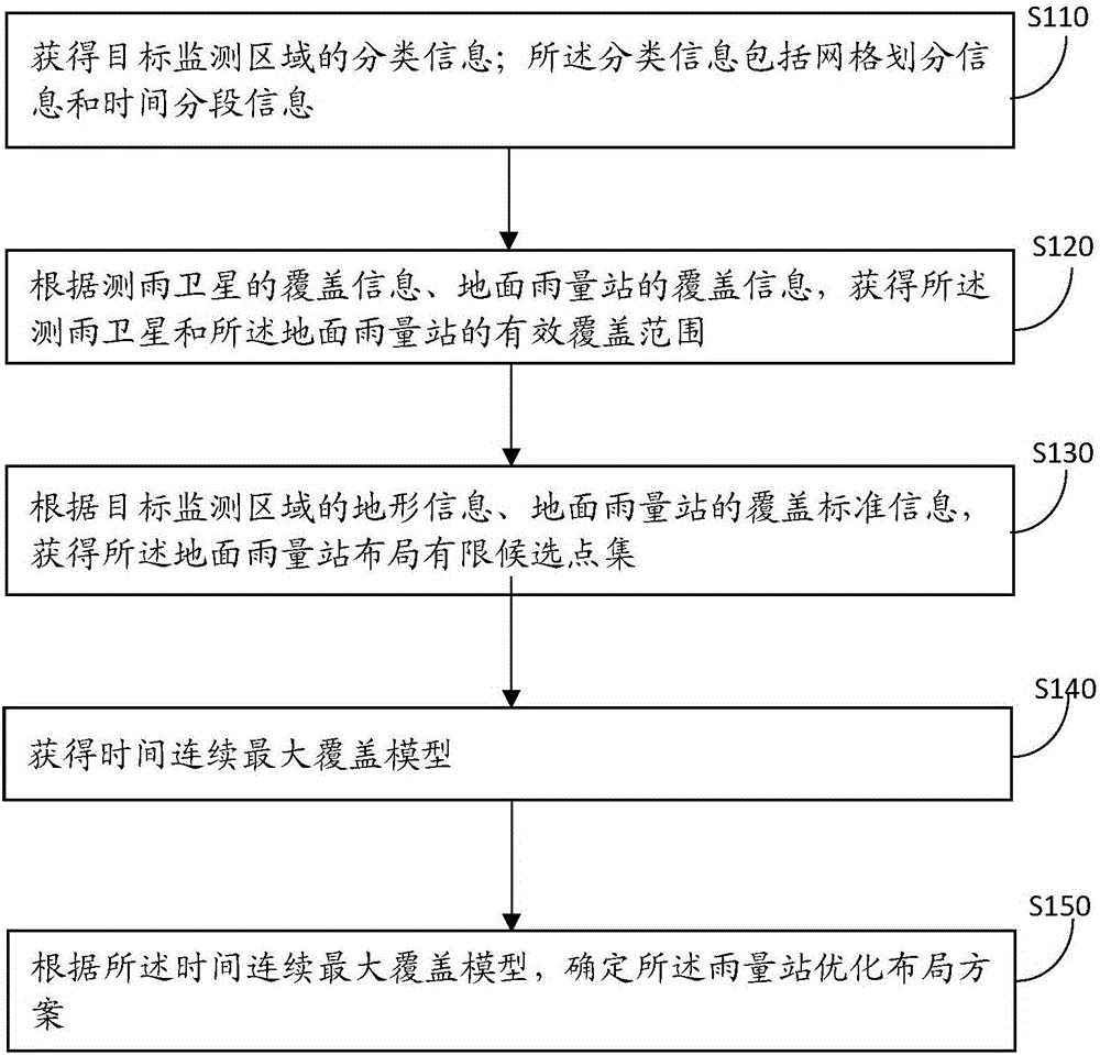
[0121] The first obtaining unit 11 is configured to obtain grid division information and time segmentation information of the target monitoring area;
[0122] The second obtaining unit 12 is configured to obtain the effective coverage of the rain measurement satellite and the ground rainfall station according to the coverage information of the rain measurement satellite and the coverage information of the ground rainfall station;
[0123] The third obtaining unit 13 is configured to obtain the limited candidate point set of the ground rainfall station layout according to the terrain information of the target monitoring area and the coverage standard information of the ground rainfall station;
[0124] The fourth obtaining unit 14 is configured to obtain the time continuous maximum coverage model;
[0125] The first determining unit 15 is configured ...
PUM
 Abstract
Description
Claims
Application Information