Route planning method for low-altitude medium- and long-distance ferry flights

A track planning, long-distance technology, applied in flight plan management, aircraft traffic control, instruments, etc., can solve problems such as low flight safety altitude, failure to realize multi-aircraft, multi-track collaborative task planning, etc. Small difficulty, guaranteed effect

Active Publication Date: 2017-05-31
华北计算技术研究所 +1
View PDF8 Cites 23 Cited by
  • Summary
  • Abstract
  • Description
  • Claims
  • Application Information

AI Technical Summary

Problems solved by technology

In the matching traditional air traffic control system, there are the following three problems: first, it is necessary to manually find the highest obstacle around the route and calculate the minimum flight safety altitude; second, it is necessary to manually collect the flight airspace, navigation station, and location Airspace environment conditions such as reporting points and alternate landing sites; the third is the failure to realize multi-vehicle, multi-track collaborative mission planning

Method used


Image

  • Route planning method for low-altitude medium- and long-distance ferry flights
  • Route planning method for low-altitude medium- and long-distance ferry flights
  • Route planning method for low-altitude medium- and long-distance ferry flights

Examples


Embodiment Construction

[0043] The present invention will be described in detail below with reference to the accompanying drawings and embodiments.

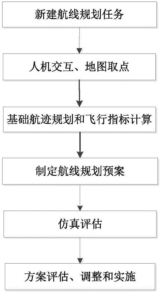
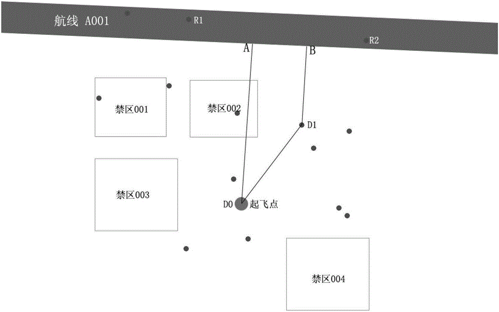
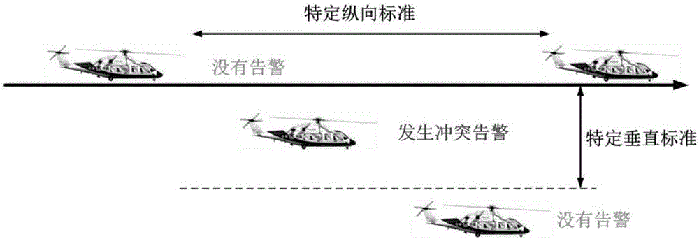
[0044] The low-altitude long-distance transition has a long flight distance and many restrictions. Not only the characteristics of the aircraft itself, but also various external environmental restrictions must be considered. The present invention makes the aircraft fly below the planned civil aviation route, and optimizes the design to enter and fly out of civil aviation. The entry and exit segments of the route can effectively avoid most threats. In addition, the planned trajectory scheme can be modified and improved through simulation evaluation, which provides a reliable planning scheme for the aircraft to efficiently complete the mission.

[0045] The scheme of the present invention is divided into three parts:

[0046] Step 1: Basic track planning:

[0047] The track is divided into the entry route path P1, the route flight path P2 and the exit ro...


PUM


Abstract

The invention discloses a route planning method for low-altitude medium- and long-distance ferry flights. The route planning method can plan a flight route with minimum flight cost for an aircraft, and multi-aircraft and multi-route collaborative task planning can be achieved herein. The route planning method is characterized in that a route is divided into a route-entering path P1, a flight path P2 and a route-exiting path P3; the route-entering path P1 and the route-exiting path P3 employ the shortest distances avoiding static threats; the flight on a flight path is a flight performed below a planned civil aviation route, and the shortest flight path is found by utilizing DijKstra algorithm; multiple aircrafts fly in a simulated manner on a digital map according the planned basic route; safety detection and warning are performed according to the current flight states of the aircrafts and the preset environment information on the digital map, and warning information is output; route optimization is finally performed according to the warning information.

Description

technical field [0001] The invention relates to the technical field of track planning, in particular to a track planning method for low-altitude long-distance transition flight. Background technique [0002] As my country's low-altitude airspace management reform has entered a substantive stage of operation, the general aviation industry is facing strategic development opportunities. In the traditional air traffic control system that is matched with it, there are the following three problems: First, it is necessary to manually find the highest obstacle around the route and calculate the minimum flight safety altitude; Airspace environment conditions such as reporting points and alternate sites; third, the coordinated mission planning of multiple aircraft and multiple tracks has not been realized. In order to solve the above practical problems restricting the development of general aviation, it is necessary to break through the key technology of "trajectory planning for low-...

Claims


Application Information

Patent Timeline
Patent Type & Authority Applications(China)
IPC IPC(8): G08G5/00
CPCG08G5/003
Inventor 杨丽费林鹤张国荣闫永恒
Owner 华北计算技术研究所
Why Eureka
Try Eureka