GNSS decimeter scale differential positioning method based on virtual grid

A virtual grid and positioning method technology, applied in the field of satellite positioning, can solve problems such as concurrent online, reducing server pressure, etc.

Inactive Publication Date: 2017-12-01
湖南省测绘科技研究所 +1
View PDF5 Cites 33 Cited by
  • Summary
  • Abstract
  • Description
  • Claims
  • Application Information

AI Technical Summary

Problems solved by technology

[0007] The technical problem to be solved by the present invention is to provide a virtual grid-based GNSS decimeter-level differential positioning method, which does not require user interaction, thereby reducing server

Method used


Image

  • GNSS decimeter scale differential positioning method based on virtual grid
  • GNSS decimeter scale differential positioning method based on virtual grid
  • GNSS decimeter scale differential positioning method based on virtual grid

Examples


Embodiment Construction

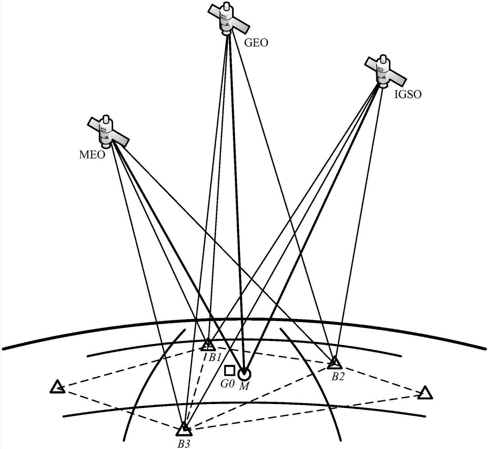
[0070] The present invention will be described in detail below in conjunction with the accompanying drawings. The description in this part is only exemplary and explanatory, and should not have any limiting effect on the protection scope of the present invention. In addition, those skilled in the art can make corresponding combinations of features in the embodiments in this document and in different embodiments according to the descriptions in this document.

[0071] The terms "first", "second", "third", "fourth", etc. (if any) in the description and claims of the present invention and the above drawings are used to distinguish similar objects and not necessarily Describe a specific order or sequence. It is to be understood that the data so used are interchangeable under appropriate circumstances such that the embodiments of the invention described herein, for example, can be practiced in sequences other than those illustrated or described herein. Furthermore, the terms "comp...


PUM


Abstract

The invention provides a GNSS decimeter scale differential positioning method based on virtual grids. Pseudo range differential correction information is divided through grids, the pseudo range differential correction information is broadcasted in a broadcast form, a user determines which grid the user is in according to a preliminary position of the user, and required correction information is selected and pseudo range differential correction is performed. Since users in all grids use same correction data, and a user terminal determines which correction information is needed, a server just needs to broadcast correction, and user interaction is not needed. The method reduces pressure of the server, and is not limited by terminal user number. The method solves a problem of user concurrent getting online, and provides algorithm basis for large amount of decimeter scale GNSS differential positioning service.

Description

technical field [0001] The invention relates to the technical field of satellite positioning, in particular to a virtual grid-based GNSS decimeter-level differential positioning method. Background technique [0002] Pseudo-range differential positioning is a kind of differential GNSS positioning technology. It uses the true value of coordinates on the reference station to find the distance from the station to the satellite, and then compares it with the pseudo-range measured by the receiver to find the pseudo-range correction. Then transmit the pseudorange correction numbers and their rate of change of all satellites to the user station, and the user uses the pseudorange correction number and its rate of change to correct the corresponding pseudorange and calculate the coordinates of the high-precision user station. [0003] In conventional pseudo-range differential positioning, it can be divided into using a single base station for differential mode (single base station mod...

Claims


Application Information

Patent Timeline
IPC IPC(8): G01S19/42G01S19/41
CPCG01S19/41G01S19/42
Inventor 董明旭华亮春秘金钟楚彬谷守周尹昊华陈春花敖敏思刘紫平方书山
Owner 湖南省测绘科技研究所
Why Eureka
Try Eureka