Five-layer fifteen-level organization structure based remote sensing data mobile terminal rapid displaying method
An organizational structure and mobile terminal technology, applied in the field of remote sensing applications, can solve problems such as memory overflow, poor continuity of map display, etc., and achieve a smooth display effect
- Summary
- Abstract
- Description
- Claims
- Application Information
AI Technical Summary
Problems solved by technology
Method used
Image

Examples
Embodiment Construction
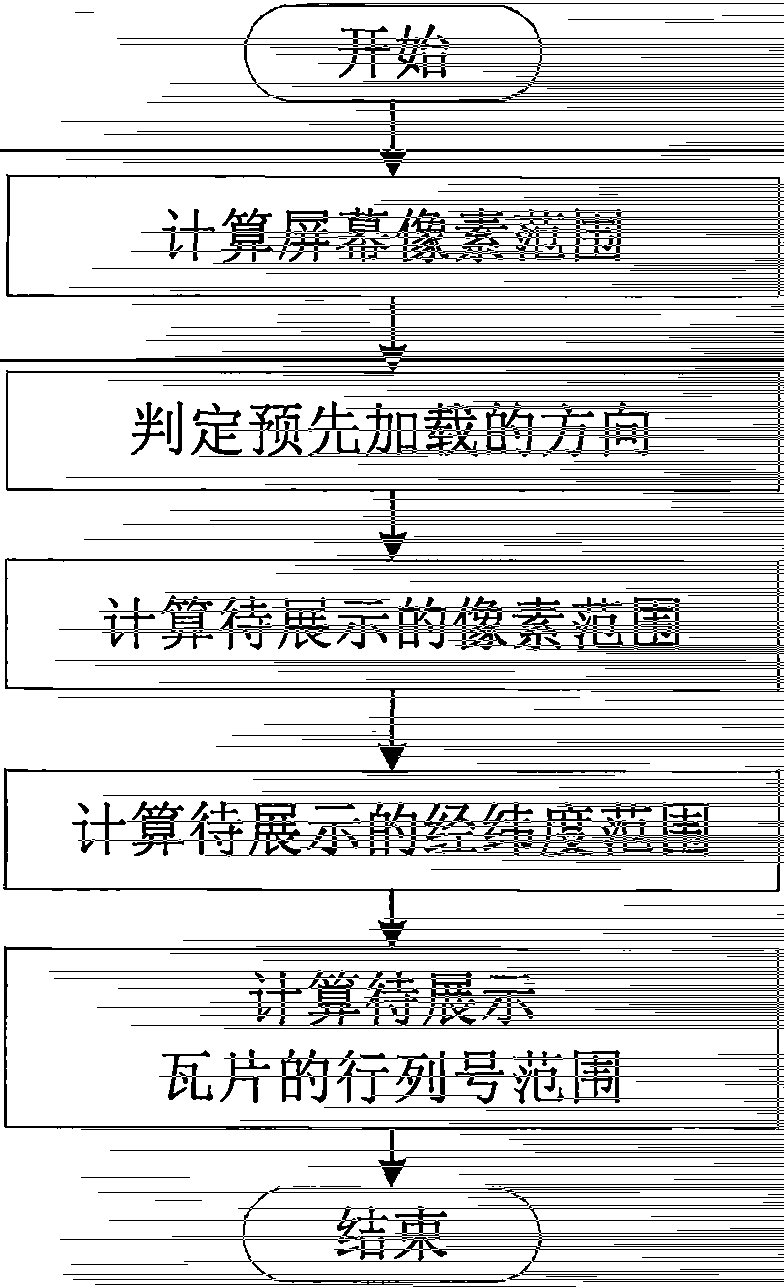
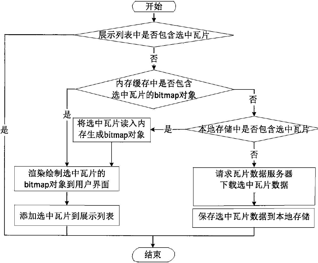
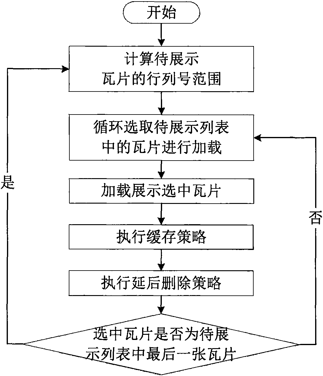
[0018] Such as figure 1 As shown, a five-layer, fifteen-level organizational structure remote sensing tile data mobile terminal rapid display method of the present invention includes the following implementation steps:
[0019] First, calculate the row and column number range of the tile to be displayed, the process is as follows figure 2 As shown, specifically: 1) Calculate the pixel range ((0, 0), (width, height)) of the screen by using the screen properties of the mobile terminal; 2) Determine the direction of preloading, and increase the pixels of the screen in this direction Range: ① When the user operation is zooming in or out, the preloaded direction is empty, and the pixel range to be displayed is the pixel range of the screen; ② When the user operation is panning, the preloaded direction is the main sliding direction of the screen last time , double the screen pixel range along this direction as the pixel range to be displayed; 3) Use the pixel range to be displayed...
PUM
 Abstract
Description
Claims
Application Information
 - R&D Engineer
- R&D Manager
- IP Professional
- Industry Leading Data Capabilities
- Powerful AI technology
- Patent DNA Extraction
Browse by: Latest US Patents, China's latest patents, Technical Efficacy Thesaurus, Application Domain, Technology Topic.
© 2024 PatSnap. All rights reserved.Legal|Privacy policy|Modern Slavery Act Transparency Statement|Sitemap