Method for identifying marine artificial facilities by using spectral remote sensing images
A technology for remote sensing images and facilities, applied in the field of intelligent recognition of remote sensing images, can solve problems such as large-scale and large-scale identification of artificial facilities, and achieve good application prospects.
- Summary
- Abstract
- Description
- Claims
- Application Information
AI Technical Summary
Problems solved by technology
Method used
Image
Examples
Embodiment
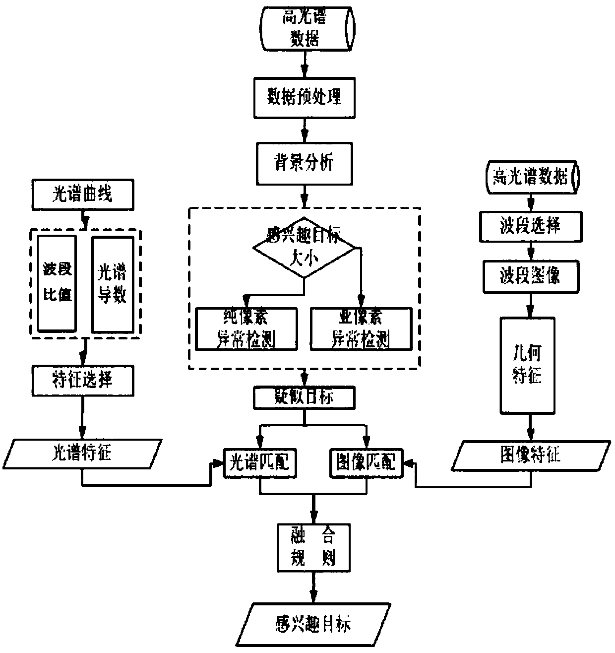
[0035] like figure 1 As shown, a method for utilizing spectral remote sensing images to identify artificial facilities on the sea provided by the present invention comprises the following steps:
[0036] (1) Background analysis: Obtain relevant information about the artificial facilities to be detected, including size, shape and material, etc., to provide input information for subsequent steps, and its size is used in step (2) to determine whether the result of abnormal detection is pure pixels or sub-pixels And roughly how many pixels are in the image, the shape is mainly used for image matching in step (5), and the material is mainly used for spectral matching in step (5).
[0037] Data preprocessing is performed on the hyperspectral data before the background analysis, and the method including removing the water absorption band is mainly used to remove the band with excessive noise.
[0038] (2) Anomaly detection: Considering that it takes a long time to perform feature ex...
PUM
 Abstract
Description
Claims
Application Information
 - R&D
- Intellectual Property
- Life Sciences
- Materials
- Tech Scout
- Unparalleled Data Quality
- Higher Quality Content
- 60% Fewer Hallucinations
Browse by: Latest US Patents, China's latest patents, Technical Efficacy Thesaurus, Application Domain, Technology Topic, Popular Technical Reports.
© 2025 PatSnap. All rights reserved.Legal|Privacy policy|Modern Slavery Act Transparency Statement|Sitemap|About US| Contact US: help@patsnap.com


