System and method for flight route planning of logistics UAV (unmanned aerial vehicle) on basis of grid map
A technology for drones and power grids, applied in the field of drones, to save manpower and material resources, reduce logistics costs, and improve the efficiency of distribution or sending and receiving
- Summary
- Abstract
- Description
- Claims
- Application Information
AI Technical Summary
Problems solved by technology
Method used
Image
Examples
Embodiment Construction
[0034] The present invention will be described in detail below in conjunction with the accompanying drawings and embodiments. The embodiments described herein by referring to the accompanying drawings are exemplary and intended to explain the present invention, but cannot be construed as limitations of the present invention, that is, the described embodiments It is a part of the embodiments of the present invention, but not all the embodiments. In the case of no conflict, the embodiments in the present application and the features in the embodiments can be combined with each other.
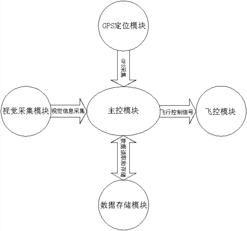
[0035] figure 1 It is the overall structural block diagram of the embodiment of the present invention.
[0036] Such as figure 1 As shown, a system for logistics UAV route planning based on the power grid map mainly includes a data storage module, a main control module, a GPS positioning module, a flight control module and a video acquisition module.
[0037] Wherein, the data storage module is ...
PUM
 Abstract
Description
Claims
Application Information
 - R&D
- Intellectual Property
- Life Sciences
- Materials
- Tech Scout
- Unparalleled Data Quality
- Higher Quality Content
- 60% Fewer Hallucinations
Browse by: Latest US Patents, China's latest patents, Technical Efficacy Thesaurus, Application Domain, Technology Topic, Popular Technical Reports.
© 2025 PatSnap. All rights reserved.Legal|Privacy policy|Modern Slavery Act Transparency Statement|Sitemap|About US| Contact US: help@patsnap.com

