Regional development evaluation method and device based on image identification

An image recognition and area technology, applied in character and pattern recognition, instruments, data processing applications, etc., can solve the problems of ineffective development and rapid evaluation, and achieve the effect of rapid evaluation and effective development.

Active Publication Date: 2018-05-18
GUANGDONG MATVIEW INTELLIGENT SCI & TECH CO LTD
View PDF6 Cites 11 Cited by
  • Summary
  • Abstract
  • Description
  • Claims
  • Application Information

AI Technical Summary

Problems solved by technology

[0004] In order to overcome the deficiencies of the prior art, one of the purposes of the present invention is to provide a regional development status assessment method based on image recognition, which can solve the problem that the prior art cannot effectively and rapidly assess the development status of a certain area
[0005] The second object of the present invention is to provide an electronic device, which can solve the problem in the prior art that the development status of a certain area cannot be effectively and quickly evaluated
[0006] The third object of the present invention is to provide a computer-readable storage medium, which can solve the problem in the prior art that the development status of a certain area cannot be effectively and quickly evaluated

Method used


Image

  • Regional development evaluation method and device based on image identification
  • Regional development evaluation method and device based on image identification
  • Regional development evaluation method and device based on image identification

Examples


Embodiment

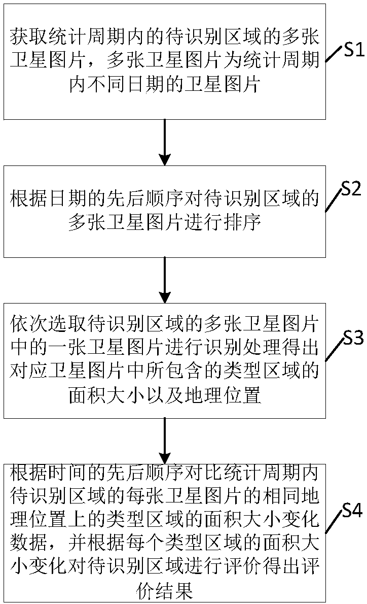
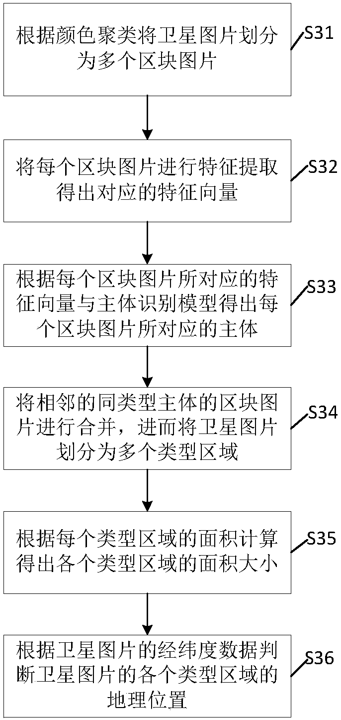
[0040] The present invention analyzes a certain area, such as satellite images of cities, harbors, forests, oceans, etc., through image recognition technology, to identify the development and changes of the area. For example, the satellite images of a certain area are regularly identified, and then the periodic changes of various factors in the area are compared to evaluate the development status of the corresponding area according to the changes of various factors.

[0041] For example, by analyzing satellite images within 10 kilometers of the junction of the two cities, and identifying the changes in the building density of commercial buildings, schools, and standard residential areas in the area, the development of urban inclusiveness can be evaluated based on these data. . For example, the increasing area of ​​the standard residential area indicates that the city is more suitable for people to live in; the increasing area of ​​the commercial center indicates that the area pay...


PUM


Abstract

The invention discloses a regional development evaluation method based on image identification. The method comprises steps that a satellite picture of a to-be-identified region is acquired; the satellite picture is divided into corresponding multiple block pictures according to color clustering; characteristic extraction of each block picture is carried out to acquire a corresponding characteristic vector, and a body corresponding to each block picture is acquired according to the corresponding characteristic vector of each block picture and an established body identification model; the blockpictures of the adjacent similar bodies are merged, and the satellite picture is divided into multiple types of regions; according to the latitude and longitude data of the map, the geographic location of each region type of the satellite picture is acquired, and the area size of each region type is calculated according to the area of each region type. The invention further discloses electronic equipment, a storage medium and a regional development evaluation device. The method is advantaged in that through identifying the satellite map of the region, the corresponding body and area change ofthe body are acquired, and thereby regional development status evaluation is realized.

Description

Technical field [0001] The invention relates to the field of urban evaluation, and in particular to a method and device for evaluating urban inclusiveness based on image recognition. Background technique [0002] At present, modern cities are the centers of human settlements, cultural education, comprehensive commercial centers, knowledge and technological innovation centers, and environmental governance. As the proportion of the urban population in the total population continues to increase, speeding up urban expansion, driving the construction of surrounding areas, and radiating satellite cities have become a major strategy that cannot be delayed. How to objectively evaluate urban development and inclusiveness, use the evaluation results to promote mature planning calibration and optimization, promote the coordinated development of urban areas, and realize that the strategic decisions of urban development are based on evidence, which have become increasingly concerned and worth...

Claims


Application Information

Patent Timeline
Patent Type & Authority Applications(China)
IPC IPC(8): G06K9/00G06Q10/06
CPCG06Q10/0639G06V20/176
Inventor 邓立邦
Owner GUANGDONG MATVIEW INTELLIGENT SCI & TECH CO LTD
Why Eureka
Try Eureka