Unmanned aerial vehicle forest cruise photography technical method

An unmanned aerial vehicle and forest technology, which is used in motor vehicles, 3D position/channel control, instruments, etc., can solve problems such as high price, large field workload, and complex solution model, so as to reduce field workload, The effect of reducing the workload in the field and simplifying the solution model

Inactive Publication Date: 2018-05-29
北京地林远景信息技术有限公司
View PDF8 Cites 0 Cited by
  • Summary
  • Abstract
  • Description
  • Claims
  • Application Information

AI Technical Summary

Problems solved by technology

[0003] ①The workload in the field is heavy. At present, the forestry investigation is still mainly on-site manual investigation, and the workload is relatively large.
[0004] ②The price is expensive. At present, most of the forestry UAV photography adopts the oblique photography method. Generally, 5 digital cameras and POS systems need to be installed on the UAV, and the cost is relatively high.
[0005] ③The calculation model is complex. The current UAV survey schemes have relatively complicated calculation models.
[0006] Therefore, in the forestry survey, the survey methods adopted at this stage, whether it is manual measurement or drone survey, have certain defects and deficiencies. How to find an efficient and fast forest survey method is particularly urgent

Method used


Image

  • Unmanned aerial vehicle forest cruise photography technical method
  • Unmanned aerial vehicle forest cruise photography technical method
  • Unmanned aerial vehicle forest cruise photography technical method

Examples


Embodiment Construction

[0019] Compared with the existing forest parameter survey method, a UAV forest cruising photography method has made great improvements and innovations in the working mode and calculation model, specifically:

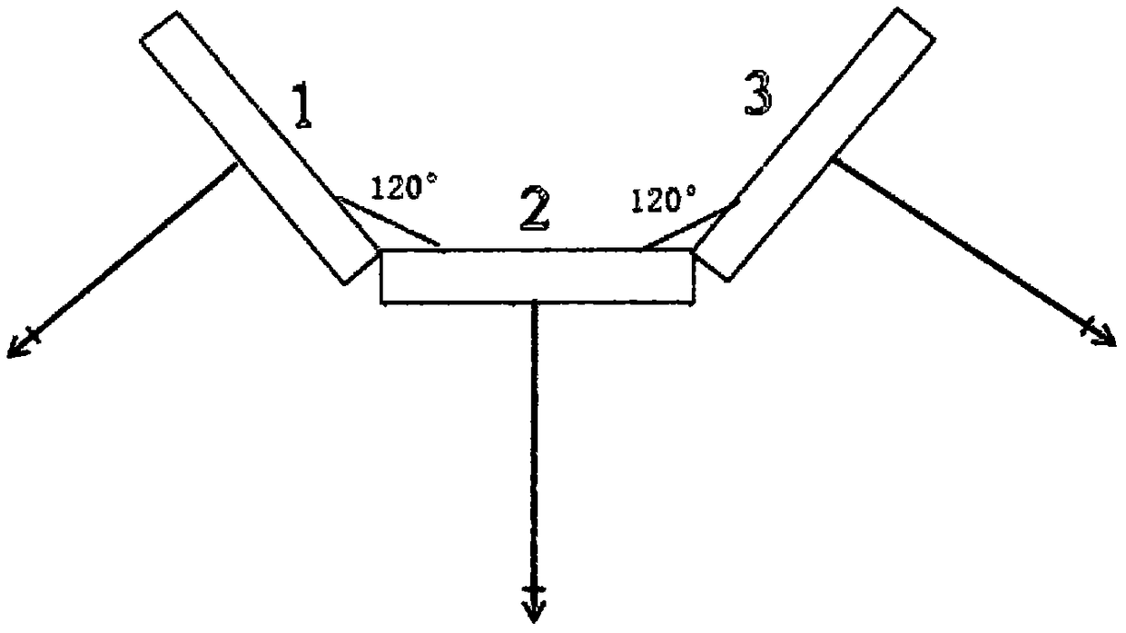
[0020] (1) if figure 1 As shown, the selection and placement of photographic cameras are as follows: select a digital camera with a field of view β≥60°, a fixed focus, and a focal length f≥20mm as the photographic device; place three photographic cameras side by side horizontally at the bottom of the drone, among which, the middle One set is placed vertically downward, and two sets are placed on both sides at an angle of 60° to ensure full coverage of the drone photography area;

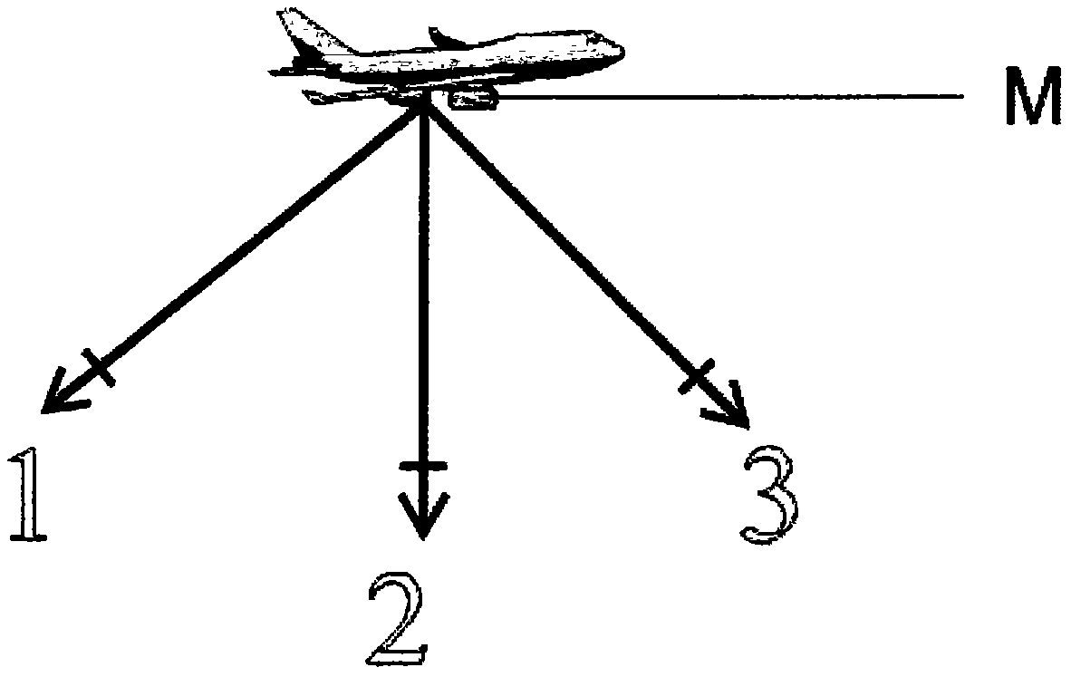
[0021] (2) if figure 2 As shown, the mobile phone placement and use method: place a smart phone on the top of the UAV platform, and determine the relative positional relationship between the center of the mobile phone and the camera; use the mobile phone to record the moment when the camera t...


PUM


Abstract

The invention discloses an unmanned aerial vehicle forest cruise photography technical method. According to the technology, the arranging mode of a forest cruise unmanned aerial vehicle photographingdevice and the optimal photographing time difference are designed by using the unmanned aerial vehicle photogrammetry with cooperation of the digital camera and the smart phone, and the unmanned aerial vehicle cruise photogrammetry scheme is formulated. Besides, a mathematical model is established through splicing of aerial photos to determine the cruise area and acquire the forest fire factors and determine the forest fire area so that unmanned aerial vehicle forest cruise automatic photogrammetry can be realized.

Description

1. Technical field [0001] The invention relates to a method for obtaining forest parameters and determining forest fire area, in particular to a method for forest patrol using unmanned aerial vehicle photogrammetry technology, thereby realizing the calculation of forest parameters and determination of forest fire area in the survey area. 2. Technical Background [0002] Judging from the development status at home and abroad, UAV technology has been widely used in all walks of life, and UAV photogrammetry technology has also been applied in surveying and mapping and survey work. In recent years, the application of drone forestry surveys has become more and more common, and the desire to replace forest field surveys with drone aerial photogrammetry has become more and more urgent. So far, foresters have begun to try to use drones for forestry investigative work. However, judging from the current UAV photography technology and photogrammetry scheme, the UAV forest survey is no...

Claims


Application Information

Patent Timeline
Patent Type & Authority Applications(China)
IPC IPC(8): G01B11/28G05D1/10B64C39/02
CPCG01B11/285B64C39/02G05D1/101
Inventor 冯仲科刘金成邱梓轩
Owner 北京地林远景信息技术有限公司
Why Eureka
Try Eureka