

Image quality based aerial remote sensing path planning method and system
An image quality and aerial remote sensing technology, applied in the field of aerial remote sensing, can solve the problems of less attention to aircraft remote sensing routes, little consideration of flight height, and low efficiency of remote sensing operations, so as to optimize flight routes and aerial photography control points, improve operational efficiency and The effect of job quality
- Summary
- Abstract
- Description
- Claims
- Application Information
AI Technical Summary
Problems solved by technology
Method used
Image

Examples
Embodiment Construction
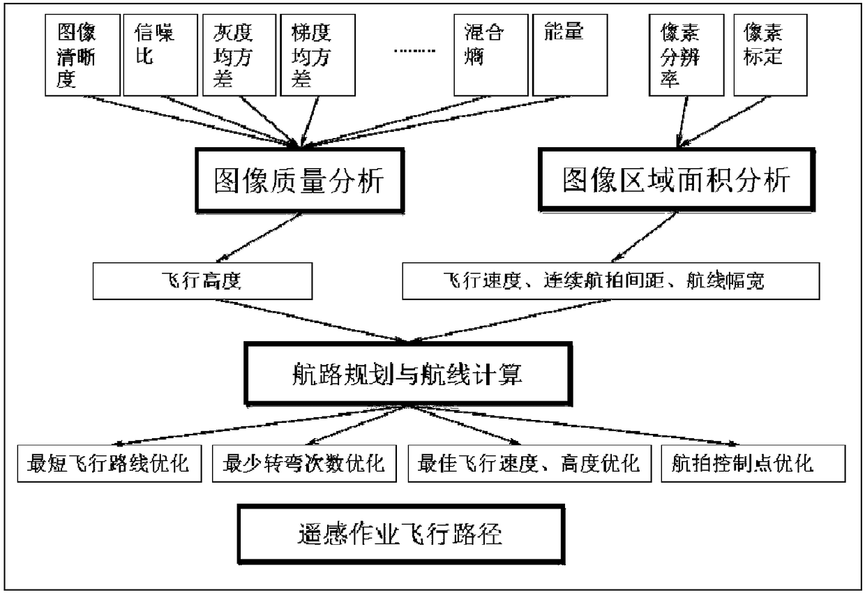
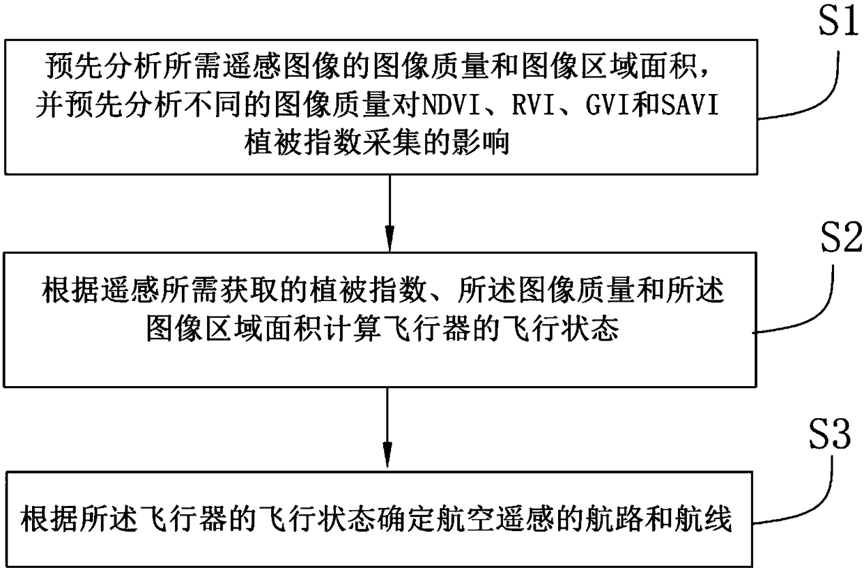
[0022] In order to make the object, technical solution and advantages of the present invention clearer, the present invention will be further described in detail below in conjunction with the accompanying drawings and embodiments. It should be understood that the specific embodiments described here are only used to explain the present invention, not to limit the present invention.
[0023] Unless the context clearly states otherwise, the number of elements and components in the present invention can exist in a single form or in multiple forms, and the present invention is not limited thereto. Although the steps in the present invention are arranged with labels, they are not used to limit the order of the steps. Unless the order of the steps is clearly stated or the execution of a certain step requires other steps as a basis, the relative order of the steps can be adjusted. It can be understood that the term "and / or" used herein refers to and covers any and all possible combina...
PUM
 Abstract
Description
Claims
Application Information