
Three-dimensional track intelligent planning method for underwater autonomous vehicle

An autonomous vehicle, intelligent planning technology, applied in three-dimensional position/channel control, navigation calculation tools, etc., can solve the problems of algorithm sacrificing algorithm optimization accuracy and optimization efficiency, comprehensive consideration, and the fact that the track cannot be really used for actual tasks, etc. Achieve the effect of overcoming long convergence time, improving search efficiency, and overcoming easy to fall into local optimum

Inactive Publication Date: 2018-09-04
SHANGHAI JIAO TONG UNIV
View PDF5 Cites 14 Cited by
  • Summary
  • Abstract
  • Description
  • Claims
  • Application Information

AI Technical Summary

Problems solved by technology

However, the two-dimensional C-space cannot fully include all the information of the theater (such as terrain, obstacles, and three-dimensional information of dynamic targets), so the trajectory generated by this method cannot have good terrain following and terrain avoidance, and cannot be used in planning. When considering the actual terrain conditions and the threat of dynamic targets
[0006] 2) Although some literatures study trajectory planning in three-dimensional space, these meth

Method used


Image

  • Three-dimensional track intelligent planning method for underwater autonomous vehicle
  • Three-dimensional track intelligent planning method for underwater autonomous vehicle
  • Three-dimensional track intelligent planning method for underwater autonomous vehicle

Examples


specific Embodiment approach

[0093] 1. Seabed terrain simulation

[0094] Track planning necessarily requires the knowledge of the seabed topography information of the navigation area. The invention adopts the method of combining random terrain simulation and mountain topography simulation to simulate the terrain of track planning.

[0095] The seafloor topography can be decomposed into two components in the height direction, the first is the height of the topographic reference plane that produces the average height of the topography, and the second is the topographic relief superimposed on the topographic reference plane:

[0096] H(x,y)=H 0 +Z(x,y) (1)

[0097] Among them, H(x,y) is the actual altitude of the coordinate (x,y) point; H 0 is the average height of the whole area; Z(x,y) is the terrain relief height based on the average terrain height. The fluctuation algorithm for the actual terrain is characterized by a random sequence of Gaussian distribution, and the correlation of terrain sampling ...


PUM


Abstract

The invention relates to a three-dimensional track intelligent planning method for an underwater autonomous vehicle. The method comprises 1) seabed terrain simulation, 2) track evaluation index and optimized function selection: through the analysis of the track planning problem, building an evaluation function model that comprehensively considers the length of the voyage and avoids the dynamic target, 3) constraint processing and searching space partitioning: making a mechanism for combining constraint processing and searching space clipping, wherein the mechanism reduces a searching space andmakes the track satisfy all the constraint conditions, and 4) voyage optimization based on an improved ant colony algorithm. Compared with the prior art, the method has the advantage of improving thesearching efficiency of the optimal track.

Description

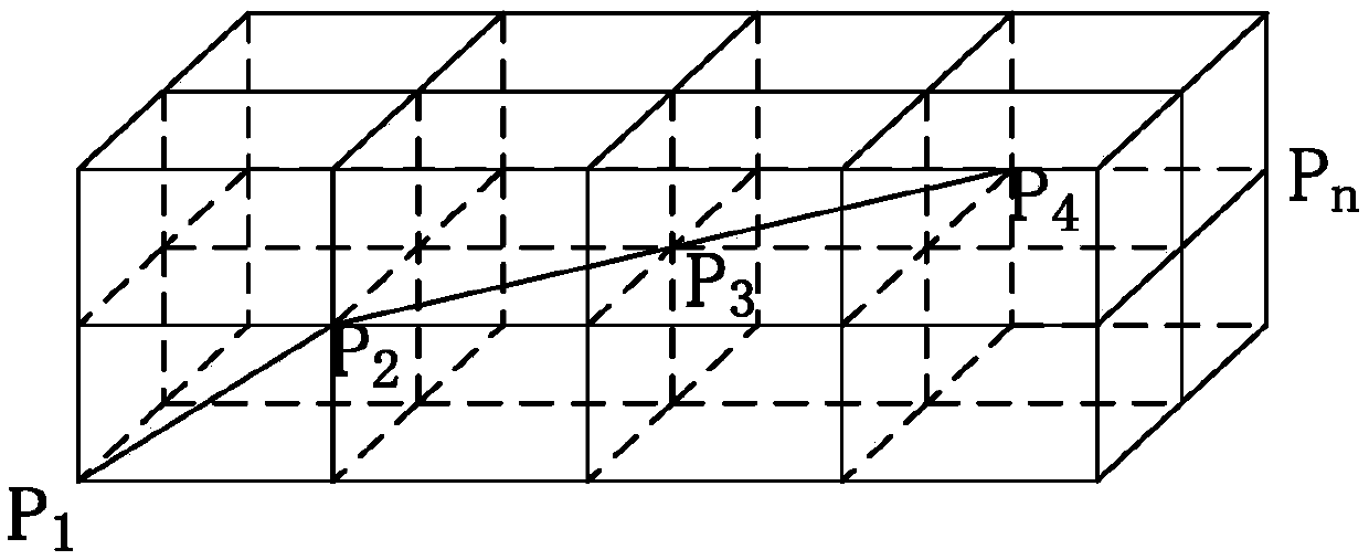
technical field [0001] The invention relates to the technical field of robot path planning, in particular to a three-dimensional track intelligent planning method for an underwater autonomous vehicle. Background technique [0002] Track planning is one of the cores of the mission planning system for underwater autonomous vehicles. Excellent, or the most satisfactory flight path. [0003] Compared with other unmanned systems, the trajectory planning of underwater autonomous vehicles has some particularities. On the one hand, the task requirements of underwater autonomous vehicles are complex, not only to avoid static obstacles, but also to avoid dynamic obstacles such as other underwater vehicles. Since most underwater autonomous vehicles are underactuated vehicles with poor maneuverability and slow response speed, real-time trajectory planning is crucial to accomplish tasks. On the other hand, the working environment of underwater autonomous vehicles is complex, and will ...

Claims


Application Information

Patent Timeline
IPC IPC(8): G01C21/20G05D1/10
CPCG01C21/20G05D1/10
Inventor 乔磊张卫东张国庆孙志坚衣博文林淑怡赵亚东
Owner SHANGHAI JIAO TONG UNIV
Learn More