
Design method of tidal river flood control and tidal protection coastline

A technology for river channels and floods, which is applied in the field of tidal river flood control and tidal protection coastline formulation, can solve the problems that the model is difficult to be accurately verified, and achieve the effects of ensuring flood discharge capacity, enriching environmental conditions, and clear physical concepts

Active Publication Date: 2020-10-16
FUJIAN PROVINCIAL INVESTIGATION DESIGN & RES INST OF WATER CONSERVANCY & HYDROPOWER
View PDF3 Cites 0 Cited by
  • Summary
  • Abstract
  • Description
  • Claims
  • Application Information

AI Technical Summary

Problems solved by technology

The laws of water movement in the lower reaches of rivers are complex, and tidal current physical models and mathematical models are effective means to reveal the laws of hydrodynamics and sediment transport. In the case of a large amount of sand mining on the river channel, the river bed evolves rapidly and violently, making it difficult to accurately verify the model

Method used


Image

  • Design method of tidal river flood control and tidal protection coastline
  • Design method of tidal river flood control and tidal protection coastline
  • Design method of tidal river flood control and tidal protection coastline

Examples


Embodiment 1

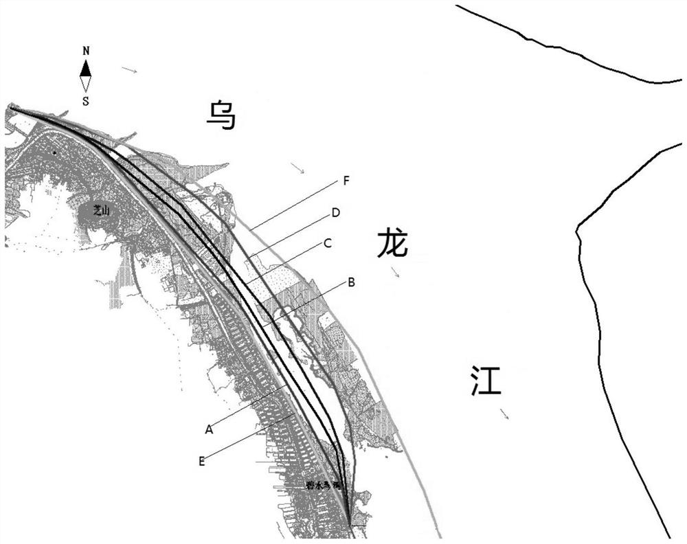
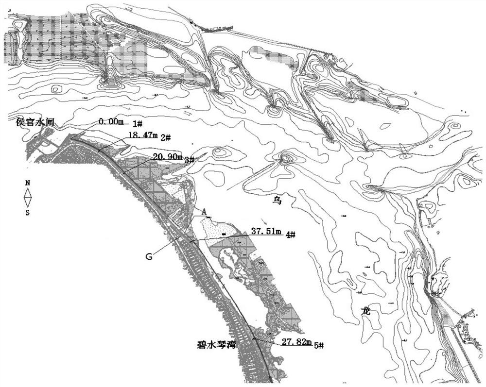
[0026] Taking the shoreline from Houguan Sluice to Bishuiqinwan in the lower reaches of the Minjiang River in Fuzhou as an example of this implementation, the formulation method considers the dual effects of floods and tidal currents, especially the long-term effects of tidal currents, and formulates a method for formulating flood and tidal prevention coastlines, including the following Step, with reference to the hydrological data in previous years, establish a physical model and a mathematical model of the river course, the mathematical model includes a two-dimensional mathematical model, a three-dimensional mathematical model, and the physical model of the river course includes three levels of flow tests of flood, medium and dry; The model is coupled with the two-dimensional mathematical model and the three-dimensional mathematical model. The physical-numerical coupling is embodied in the following three aspects: ① simulate hydraulic boundary conditions, and use the two-dimen...

Embodiment 2

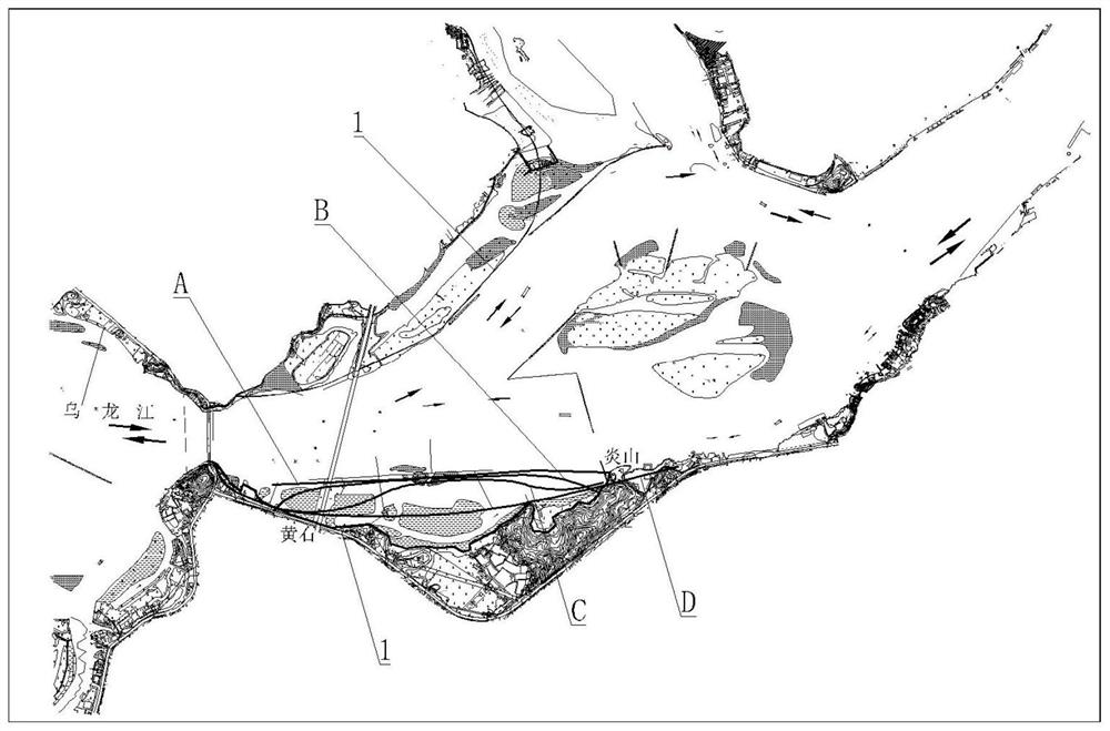
[0073] The modified coastline of Changle Huangshi to Yanshan section in Sanjiangkou District, the intersection of Minjiang River and Beigang, is used as this embodiment. The flood standard adopts a 100-year flood, and the discharge flow of the Shuikou Dam is 35,700m 3 / s, the corresponding Dazhangxi discharge flow is 3000m 3 / s, the flood process is 7 days, considering that the embankments on both sides of the lower reaches of the Minjiang River do not overflow, and considering that the Shuikou Dam discharges 308m in the dry season 3 / s, the tidal level of the East China Sea adopts the 7-day process corresponding to the multi-year average high tide level at Meihua Station from April to July. Two working conditions are considered for the flood tide combination in the flood season: (1) The upper boundary condition is the 100-year flood process, and the flood peak meets the high tide level when it reaches the revised area of ​​the Changle coastline. (2) The upper boundary condi...


PUM


Abstract

The invention discloses a tide-sensing river channel flood prevention and moisture prevention shoreline making method, and belongs to the technical field of flood prevention and moisture prevention foundation water conservancy facilities. The method is based on actually measured river channel terrain and hydrology sediment materials, a river channel physical model and a mathematical model are established, the mathematical model comprises a two-dimensional mathematical model and a three-dimensional mathematical model, and the river channel physical model, the two-dimensional mathematical modeland the three-dimensional mathematical model are carrying out digital-to-analogue coupling; and according to hydrodynamic characteristics under different regional tidal currents and different workingconditions, water force of a river channel field, change rule of flow velocity gradient, distribution rule a water power curve, erosion and silting process of a riverbed and a form of ultimate erosionand silting are under the long-time action of the river flood and the outer sea boundary at different frequencies are achieved, and a shoreline conforming to a natural river tidal flooding intersection movement rule is formulated. The tide-sensing river channel flood prevention and moisture prevention shoreline making method has the advantages that the defect that in traditional shoreline making,the flood power function is considered independently and the long-term effect of the tidal power is ignored are broken through, and the adaptability of a combined action area river channel shorelineof a runoff and a tide is enhanced.

Description

technical field [0001] The invention belongs to the technical field of flood and tide control basic water conservancy facilities, and in particular relates to a method for formulating a tidal river channel flood and tide control coastline. Background technique [0002] The lower reaches of rivers are generally affected by both river runoff and ocean tides at the same time. The water flow is not unidirectional but reciprocating periodically. The water level process line also presents the shape of high and low tides. Therefore, how to accurately delineate the shoreline utilization area and the shoreline control line has become the primary problem to be solved in the riverside shoreline utilization planning. Velocity gradient is an important parameter to quantify the secondary flow characteristics of the river channel and the law of water energy dissipation, while the water level gradient is closely related to the stability of the river bank and the habitat of the river channel...

Claims


Application Information

Patent Timeline
Patent Type & Authority Patents(China)
IPC IPC(8): E02B1/00E02B1/02
CPCE02B1/00E02B1/02
Inventor 付开雄杨首龙何承农胡朝阳谢建清叶丽清黄梅琼夏厚兴
Owner FUJIAN PROVINCIAL INVESTIGATION DESIGN & RES INST OF WATER CONSERVANCY & HYDROPOWER
Learn More