Method for acquiring three-dimensional topographic data of mountain wound surface
A 3D terrain and wound surface technology, applied in image data processing, details involving processing steps, 3D modeling, etc., can solve the problems of low integrity and accuracy of 3D terrain data, improve integrity and accuracy, avoid The effect of being occluded and ensuring the overlap rate
- Summary
- Abstract
- Description
- Claims
- Application Information
AI Technical Summary
Problems solved by technology
Method used
Image

Examples
Embodiment 1
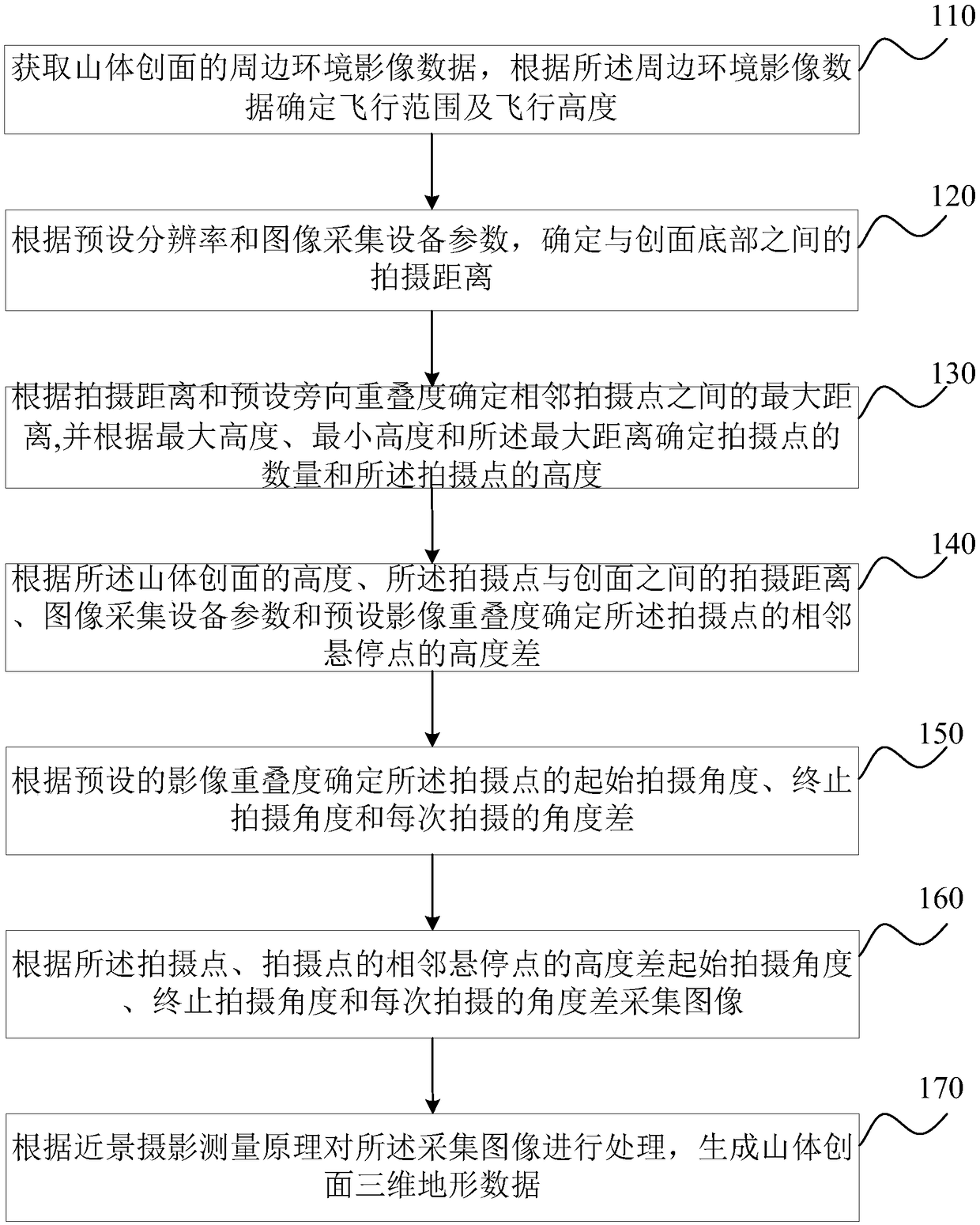
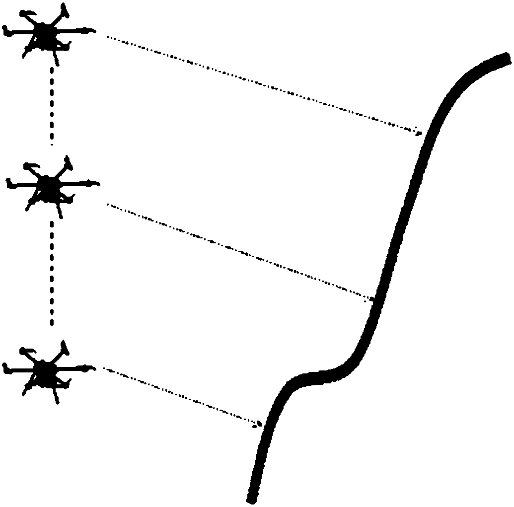
[0044] figure 1 It is a flow chart of the method for obtaining 3D topographic data of mountain wounds provided by Embodiment 1 of the present invention. This embodiment is applicable to the case of obtaining 3D topographic data of mountain wounds, especially for the case of obtaining 3D topographic data of steep mountain wounds.
[0045] see figure 1 , the method for acquiring three-dimensional terrain data of mountain wounds, comprising:
[0046] S110, acquiring the surrounding environment image data of the mountain wound, and determining the flight range and flight height according to the surrounding environment image data.
[0047] The surrounding environment image data is obtained by means of vertical photography of drones. The scope of the survey area is determined according to the position and range of the mine wound in the surrounding environment image. At the same time, the minimum and maximum heights of the survey area and the performance of image acquisition equip...
Embodiment 2
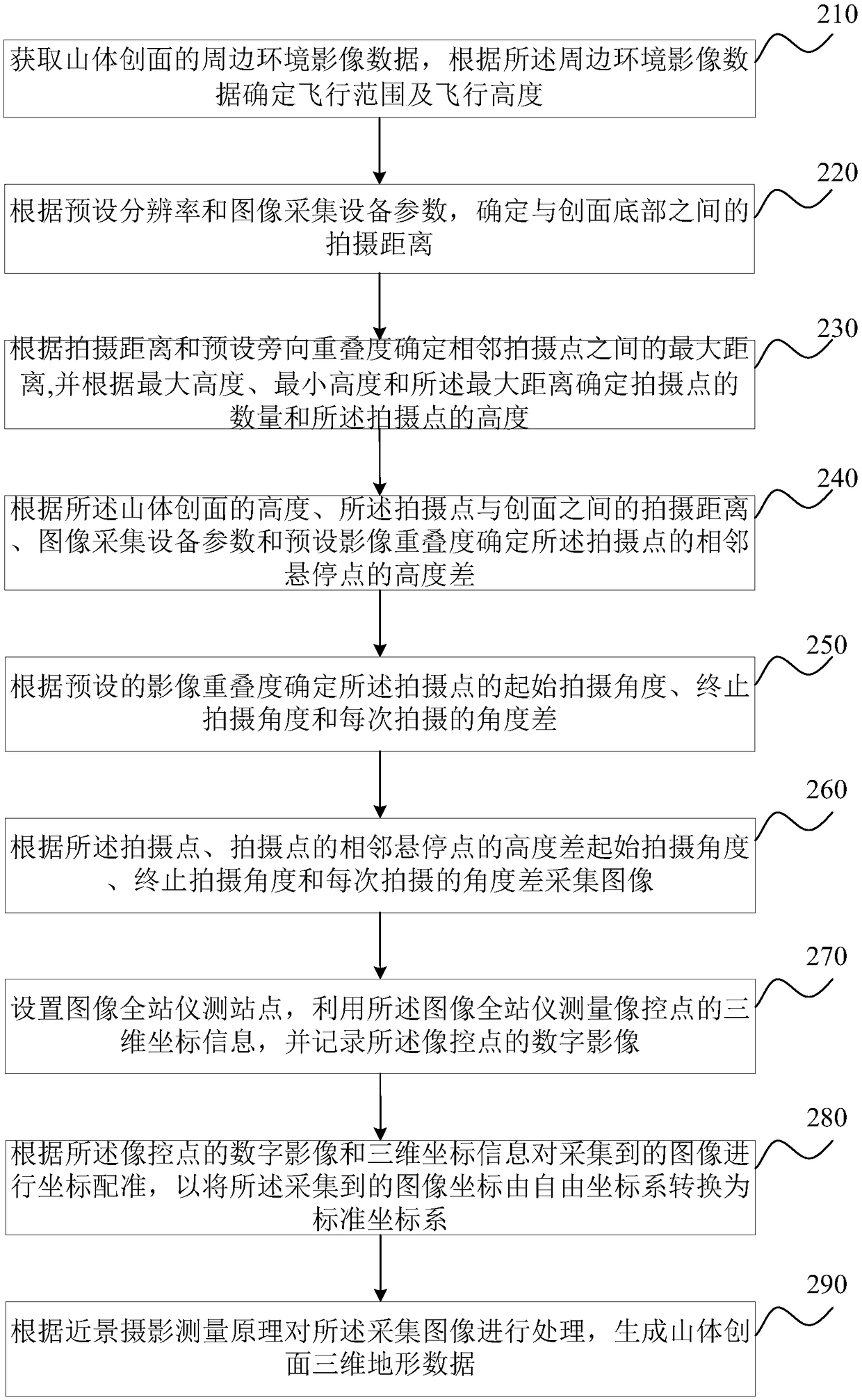
[0089] figure 2 It is a schematic flowchart of the method for acquiring three-dimensional terrain data of mountain wounds provided by Embodiment 2 of the present invention. This embodiment is optimized on the basis of the foregoing embodiments. In this embodiment, the method further includes: setting an image total station measuring site, using the image total station to measure the three-dimensional coordinate information of the image control point, and recording The digital image of the image control point; correspondingly, after the image is collected according to the shooting site, the starting shooting angle, the ending shooting angle and the angle difference of each shooting, the collected image is processed according to the principle of close-range photogrammetry Before processing, before generating the three-dimensional terrain data of the mountain wound surface, it also includes: coordinate registration of the collected images according to the digital image of the im...
PUM
 Abstract
Description
Claims
Application Information
 - R&D Engineer
- R&D Manager
- IP Professional
- Industry Leading Data Capabilities
- Powerful AI technology
- Patent DNA Extraction
Browse by: Latest US Patents, China's latest patents, Technical Efficacy Thesaurus, Application Domain, Technology Topic.
© 2024 PatSnap. All rights reserved.Legal|Privacy policy|Modern Slavery Act Transparency Statement|Sitemap