A Color Enhancement Method Suitable for Remote Sensing Image
A remote sensing image and color enhancement technology, which is applied in image enhancement, image analysis, image data processing, etc., can solve the problems of noise enhancement and poor image enhancement effect, and achieve the effect of improving contrast, enhancing details, and improving contrast and detail information
- Summary
- Abstract
- Description
- Claims
- Application Information
AI Technical Summary
Problems solved by technology
Method used
Image
Examples
specific Embodiment approach 1
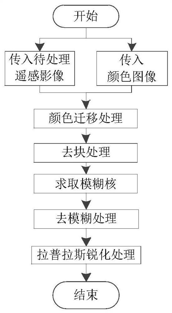
[0039] Specific implementation mode 1. Combination Figure 1 to Figure 11 Describe this embodiment, a color enhancement method suitable for remote sensing images, aiming at the characteristics of the remote sensing images to be processed are not rich in color and low contrast, the remote sensing images are enhanced, and the process includes color migration processing, deblocking processing, deblurring processing and Sharpening. After processing, the color of the remote sensing image is significantly enriched, the brightness is improved, the contrast is improved, and the edge details are enhanced.
[0040] The concrete process of this implementation mode is:
[0041] 1. Carry out color migration processing on remote sensing color images, including the following steps:
[0042] 1.1 Input the remote sensing image src to be processed, and the color image tgt, where tgt is an image obtained in a high-definition library such as Google Maps that has the same geographical location a...
specific Embodiment approach 2
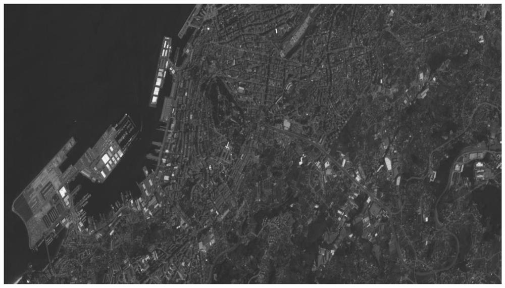
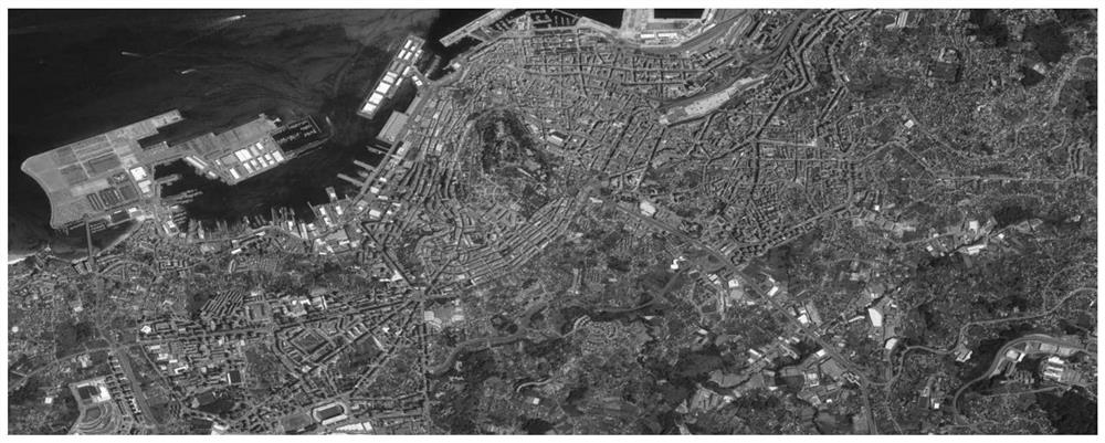
[0096] Specific embodiment two, combine Figure 2 to Figure 11 Describe this embodiment. This embodiment is a verification example of the color enhancement method suitable for remote sensing images described in Embodiment 1: the image after each step of remote sensing image processing is given in sequence, and at the end it is compared with the existing histogram equalization method, The Laplacian sharpening method and the linear stretching method are used to compare the results. The test sample comes from the Jilin-1 video 03 star data.
[0097] like figure 2 The image shown is the image of the Vigo area in Spain taken by the 03 satellite data of the Jilin-1 video. Observation shows that the image is overall dark and the contrast is not obvious; image 3 The incoming color image, which is a high-res image from Google Earth, is the same as figure 2 roughly the same geographic location; Figure 4It is the image obtained after the color migration processing in step 1. The ...
PUM
 Abstract
Description
Claims
Application Information
 - R&D
- Intellectual Property
- Life Sciences
- Materials
- Tech Scout
- Unparalleled Data Quality
- Higher Quality Content
- 60% Fewer Hallucinations
Browse by: Latest US Patents, China's latest patents, Technical Efficacy Thesaurus, Application Domain, Technology Topic, Popular Technical Reports.
© 2025 PatSnap. All rights reserved.Legal|Privacy policy|Modern Slavery Act Transparency Statement|Sitemap|About US| Contact US: help@patsnap.com


