
A multi-view layout method and system for immersive spatio-temporal data visual analysis

A spatiotemporal data, multi-view technology, applied in the field of geospatial information systems, can solve problems such as the inability to meet immersive visual analysis, and achieve the effect of maintaining continuity and efficiency

Inactive Publication Date: 2021-04-13
SOUTHWEST JIAOTONG UNIV +1
View PDF5 Cites 0 Cited by
  • Summary
  • Abstract
  • Description
  • Claims
  • Application Information

AI Technical Summary

Problems solved by technology

Due to the transformation of the layout space from a two-dimensional plane to a 360-degree three-dimensional space surrounding the analyst, and the development of analysis tasks from data visualization to visual reasoning in the analysis process, the traditional multi-view layout method has been unable to meet the needs of immersive visual analysis.

Method used


Image

  • A multi-view layout method and system for immersive spatio-temporal data visual analysis
  • A multi-view layout method and system for immersive spatio-temporal data visual analysis
  • A multi-view layout method and system for immersive spatio-temporal data visual analysis

Examples


Embodiment Construction

[0026] The technical solutions in the embodiments of the present invention will be clearly and completely described below in conjunction with the accompanying drawings in the embodiments of the present invention. It should be understood that the specific embodiments described here are only used to explain the present invention, not to limit the present invention. Based on the embodiments of the present invention, all other embodiments obtained by those skilled in the art without creative efforts shall fall within the protection scope of the present invention.

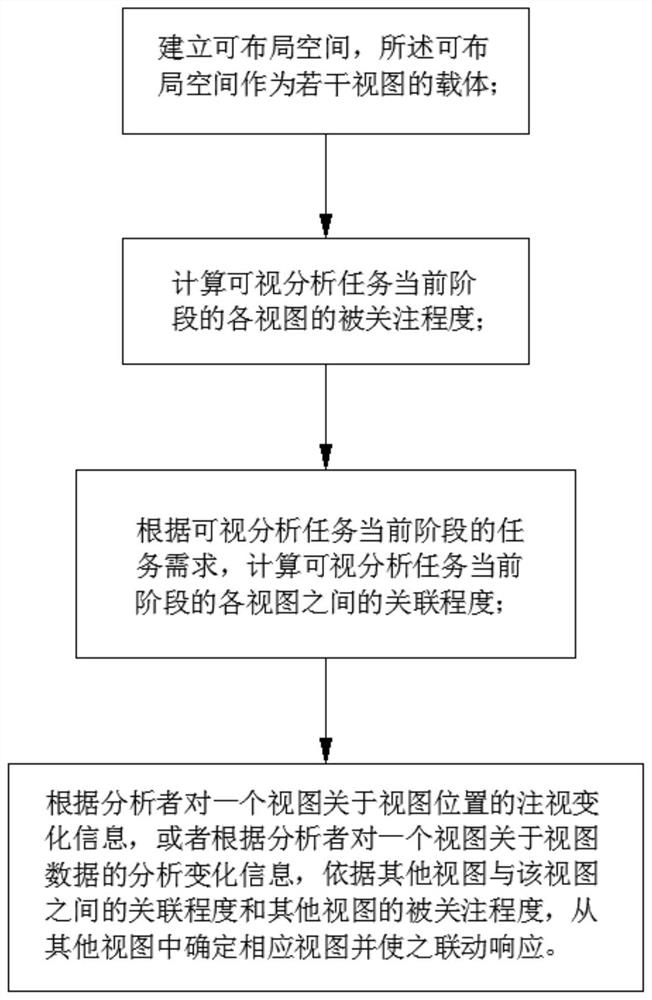
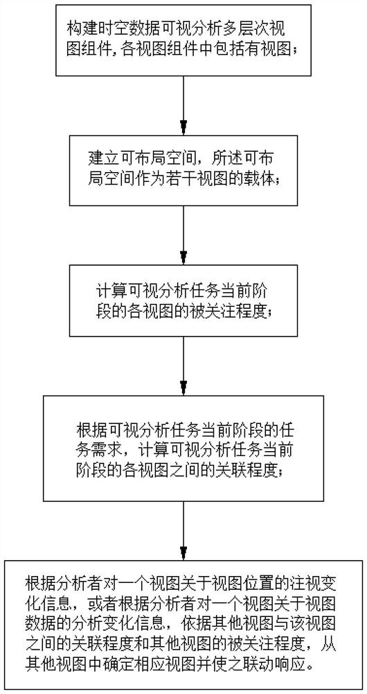
[0027] see figure 1 As shown, the embodiment of the present invention provides an immersive spatio-temporal data visual analysis multi-view dynamic layout method, the method mainly includes figure 1 The four steps of S101 to S104 shown in . Wherein, the sequence between step S102 and step S103 is not limited.

[0028] Wherein, the several views may be obtained through visualization of spatio-temporal data related to ...


PUM


Abstract

The invention belongs to the technical field of geospatial information systems, and provides an immersive spatio-temporal data visual analysis multi-view layout method and system, aiming to solve the discontinuity and cognition between multiple views of the analyst existing in the prior art inefficiency etc. The method includes establishing a view layout space; calculating the attention degree of each view in the current stage of the visual analysis task; calculating the degree of association between the views in the current stage of the visual analysis task; Gaze change information of the position, or according to the analysis change information of a view about view data by the analyst, according to the degree of association between other views and this view and the degree of attention of other views, determine the corresponding view from other views and make it Linkage response. The method dynamically optimizes the multi-view layout, realizes the cognitive focus related to the visual analysis task, and maintains the continuity and efficiency of the analyst's cognition among multiple views.

Description

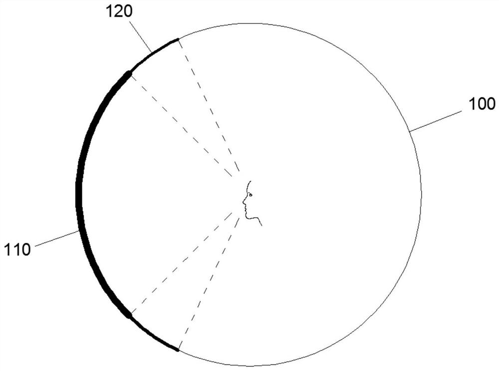
technical field [0001] The invention belongs to the technical field of geospatial information systems, and mainly relates to a multi-view layout method and system for immersive spatiotemporal data visual analysis. Background technique [0002] With the rapid development of AR / VR technology, immersive experience has been gradually applied in the field of data analysis, and the immersive visual analysis of spatio-temporal big data has become a hot research frontier in academia and industry. [0003] The traditional multi-view method represents information in different forms from different sides and realizes the visualization of multi-dimensional features of data. The layout design standard mainly considers the continuity of the analyst's cognition of different features. Unlike traditional visual analysis, where multiple views are mainly arranged in a two-dimensional plane, the multi-view layout space of immersive visual analysis is centered on the analyst and surrounds the ana...

Claims


Application Information

Patent Timeline
Patent Type & Authority Patents(China)
IPC IPC(8): G06F3/01G06T19/20
CPCG06F3/013G06T19/20G06T2219/2004
Inventor 付萧朱庆李赟杨卫军郭永欣
Owner SOUTHWEST JIAOTONG UNIV
Learn More