Earth fixing grid mapping method of stationary meteorological satellite imager

A geostationary meteorological satellite, mapping method technology, applied in the re-radiation of electromagnetic waves, instruments, image analysis, etc.

Active Publication Date: 2018-11-16
SHANGHAI SATELLITE ENG INST +1
View PDF5 Cites 8 Cited by
  • Summary
  • Abstract
  • Description
  • Claims
  • Application Information

AI Technical Summary

Problems solved by technology

[0009] Aiming at the defects of the fixed earth grid of the existing geostationary remote sensing satellite imager, the present invention proposes a geostationary meteorological satelli

Method used


Image

  • Earth fixing grid mapping method of stationary meteorological satellite imager
  • Earth fixing grid mapping method of stationary meteorological satellite imager
  • Earth fixing grid mapping method of stationary meteorological satellite imager

Examples


Embodiment

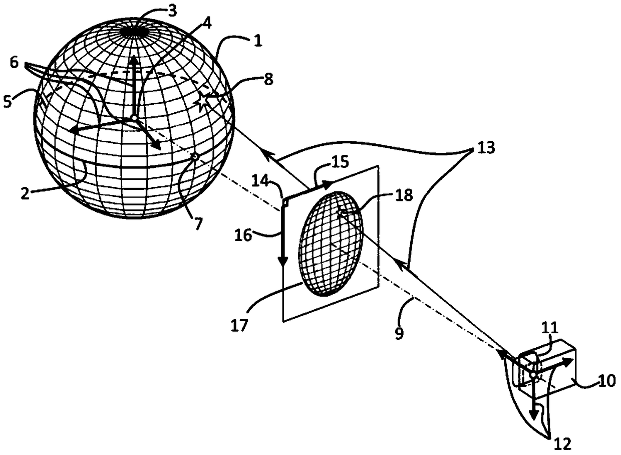
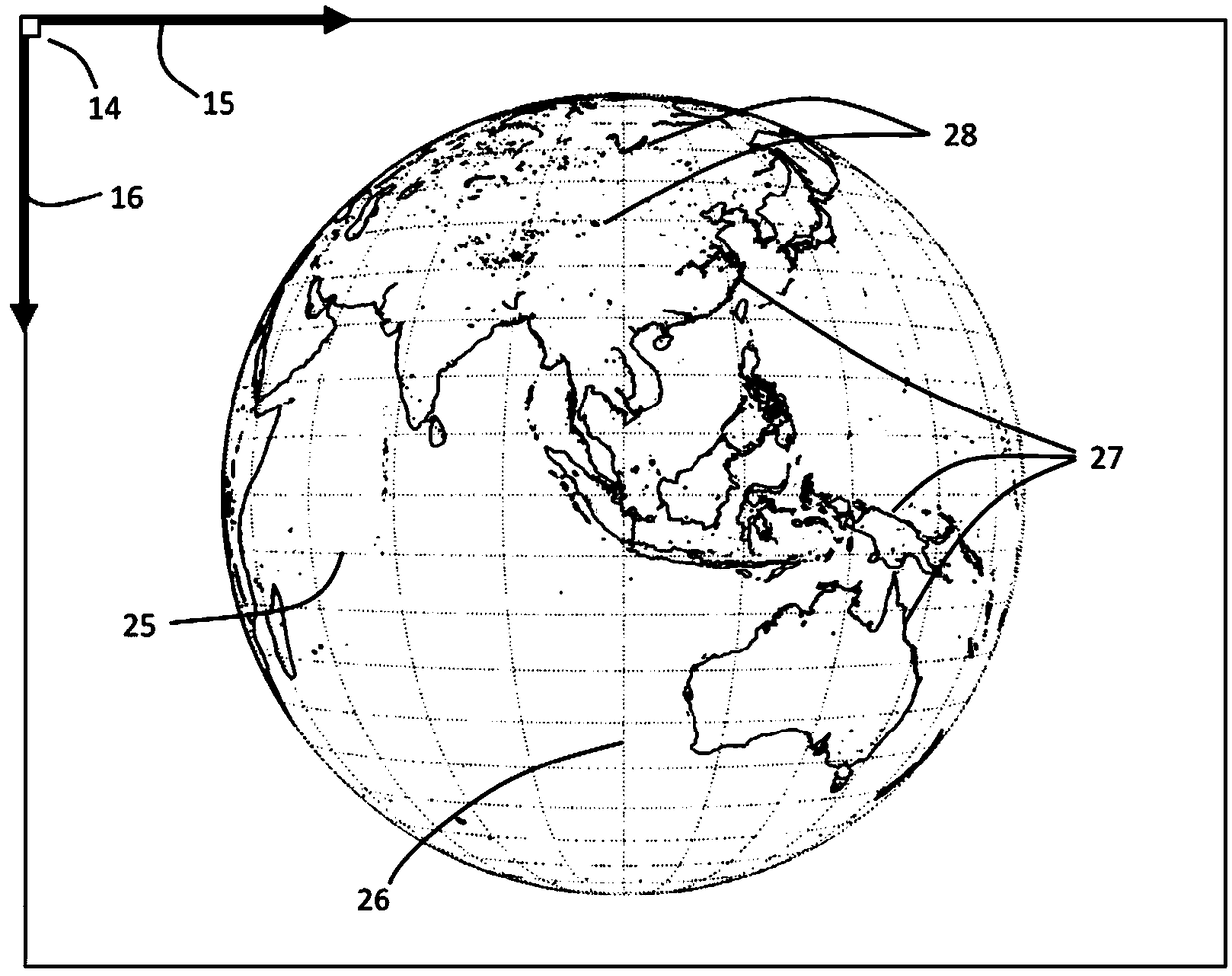
[0047] The fixed earth grid is a benchmark for ideal state imaging of geostationary meteorological satellite imagers, which maps the characteristic objects on the earth's surface to images formed by geostationary meteorological satellite imagers under nominal ideal conditions.

[0048] The feature objects on the earth's surface are coastlines and inland lake contours, as well as other fixed feature contours with large remote sensing radiation gradients on the earth's surface.

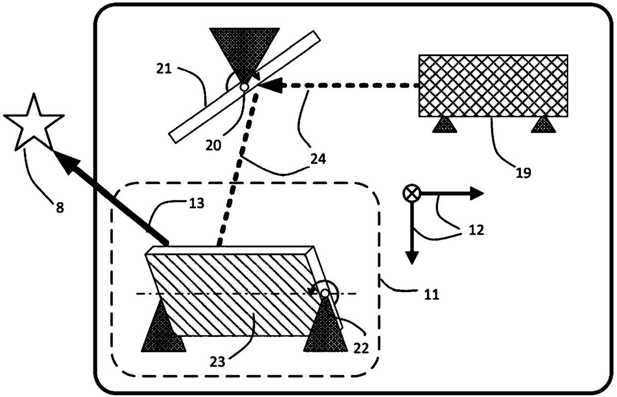
[0049] The new generation of geostationary meteorological satellites all work in a three-axis stable manner, and their imager scanning mechanisms are divided into two types: single-mirror dual-axis and dual-mirror dual-axis. For example, the imagers of China's Fengyun-4 satellite and the US GOES-R satellite both have two mirrors and two mutually perpendicular rotation axes, and adopt the scheme of reciprocating scanning in the east-west direction. The light emitted from the earth is first incident on th...


PUM


Abstract

The invention discloses an earth fixing grid mapping method of a stationary meteorological satellite imager. The method includes following steps: step 1, mapping earth surface characteristic objects to an image formed by the stationary meteorological satellite imager in a nominal ideal condition, and regarding mapping points as earth fixing grids; and step 2, comparing the difference between a practical remote-sensing image and the fixed grids as a datum reference output by an L1-level image, evaluating the positioning prevision of the image of the imager, analyzing an internal optical path deformation characteristic and an external installation error of the imager, and analyzing a current orbit position of a satellite, wherein the nominal ideal condition comprises following descriptions:the satellite is located on an intersecting line of an equatorial plane and a fixed point longitude half-circle plane and is 42164.172 kilometers away from the center of earth, the Z-axis of an imager optical reference coordinate system points to the center of earth, the X-axis is located in a clockwise equatorial plane and points to a local east, and the internal optical path of the imager is collimated and avoids distortion and mismatch. According to the method, the data processing efficiency and precision of a stationary meteorological satellite ground application system can be improved.

Description

technical field [0001] The invention relates to a fixed earth grid mapping method for a stationary remote sensing satellite imager, in particular to a fixed earth grid mapping method for a stationary meteorological satellite imager. Background technique [0002] Geostationary remote sensing satellites use scanning imagers to perceive the radiation information of objects on the earth's surface, which can be used for map mapping, weather diagnosis, disaster monitoring, and other qualitative and quantitative remote sensing products. This requires that the absolute geographic location corresponding to the remote sensing image of the imager is accurate, and the relative positional relationship registration of adjacent images is accurate. However, satellite platforms and remote sensing instruments are affected by factors such as celestial mechanics, space mechanical environment, and thermal environment changes. Satellites will have orbital drift and attitude pointing deviations, a...

Claims


Application Information

Patent Timeline
IPC IPC(8): G01S17/95G06T7/11G06T7/149G06T7/73
CPCG01S17/95G06T7/11G06T7/149G06T7/75Y02A90/10
Inventor 吕旺董瑶海宋效正沈毅力周徐斌陈文强
Owner SHANGHAI SATELLITE ENG INST
Why Eureka
Try Eureka