Fast extraction method of highway landslide area

An extraction method, a highway technology, applied in the directions of instruments, character and pattern recognition, scene recognition, etc., can solve the problems of few landslide studies, long time consumption, large workload, etc., to reduce manpower, time consumption, data easy effect

Active Publication Date: 2018-11-20
GUANGXI TEACHERS EDUCATION UNIV
View PDF5 Cites 11 Cited by
  • Summary
  • Abstract
  • Description
  • Claims
  • Application Information

AI Technical Summary

Problems solved by technology

Although satellite imagery provides an economical and rapid means of data acquisition and is often used to monitor and map landslides in large and inaccessible mountainous regions, there is little current research on road-induced landslides
The most commonly used extraction method for road landslide areas is still completed through aerial photo interpretation and limited field investigation. This method has a large workload, takes a long time, has low efficiency and low accuracy. Personnel can only enter local areas, and ultimately it is difficult to provide scientific decision-making for landslide hazard analysis along the highway

Method used


Image

  • Fast extraction method of highway landslide area
  • Fast extraction method of highway landslide area
  • Fast extraction method of highway landslide area

Examples


Embodiment

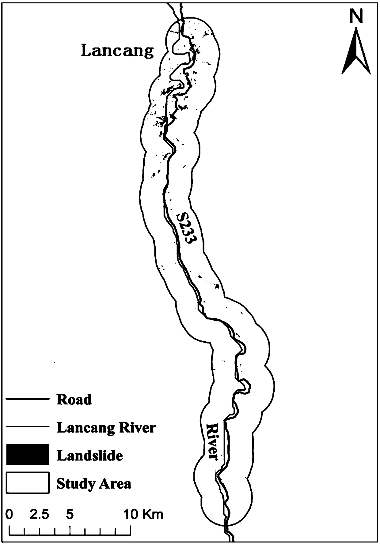
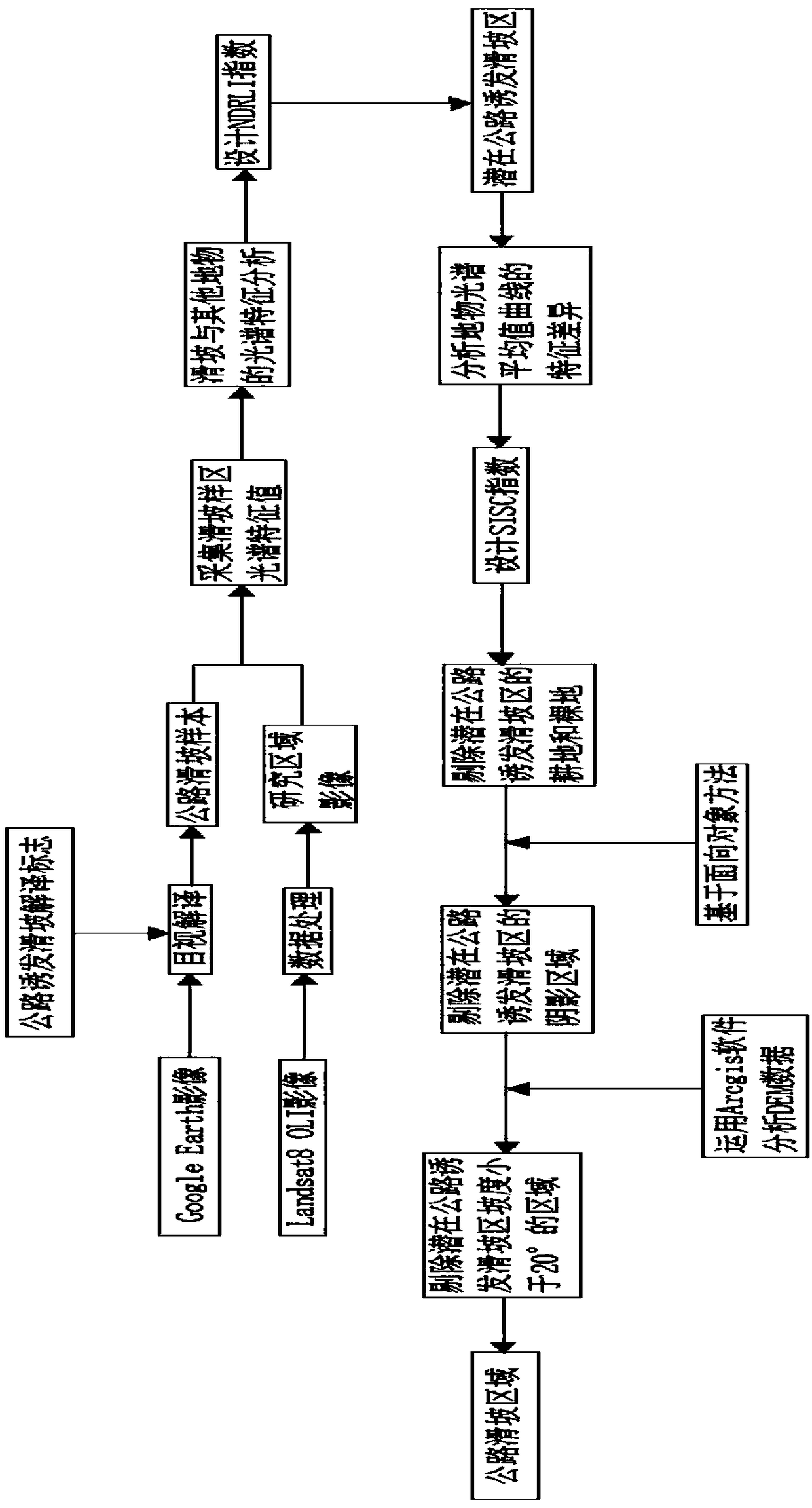
[0048] Such as figure 1 As shown, a fast extraction method of road landslide area, including the following steps:

[0049] (1) Set up the road-induced landslide interpretation sign on the Google earth image, and the Google earth image is the image of the drought period;

[0050] (2) According to the road-induced landslide interpretation signs, the landslide area is drawn by visually interpreting the images on both sides of the road in Google earth images, and the road landslide samples are obtained. The landslide area includes mountain-cutting landslides and filling landslides;

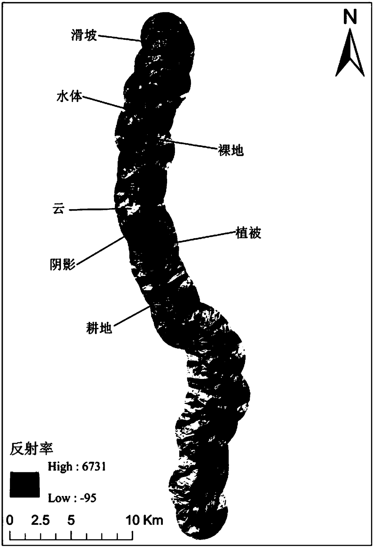
[0051] (3) if figure 2 As shown, the Landsat8 OLI image is preprocessed to obtain the Landsat8 OLI study area image. The data preprocessing includes four steps, which are radiometric calibration, atmospheric correction, image mosaic, and image cropping;

[0052] (4) Superimpose the road landslide sample collected from Google earth image on the Landsat8 OLI study area image, and then use ENVI softw...


PUM


Abstract

The invention relates to the technical field of landslide research, in particular to a fast extraction method of a highway landslide area. The fast extraction method includes: acquiring a highway landslide sample and a study area image; acquiring a landslide sample area spectrum characteristic value; designing a new remote sensing index NDRLI; determining a potential highway-induced landslide area; designing a spectral curve shape index SISC; eliminating the water, cultivated lands, bare lands, shadow areas, building lands and land features with the slope less than 20 degrees in the potentialhighway-induced landslide area; and finally obtaining the highway landslide. Compared with the existing common methods, the invention has the advantages of small workload, short consumption time, highefficiency, easy data acquisition and high classification accuracy, provides a scientific basis for studying and analyzing the landslide disaster along the highway, and has the prospect of large-scale promotion and application.

Description

technical field [0001] The invention relates to the technical field of landslide research, in particular to a rapid extraction method for road landslide areas. Background technique [0002] Landslides are one of the most serious natural disasters in the world, which may cause loss of human life and property, block roads and rivers, affect road traffic and cause floods. In the current road construction process, this method of cutting and filling construction will create large unstable areas by blasting and excavating to embed or penetrate steep hillsides. The cutting or filling of road slopes for road widening and reinforcement is an important factor to effectively eliminate the cohesion and strength of the slope, making it easier for the slope to be destroyed. The downhill side of built roads is a common dumping area for road construction waste. In addition, road construction will cause interruption of surface drainage, blockage of ditches and culverts, and changes in grou...

Claims


Application Information

Patent Timeline
Patent Type & Authority Applications(China)
IPC IPC(8): G06K9/00
CPCG06V20/13G06V20/194
Inventor 赵银军黄玉莹
Owner GUANGXI TEACHERS EDUCATION UNIV
Why Eureka
Try Eureka