Eureka AIR delivers breakthrough ideas for toughest innovation challenges, trusted by R&D personnel around the world.

Navigation method, navigation device and navigation system

A navigation method and technology of a satellite navigation system, applied in the direction of measuring devices, radio wave measurement systems, satellite radio beacon positioning systems, etc., can solve problems such as taking into account obstacles and not allowing completeness, so as to improve positioning accuracy and reduce calculation cost effect

Active Publication Date: 2018-11-23
VOLKSWAGEN AG
View PDF13 Cites 2 Cited by
  • Summary
  • Abstract
  • Description
  • Claims
  • Application Information

AI Technical Summary

Problems solved by technology

[0012] Although both of the discussed publications clarify in principle the method of taking into account obstacles between navigation aids and satellite signals, the solutions set forth there do not allow such obstacles to be fully taken into account

Method used


Image

  • Navigation method, navigation device and navigation system
  • Navigation method, navigation device and navigation system
  • Navigation method, navigation device and navigation system

Examples


Embodiment Construction

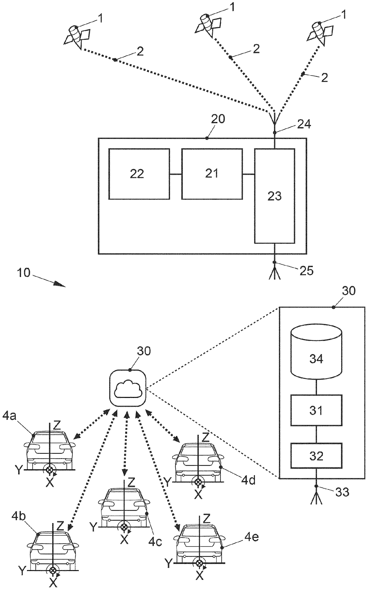
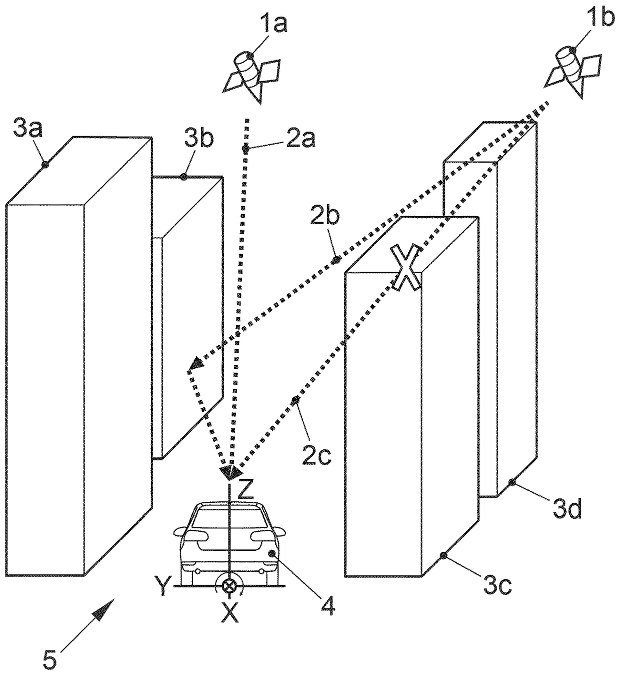
[0061] figure 1 and 2 It is clarified how satellite signals originating from satellites 1a-c and propagating on signal propagation paths 2a-d can be interfered with, as mentioned at the outset.

[0062] exist figure 1 In , two satellites 1a and 1b of a satellite navigation system, such as GPS, symbolically transmit satellite signals to the ground. The satellite 1a transmits a satellite navigation signal to the ground on a signal propagation path 2a, which can be received by a navigation device in a vehicle 4 driving on a street 5 between buildings 3a-3d. There are no obstacles in the line of sight between vehicle 4 and satellite 1 a, so that satellite navigation signals can be received on signal propagation path 2 a with high satellite navigation signal quality.

[0063] The satellite 1b transmits to the ground a satellite navigation signal which is once reflected on its signal path 2b by a building 3b and is again blocked on its signal path 2c by a building 3c. Thus, the ...


PUM


Abstract

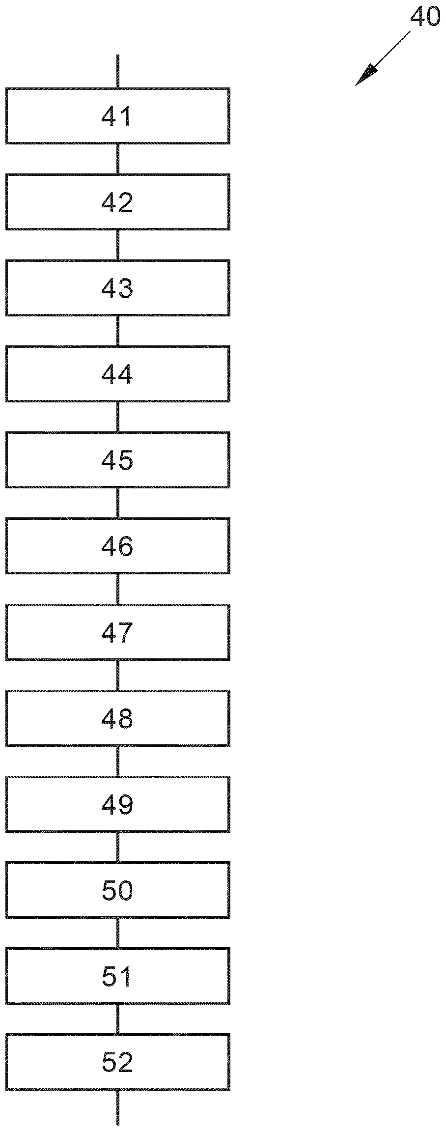
The present invention relates to a navigation method, comprising the steps of: receiving (41) a satellite navigation signal from a satellite navigation system; determining (42) a position on the basisof the received satellite navigation signal; obtaining (45) quality data indicative of a satellite navigation signal quality as a function of location information; and correcting (46) the determinedposition on the basis of the satellite navigation signal quality.

Description

technical field [0001] The invention relates to a navigation method, a navigation device and a navigation system as they are put into use, in particular in motor vehicles. Background technique [0002] Generally, vehicle navigation systems are known which are permanently embedded in the motor vehicle or which are provided as mobile devices. [0003] In the vehicle navigation system, a map is usually stored, and the navigation system determines the current position of the vehicle by means of a satellite navigation system (usually called GNSS (Globales Navigationssatellitensystem, Global Satellite Navigation System)), such as GPS, GLONASS, Galileo, etc. . [0004] Signals received from GNSS may also be combined with other data, such as with sensor signals of the motor vehicle indicating the state of the vehicle (wheel speed sensors and the like). [0005] It is also known to further improve the accuracy of signals received from GNSS, as explained below. [0006] In the so-c...

Claims


Application Information

Patent Timeline
IPC IPC(8): G01S19/08G01S19/28G01S19/49G01S19/42G01S19/03G01S5/00
CPCG01S19/03G01S19/421G01S19/428G01S5/0027G01S5/0036G01S19/08
Inventor F.赫尔曼R.科克V.雷姆斯A.维切尔
Owner VOLKSWAGEN AG
Why Eureka
Eureka Blog
Learn More