Drone system using photogrammetry technology for highway management
A photogrammetry and unmanned aerial vehicle technology, applied in the field of unmanned aerial vehicle systems, can solve the problems of lack of effective supervision of the working mode, inability to better and more effectively protect the right of way and management of road production, and low work efficiency.
- Summary
- Abstract
- Description
- Claims
- Application Information
AI Technical Summary
Problems solved by technology
Method used
Image
Examples
Embodiment
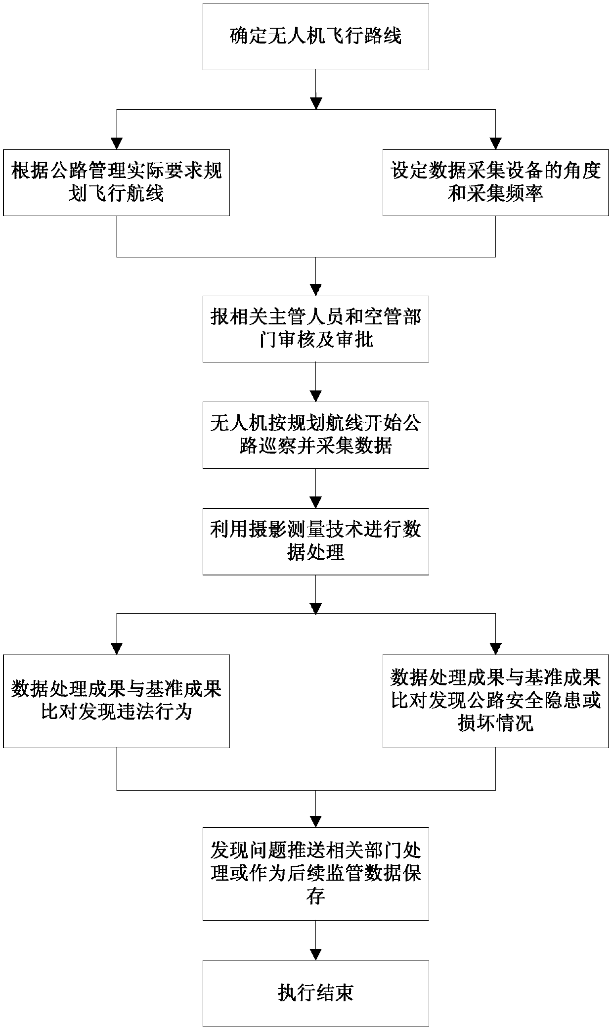
[0039] A kind of unmanned aerial vehicle system that utilizes camera measurement technology for road management in this embodiment includes a ground management unit, a flight unit and a camera acquisition unit installed on the unmanned aerial vehicle, see figure 1 , its inspection management process includes the following:
[0040] Step S1, setting flight parameters: the ground management unit plans the flight route of the UAV flight unit according to the actual requirements of road management, and sets the image acquisition angle and acquisition frequency of the camera acquisition unit.
[0041] Before the drone flies, it is necessary to know the flight route, flight altitude, and the weather of the flight area in advance. Plan routes and frequency of data collection according to highway management requirements, such as: route separation distance, data collection distance, resolution of photographs relative to ground objects, etc.
[0042] In order to ensure flight safety, t...
PUM
 Abstract
Description
Claims
Application Information
 - R&D
- Intellectual Property
- Life Sciences
- Materials
- Tech Scout
- Unparalleled Data Quality
- Higher Quality Content
- 60% Fewer Hallucinations
Browse by: Latest US Patents, China's latest patents, Technical Efficacy Thesaurus, Application Domain, Technology Topic, Popular Technical Reports.
© 2025 PatSnap. All rights reserved.Legal|Privacy policy|Modern Slavery Act Transparency Statement|Sitemap|About US| Contact US: help@patsnap.com


