Geographic grid information processing method, device, equipment and readable storage medium

An information processing method and geographic grid technology, which can be used in geographic information databases, electronic digital data processing, digital data information retrieval, etc., and can solve problems such as vague description of business circles

Active Publication Date: 2020-06-02
KOU KOU XIANG CHUAN BEIJING NETWORK TECH CO LTD
View PDF4 Cites 0 Cited by
  • Summary
  • Abstract
  • Description
  • Claims
  • Application Information

AI Technical Summary

Problems solved by technology

[0006] In view of this, the present invention provides a geographical grid information processing method, device, equipment and readable storage medium. geographical location, resulting in a vague description of the business district

Method used


Image

  • Geographic grid information processing method, device, equipment and readable storage medium
  • Geographic grid information processing method, device, equipment and readable storage medium
  • Geographic grid information processing method, device, equipment and readable storage medium

Examples


Embodiment Construction

[0096] Exemplary embodiments of the present disclosure will be described in more detail below with reference to the accompanying drawings. Although exemplary embodiments of the present disclosure are shown in the drawings, it should be understood that the present disclosure may be embodied in various forms and should not be limited by the embodiments set forth herein. Rather, these embodiments are provided for more thorough understanding of the present disclosure and to fully convey the scope of the present disclosure to those skilled in the art.

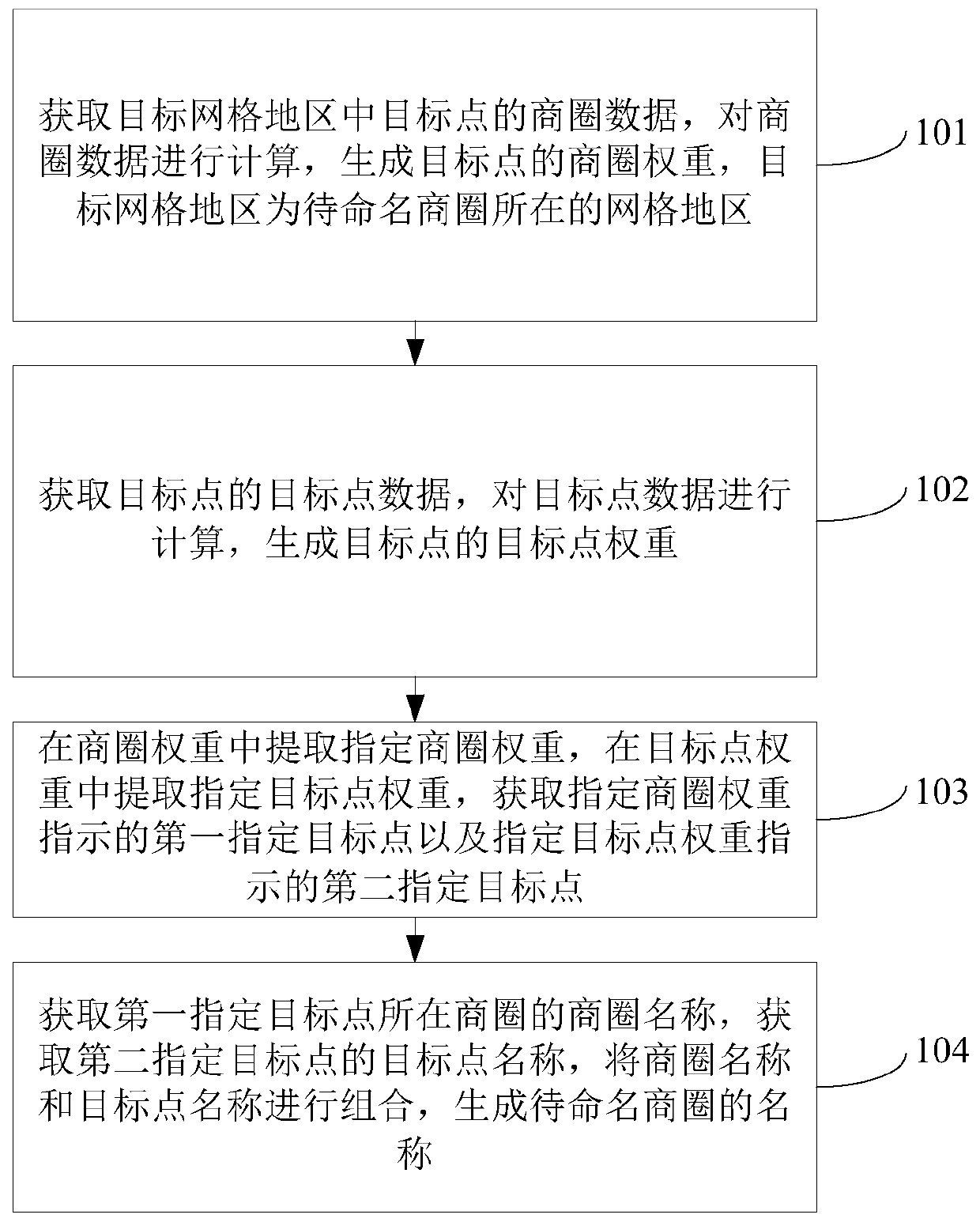
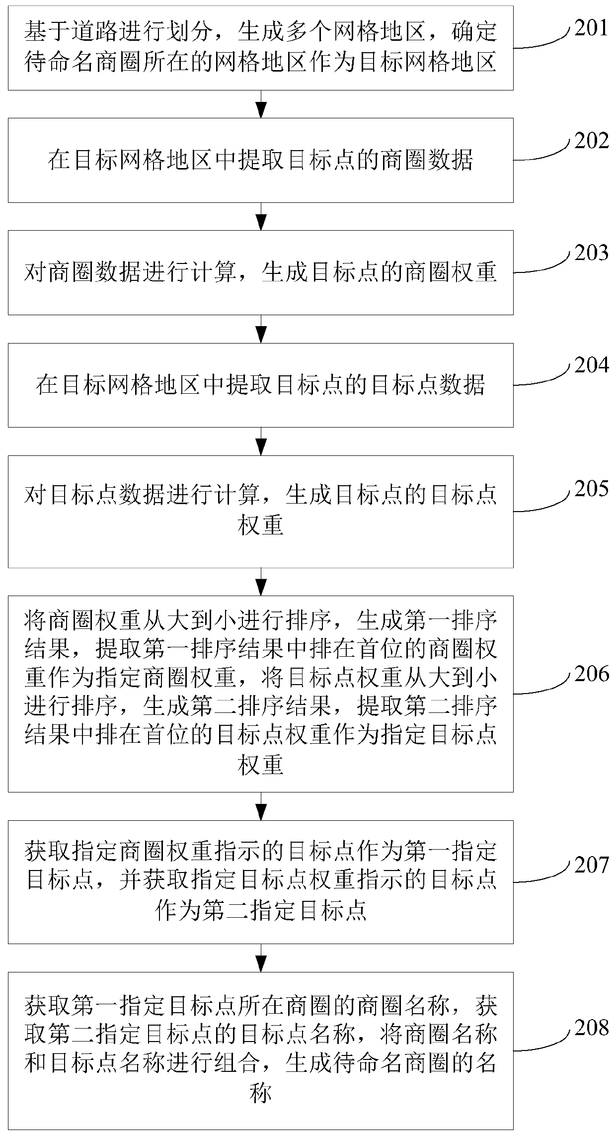
[0097] The embodiment of the present invention provides a geographic grid information processing method, such as figure 1 As shown, the method includes:

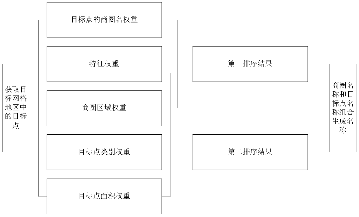
[0098] 101. Obtain the business circle data of the target point in the target grid area, calculate the business circle data, and generate the business circle weight of the target point, and the target grid area is the grid area where the business circle to be named is located.

...


PUM


Abstract

The invention discloses an Information processing method and device for geographic grid, an apparatus, and areadable storage medium, and relates to the technical field of maps. A first designated target point and a second designated target point may be extracted from the business area data and the target point data, Combined with the first designated target point and the second designated targetpoint, the name of standby name business circle is generated, which not only indicates the geographical position of standby name business circle, but also reflects the characteristics of business circle and target point, and the description of naming business circle is clear. The method comprises the following steps: obtaining the business circle data of the target point in the target grid area and generating the business circle weight; Acquiring target point data of the target point and generating target point weights; Extracting a designated business circle weight from the business circle weights, extracting a designated target point weight from the target point weights, and obtaining a first designated target point and a second designated target point; Obtaining the business circle name, obtaining the target point name, and combining the business circle name and the target point name to generate the name of the standby business circle.

Description

technical field [0001] The present invention relates to the technical field of maps, in particular to a geographical grid information processing method, device, equipment and readable storage medium. Background technique [0002] With the continuous development of society and the continuous improvement of map technology, business districts are usually divided according to the range of commercial areas in cities, so that there are various levels of business districts in the city, such as core business districts, secondary business districts and fringe business districts Wait. The business districts of a city are often related to the development of the city. Generally speaking, there may be several to dozens of business districts in each city. Since the business district covers a large area, in order to facilitate the distinction of each business district, a business district name exclusive to the business district will be generated for each business district. [0003] In re...

Claims


Application Information

Patent Timeline
Patent Type & Authority Patents(China)
IPC IPC(8): G06F16/29G06F16/9537
Inventor 李瑞方郭怀印石拓
Owner KOU KOU XIANG CHUAN BEIJING NETWORK TECH CO LTD
Why Eureka
Try Eureka