Human-computer interaction method and device based on a high-definition map

A human-computer interaction and map technology, applied in the computer field, can solve problems such as unsatisfactory unmanned vehicles, precision limitations, and inability to accurately judge the distance between unmanned vehicles and obstacles

Active Publication Date: 2019-06-11
APOLLO INTELLIGENT DRIVING (BEIJING) TECHNOLOGY CO LTD
View PDF19 Cites 5 Cited by
  • Summary
  • Abstract
  • Description
  • Claims
  • Application Information

AI Technical Summary

Problems solved by technology

Usually, the distance between the vehicle and the obstacle next to the road, as well as the distance between the vehicle and the lane next to it, is about ten centimeters or even a few centimeters. Using ordinary navigation electronic maps, due to the limitation of its accuracy, it is impossible to accurately judge unmanned driving. The distance between the vehicle and obstacles, as well as the relationship between the unmanned vehicle and the side lane, therefore, ordinary navigation electronic maps are far from meeting the needs of unmanned vehicles

Method used


Image

  • Human-computer interaction method and device based on a high-definition map
  • Human-computer interaction method and device based on a high-definition map
  • Human-computer interaction method and device based on a high-definition map

Examples


Embodiment Construction

[0027] The application will be further described in detail below in conjunction with the accompanying drawings and embodiments. It should be understood that the specific embodiments described here are only used to explain related inventions, rather than to limit the invention. It should also be noted that, for the convenience of description, only the parts related to the related invention are shown in the drawings.

[0028] It should be noted that, in the case of no conflict, the embodiments in the present application and the features in the embodiments can be combined with each other. The present application will be described in detail below with reference to the accompanying drawings and embodiments.

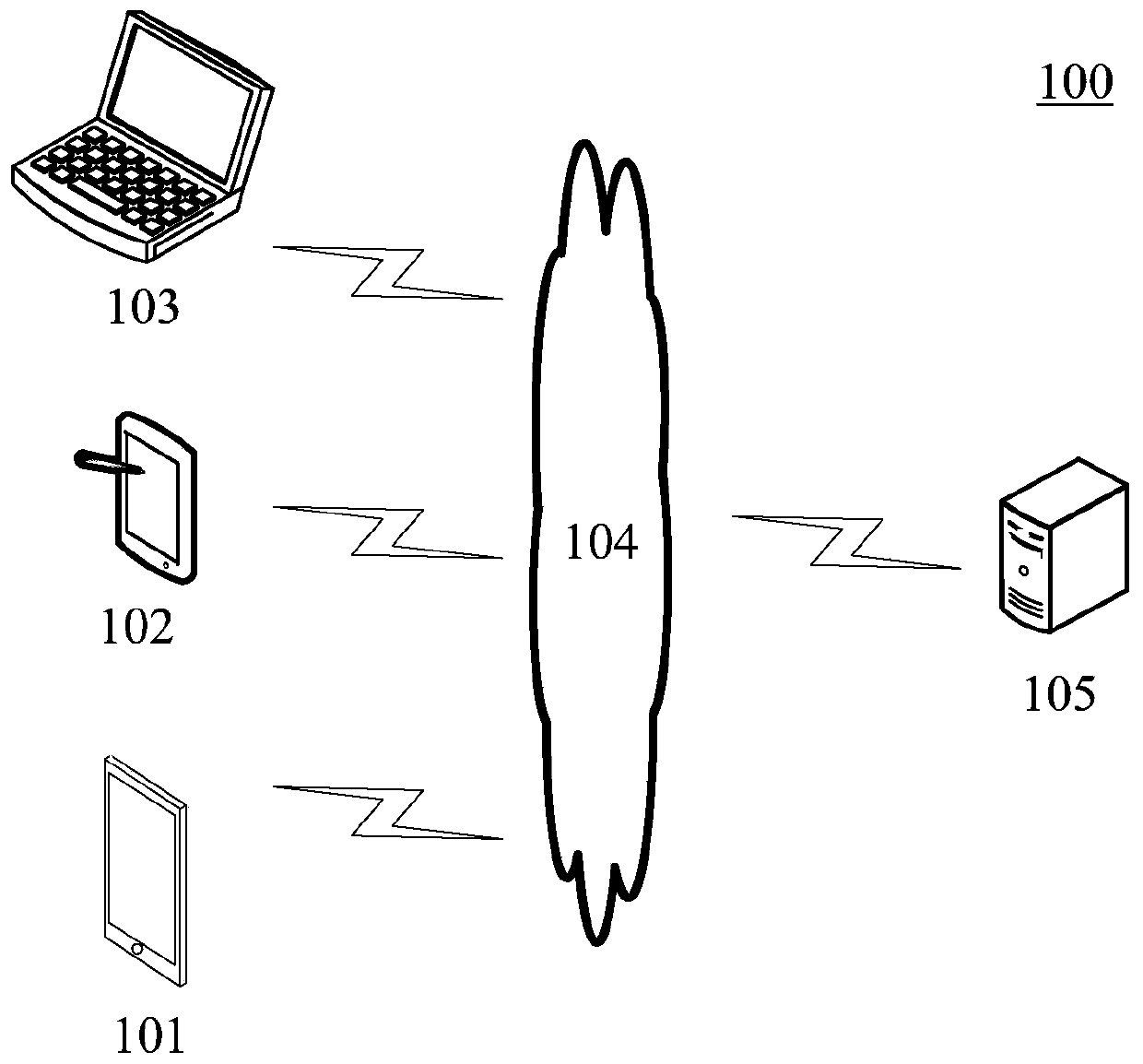
[0029] figure 1 An exemplary system architecture 100 is shown in which the high-precision map-based human-computer interaction method according to an embodiment of the present application can be applied.

[0030] Such as figure 1 As shown, the system architecture 100 may i...


PUM


Abstract

The embodiment of the invention discloses a human-computer interaction method and device based on a high-definition map. A specific embodiment of the method comprises the steps of obtaining a pre-generated high-definition map; responding to the received information adding request, and analyzing the information adding request; and adding the adding information indicated by the information adding request to the pre-generated high-definition map to generate an updated high-definition map. According to the implementation mode, a user can conveniently add map elements to the high-definition map, and further improvement of the high-definition map and simulation of a traffic scene are facilitated.

Description

technical field [0001] The embodiments of the present application relate to the field of computer technology, specifically to the field of electronic map technology, and in particular to a method and device for human-computer interaction based on high-definition maps. Background technique [0002] High-precision maps refer to high-precision electronic maps with absolute coordinate accuracy at the centimeter level. The absolute coordinate accuracy here refers to the deviation between the coordinates of a target on the map and the real coordinates of things in the external world corresponding to the target, usually expressed in units of measurement of length. Compared with ordinary navigation electronic maps, HD maps contain richer information. For example, HD maps can include various road markings, traffic signs, etc. [0003] High-precision maps can be used in the field of unmanned driving, and can provide a large amount of driving assistance information to unmanned vehicle...

Claims


Application Information

Patent Timeline
Patent Type & Authority Applications(China)
IPC IPC(8): G06T17/05G06Q10/04G06F16/29
CPCG06T17/05G06F16/29G01C21/3614G01C21/3667G01C21/3807G01C21/3856G01C21/3885G01C21/32G01C21/3608G01C21/3638G01C21/367
Inventor 王月吴泽琳薛晶晶刘颖楠饶文龙龚伟
Owner APOLLO INTELLIGENT DRIVING (BEIJING) TECHNOLOGY CO LTD
Why Eureka
Try Eureka