Long baseline imaging STAP method for distributed geosynchronous orbit SAR

A geosynchronous orbit, distributed technology, applied in the use of re-radiation, radio wave measurement system, radio wave reflection/re-radiation, etc., can solve problems such as trajectory bending, phase error, and detection performance degradation

Active Publication Date: 2019-06-18
BEIJING INSTITUTE OF TECHNOLOGYGY
View PDF4 Cites 8 Cited by
  • Summary
  • Abstract
  • Description
  • Claims
  • Application Information

AI Technical Summary

Problems solved by technology

Compared with the traditional multi-channel low-orbit SAR system, the satellite spacing of the distributed GEO SAR system is relatively large, resulting in obvious trajectory curvature and failure of far-field assumptions
These problems add a high-order variable factor to the multi-ch

Method used


Image

  • Long baseline imaging STAP method for distributed geosynchronous orbit SAR
  • Long baseline imaging STAP method for distributed geosynchronous orbit SAR
  • Long baseline imaging STAP method for distributed geosynchronous orbit SAR

Examples


Embodiment Construction

[0073] The present invention will be described in detail below with reference to the drawings and embodiments.

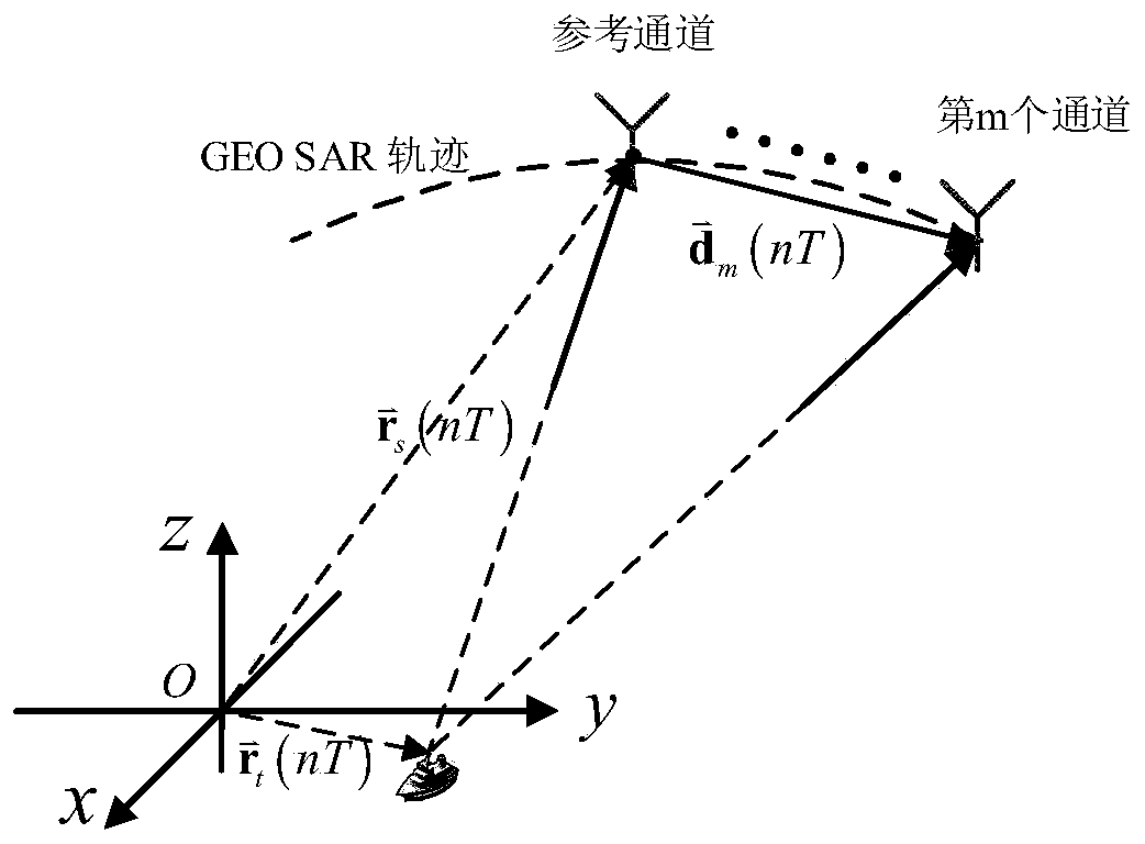
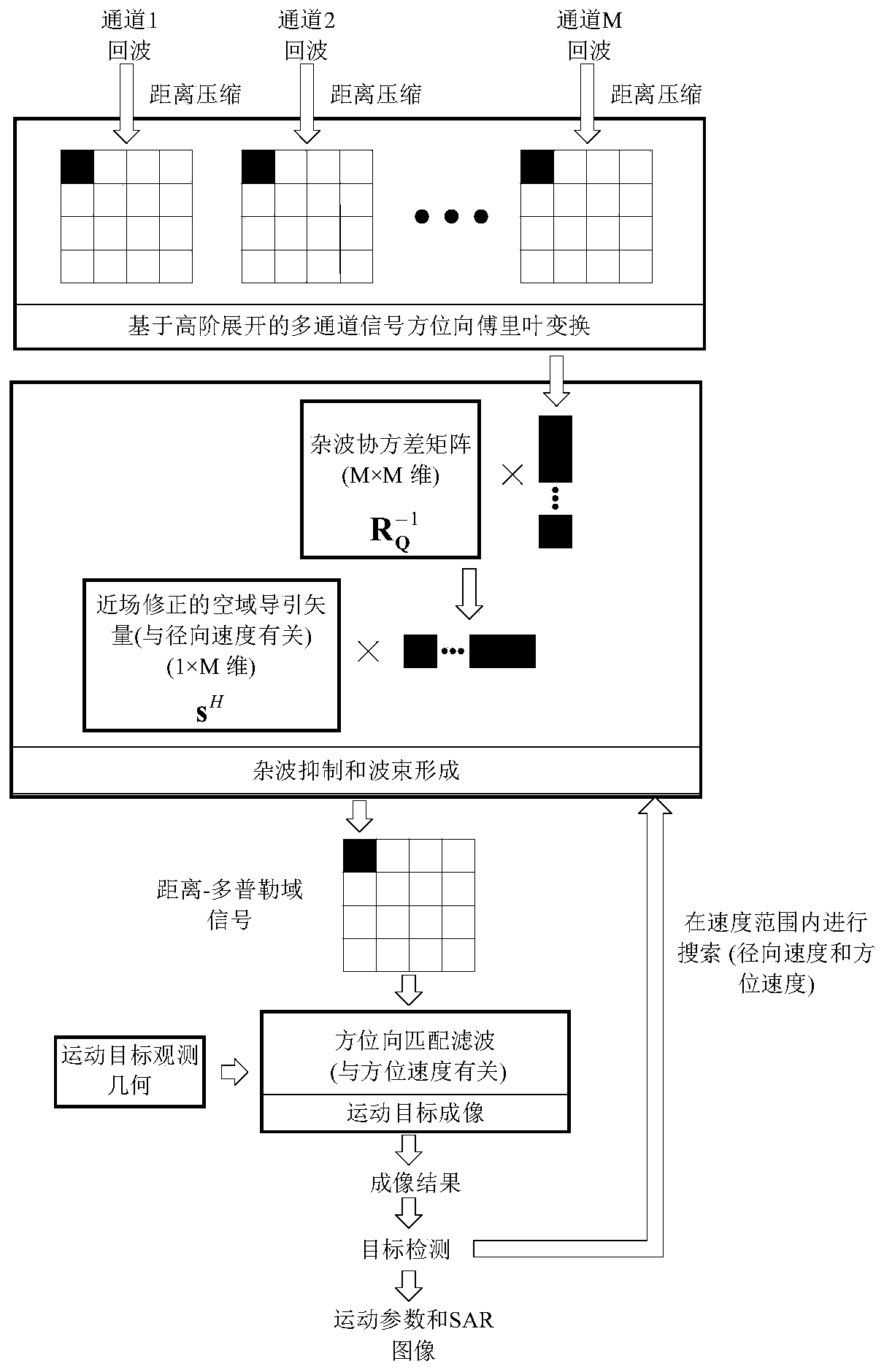
[0074] Such as figure 1 As shown, the long-baseline imaging space-time adaptive processing method suitable for distributed geosynchronous orbit synthetic aperture radar of the present invention specifically includes the following steps:

[0075] Step 1. Assuming that the distributed GEO SAR satellites are equidistantly distributed along the track, the multi-channel echo data is received through the multi-transmit and multi-receive working mode, and the distributed GEO SAR multi-channel echo data is compressed and azimuth-to-Fourier transform. Obtain multi-channel range-Doppler domain signals.

[0076] Considering that the present invention is based on imaging STAP for moving target detection, it is necessary to convert the distributed GEO SAR multi-channel echo signal into the range-Doppler domain for processing. Therefore, before the distributed GEO SAR adaptive processi...


PUM


Abstract

The invention relates to a long baseline imaging STAP method suitable for a distributed geosynchronous orbit SAR. The method is characterized in that an azimuth spectrum of multi-channel signals is derived through constructing a precise distributed GEO SAR moving target multi-channel signal model under the long baseline, an airspace guiding vector is then modified to match a distributed GEO SAR moving target, and thereby problems of far-field hypothesis failure and bending trajectory caused by the long baseline are overcome. The method is advantaged in that the method has a high output signal-to-noise ratio, and detection performance of the distributed GEO SAR moving target under long baseline conditions is improved.

Description

Technical field [0001] The invention belongs to the technical field of synthetic aperture radar, and specifically relates to a long baseline imaging STAP method suitable for distributed geosynchronous orbit SAR. Background technique [0002] Distributed Geosynchronous Orbit Synthetic Aperture Radar (GEO SAR) is composed of multiple small satellites operating in formation at an altitude of 36000km. It has the advantages of high resolution, surveying bandwidth and short revisit time. Multiple satellites can work together. Imaging, moving target detection, ground elevation measurement and many other tasks. Compared with a single large satellite, multiple small satellites can obtain multi-channel data and form a long baseline along the orbit. In moving target detection, multi-channel data can be used for clutter suppression, and a long baseline along the track helps to obtain a smaller minimum detectable speed. [0003] Space-time adaptive processing (STAP) is one of the effective me...

Claims


Application Information

Patent Timeline
IPC IPC(8): G01S13/90G01S7/41
Inventor 龙腾董锡超崔畅胡程
Owner BEIJING INSTITUTE OF TECHNOLOGYGY
Why Eureka
Try Eureka