New map path planning system
A path planning and map technology, applied in two-dimensional position/channel control and other directions, can solve the problems of not being able to know the accurate three-dimensional structure of the surrounding environment, and not being able to guarantee robot collisions
- Summary
- Abstract
- Description
- Claims
- Application Information
AI Technical Summary
Problems solved by technology
Method used
Image

Examples
Embodiment Construction
[0008] The present invention will be described in more detail and complete below in conjunction with the accompanying drawings and specific embodiments. It should be understood that the specific embodiments described here are only used to explain the present invention, but not to limit the present invention.
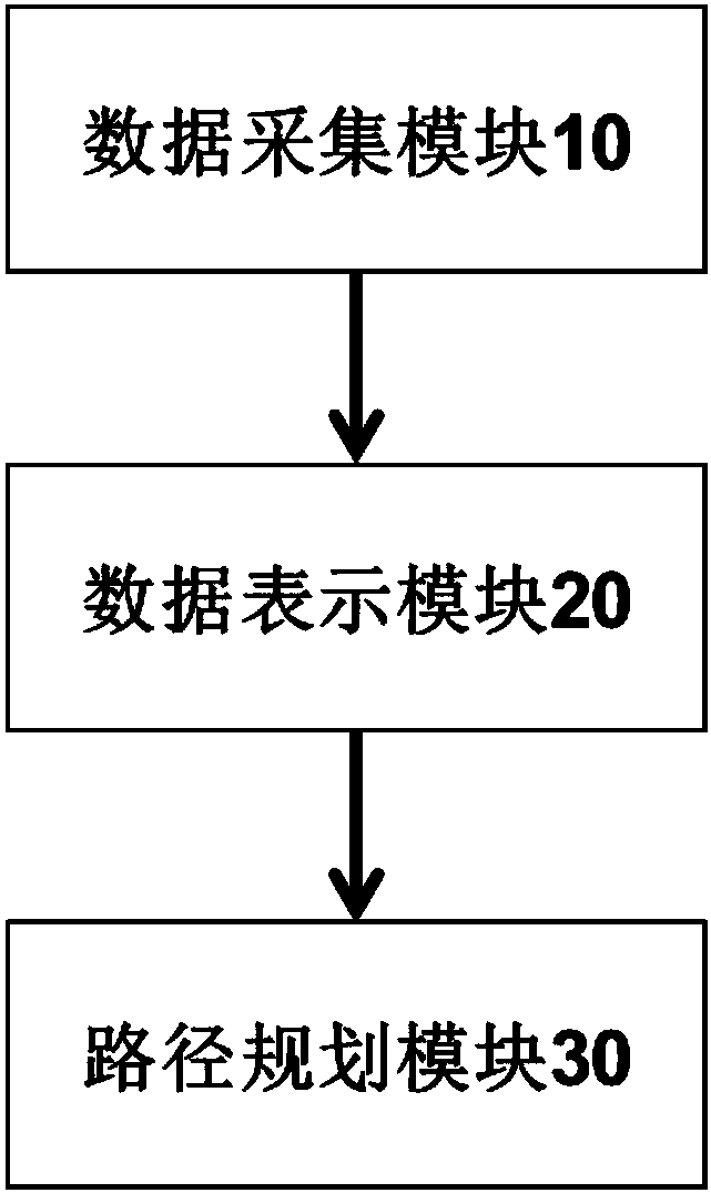
[0009] figure 1 is a schematic diagram of a map route planning system according to an embodiment of the present invention.
[0010] refer to figure 1 , the map path planning system includes: a data acquisition module 10, which collects point cloud data with a laser sensor; a data representation module 20, which uses an octree to convert the point cloud map into a grid map; a path planning module 30, which specifies the starting point of the robot position and end position, the robot automatically avoids obstacles and chooses the optimal path.
[0011] In this embodiment, after the point cloud map is converted into a three-dimensional grid map, the optimal path plannin...
PUM
 Abstract
Description
Claims
Application Information