Geographic information system hotspot statistics method and device and storage medium

A geographic information system and hotspot technology, applied in geographic information databases, structured data retrieval, etc., can solve problems such as poor versatility of solutions, and achieve good applicability

Pending Publication Date: 2019-06-28
BEIJING SUPERMAP SOFTWARE CO LTD
View PDF7 Cites 0 Cited by
  • Summary
  • Abstract
  • Description
  • Claims
  • Application Information

AI Technical Summary

Problems solved by technology

[0007] This application provides a method, device and storage medium for GIS hotspot statistics, which are used to solve the problems in the prior art that the source code needs to be modified separately for the GIS servers of different GIS manufacturers, and the solution has poor versatility.

Method used


Image

  • Geographic information system hotspot statistics method and device and storage medium
  • Geographic information system hotspot statistics method and device and storage medium
  • Geographic information system hotspot statistics method and device and storage medium

Examples


Embodiment Construction

[0032] In order to make the above objects, features and advantages of the present application more obvious and comprehensible, the present application will be further described in detail below in conjunction with the accompanying drawings and specific implementation methods.

[0033] In the description of the present application, it should be understood that the terms "request" and "second" are only used for descriptive purposes, and cannot be interpreted as indicating or implying relative importance or implicitly specifying the quantity of indicated technical features. Thus, the features defined as "request" and "second" may explicitly or implicitly include one or more of these features. "Plurality" means two or more, unless otherwise clearly and specifically defined. The terms "including", "comprising" and similar terms should be understood as open-ended terms, ie "including / comprising but not limited to". The term "based on" is "based at least in part on". The term "an em...


PUM


Abstract

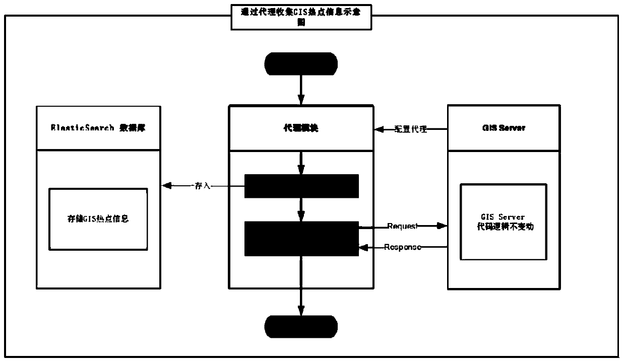
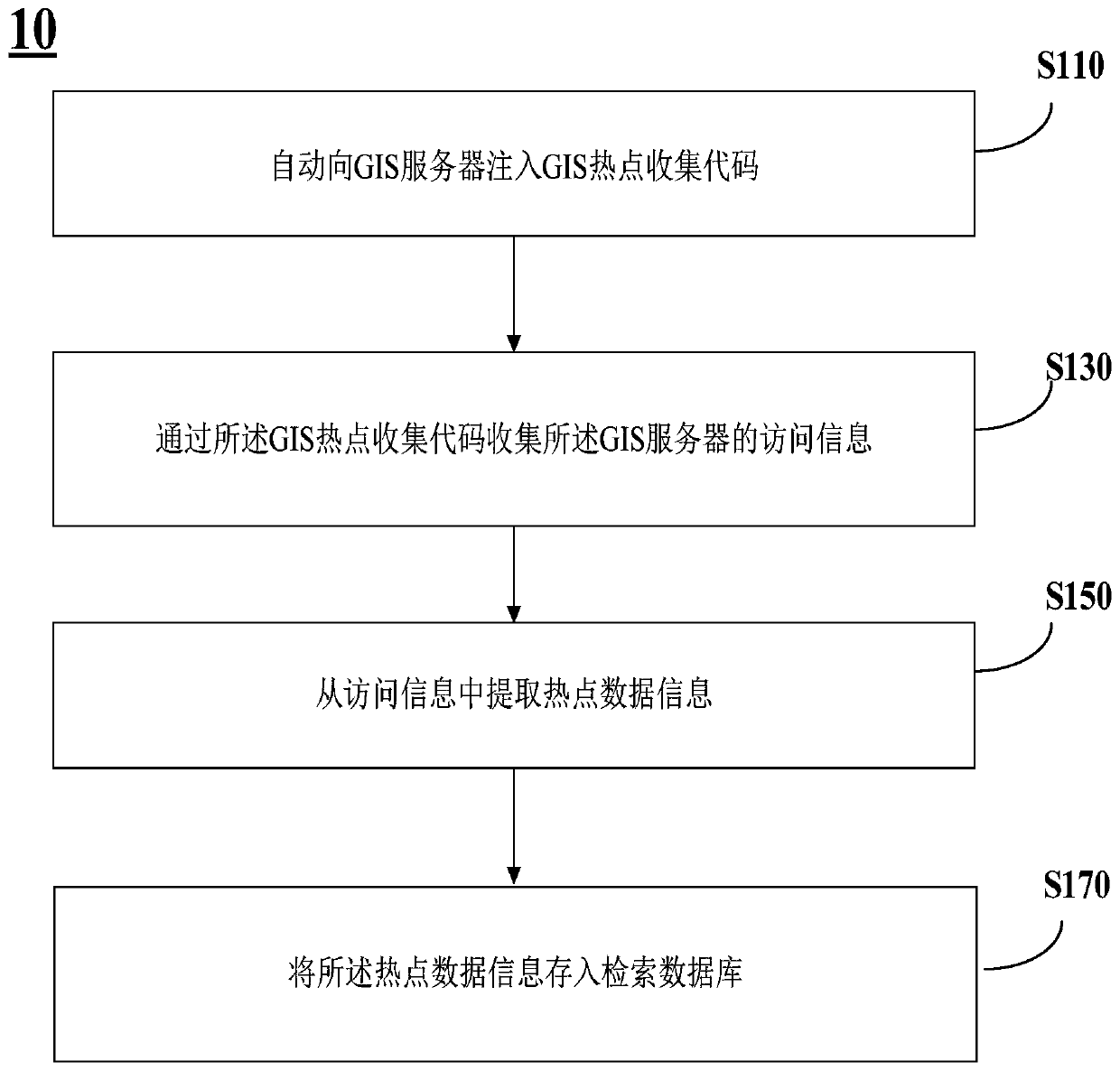
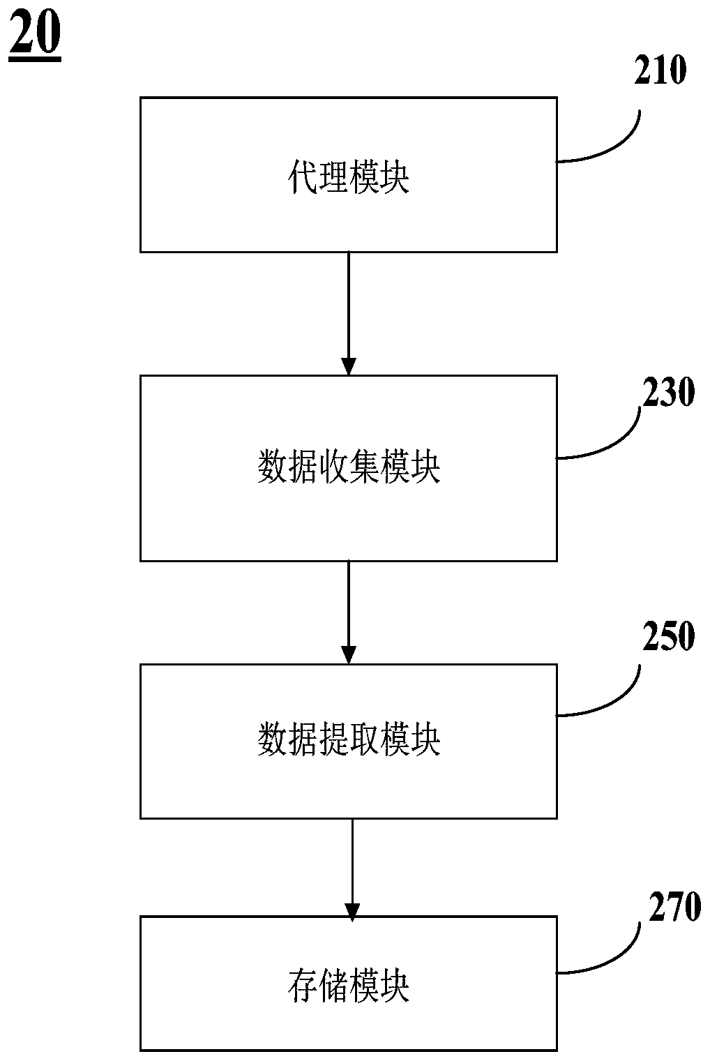
The invention provides a geographic information system hotspot statistics method and device and a storage medium, and the method comprises the steps: automatically injecting a geographic information system hotspot collection code into a geographic information system server; Collecting access information of the geographic information system server through the geographic information system hot spotcollection code, and extracting hot spot data information from the access information; And storing the hotspot data information into a retrieval database. By means of the method and device, the problems that in the prior art, source codes need to be independently modified for geographic information system servers of different geographic information system manufacturers, and the scheme universalityis poor are solved.

Description

technical field [0001] The present invention relates to the technical field of geographic information systems, and in particular, to a method, device and storage medium for statistics of hotspots in geographic information systems. Background technique [0002] Geographic Information System (GIS, Geographic Information Systems) technology is a spatial information processing technology that has developed rapidly in recent years. It is based on geographic space, adopts geographic model analysis methods, and provides a variety of spatial and dynamic geographic information. A computer technology system serving geographic research and geographic decision-making. Its basic function is to convert tabular data from databases, spreadsheet files or directly input in the program into geographic graphic display, and then browse, operate and analyze the displayed results. Not only can it effectively manage various resource and environmental information with spatial attributes, it can qui...

Claims


Application Information

Patent Timeline
Patent Type & Authority Applications(China)
IPC IPC(8): G06F16/29
Inventor 钟耳顺
Owner BEIJING SUPERMAP SOFTWARE CO LTD
Why Eureka
Try Eureka