Coordinate transformation method for displaying detection information in AR system
A technology for detecting information and coordinate transformation, applied in image data processing, instruments, etc., can solve problems such as misalignment, reducing the reality of virtual information, and lack of accurate calculation of position coordinates
- Summary
- Abstract
- Description
- Claims
- Application Information
AI Technical Summary
Problems solved by technology
Method used
Image
Examples
Embodiment 1
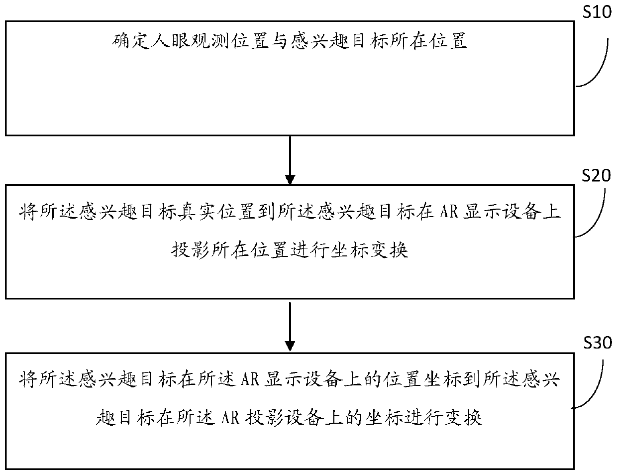
[0024] figure 1 It is a schematic flow diagram of a method for removing fluoride ions in water in an embodiment of the present invention, as figure 1 As shown, the method includes:
[0025] Step 10: Determine the observation position of the human eye and the position of the target of interest.
[0026] Step 20: Perform coordinate transformation from the real position of the target of interest to the projected position of the target of interest on the AR display device.
[0027] Step 30: Transform the position coordinates of the object of interest on the AR display device to the coordinates of the object of interest on the AR projection device.
[0028] Specifically, first determine the coordinates of the human eye observation position, and obtain the position information of the target of interest in the real world coordinate system, determine the plane equation of the plane where the virtual information display device is located, and calculate the projection of the real posi...
Embodiment 2
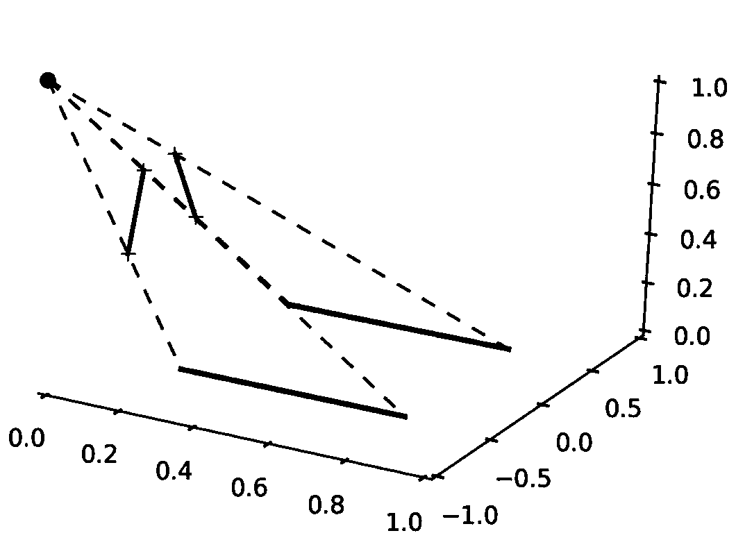
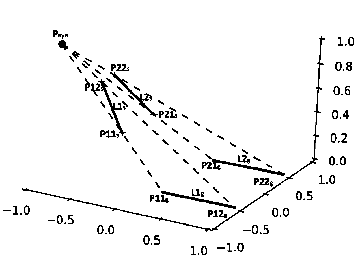
[0050] In order to better introduce the technical characteristics and uses of the coordinate transformation method used to display detection information in an AR system of the present invention, the advantages of the present invention will be described in detail below in conjunction with specific embodiments, please refer to figure 2 , 3 , 4.
[0051] combined with Figure 2-4 , using the coordinate transformation method proposed in the present invention to detect and display lane lines in the vehicle-mounted HUD system for further description and deduction of formulas.
[0052] In the first step, the camera is used to obtain the position information of the object of interest in the real world coordinate system.
[0053] (1a) if figure 2 As shown, establish the real world three-dimensional space coordinate system XYZ, with the ground as the XOY plane;
[0054] (1b) if figure 2 , determine the camera 1 position coordinate P in the real world coordinate system c =(x c ...
PUM
 Abstract
Description
Claims
Application Information
 - R&D
- Intellectual Property
- Life Sciences
- Materials
- Tech Scout
- Unparalleled Data Quality
- Higher Quality Content
- 60% Fewer Hallucinations
Browse by: Latest US Patents, China's latest patents, Technical Efficacy Thesaurus, Application Domain, Technology Topic, Popular Technical Reports.
© 2025 PatSnap. All rights reserved.Legal|Privacy policy|Modern Slavery Act Transparency Statement|Sitemap|About US| Contact US: help@patsnap.com


