Geological Profile Method Based on Spatial Coordinates
A technology of geological profiles and spatial coordinates, applied in the field of geological surveying and mapping, can solve the problems of large amount of calculation, cumbersome process, and large number of people needed for the projection map of the unfolded map.
- Summary
- Abstract
- Description
- Claims
- Application Information
AI Technical Summary
Problems solved by technology
Method used
Image
Examples
Embodiment Construction
[0033] The present invention will be further described below in conjunction with accompanying drawing.
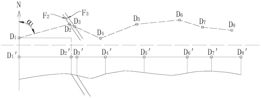
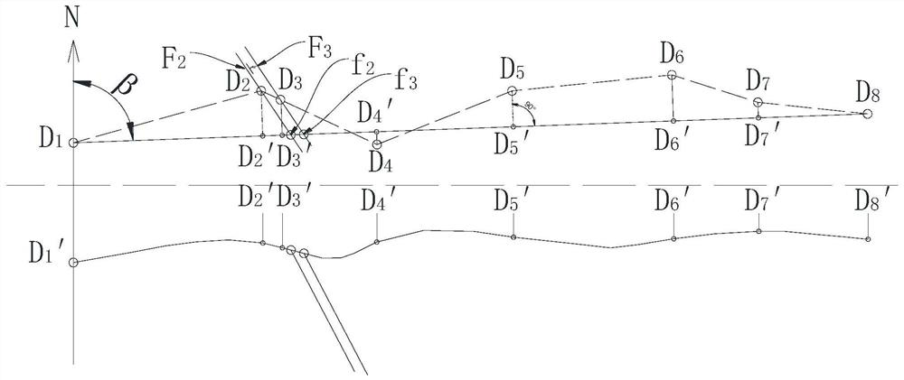
[0034] The method of the present invention based on the measured geological section of the spatial coordinates comprises drawing an unfolded diagram and drawing a projected diagram, wherein drawing the unfolded diagram comprises the following steps:
[0035] S1. Field geological surveying and mapping
[0036] Determine the baseline in the survey area, plan the section line, determine n geological points, and number the points as D 1 ~D n, through the mobile terminal GPS, etc. to automatically obtain the spatial coordinates of each particle, and carry out geological description and measure the occurrence of each particle. In order to facilitate statistical analysis, the principle of numbering the quality points of each place is as follows: determine the order of the points in the direction of the baseline, and then number them sequentially along the direction of the baseli...
PUM
 Abstract
Description
Claims
Application Information
 - R&D
- Intellectual Property
- Life Sciences
- Materials
- Tech Scout
- Unparalleled Data Quality
- Higher Quality Content
- 60% Fewer Hallucinations
Browse by: Latest US Patents, China's latest patents, Technical Efficacy Thesaurus, Application Domain, Technology Topic, Popular Technical Reports.
© 2025 PatSnap. All rights reserved.Legal|Privacy policy|Modern Slavery Act Transparency Statement|Sitemap|About US| Contact US: help@patsnap.com


